Estimated Value: $158,000 - $370,000
3
Beds
2
Baths
1,836
Sq Ft
$118/Sq Ft
Est. Value
About This Home
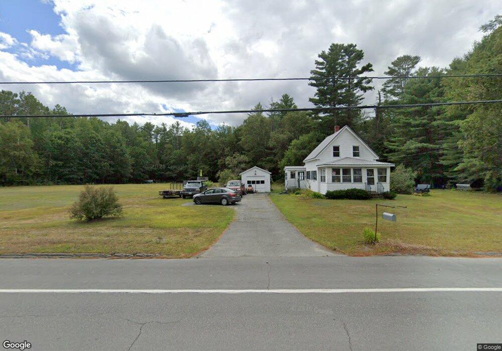
This home is located at 209 Elm St, Milo, ME 04463 and is currently estimated at $216,121, approximately $117 per square foot. 209 Elm St is a home located in Piscataquis County with nearby schools including Milo Elementary School, Penquis Valley High School, and Brownville Elementary School.
Ownership History
Date
Name
Owned For
Owner Type
Purchase Details
Closed on
Jan 9, 2025
Sold by
Elliott-Johnson Emilie M and Johnson Steven P
Bought by
Durette Jared R and Durette Shirley
Current Estimated Value
Home Financials for this Owner
Home Financials are based on the most recent Mortgage that was taken out on this home.
Original Mortgage
$142,500
Outstanding Balance
$141,510
Interest Rate
6.81%
Mortgage Type
Purchase Money Mortgage
Estimated Equity
$74,611
Purchase Details
Closed on
Feb 23, 2015
Sold by
Jp Morgan Chase Bank Na
Bought by
Elliott-Johnson Emilie M and Johnson Steven P
Create a Home Valuation Report for This Property
The Home Valuation Report is an in-depth analysis detailing your home's value as well as a comparison with similar homes in the area
Home Values in the Area
Average Home Value in this Area
Purchase History
| Date | Buyer | Sale Price | Title Company |
|---|---|---|---|
| Durette Jared R | $150,000 | None Available | |
| Durette Jared R | $150,000 | None Available | |
| Elliott-Johnson Emilie M | $42,500 | -- |
Source: Public Records
Mortgage History
| Date | Status | Borrower | Loan Amount |
|---|---|---|---|
| Open | Durette Jared R | $142,500 | |
| Closed | Durette Jared R | $142,500 |
Source: Public Records
Tax History Compared to Growth
Tax History
| Year | Tax Paid | Tax Assessment Tax Assessment Total Assessment is a certain percentage of the fair market value that is determined by local assessors to be the total taxable value of land and additions on the property. | Land | Improvement |
|---|---|---|---|---|
| 2024 | $1,709 | $62,700 | $21,500 | $41,200 |
| 2023 | $1,499 | $62,700 | $21,500 | $41,200 |
| 2022 | $1,627 | $62,700 | $21,500 | $41,200 |
| 2021 | $1,615 | $62,700 | $21,500 | $41,200 |
| 2020 | $661 | $60,600 | $22,100 | $38,500 |
| 2019 | $1,672 | $57,650 | $21,000 | $36,650 |
| 2018 | $383 | $57,650 | $21,000 | $36,650 |
| 2017 | $1,802 | $57,650 | $21,000 | $36,650 |
| 2016 | $1,874 | $57,650 | $21,000 | $36,650 |
| 2015 | $1,655 | $57,650 | $21,000 | $36,650 |
| 2014 | $1,754 | $82,370 | $30,000 | $52,370 |
Source: Public Records
Map
Nearby Homes