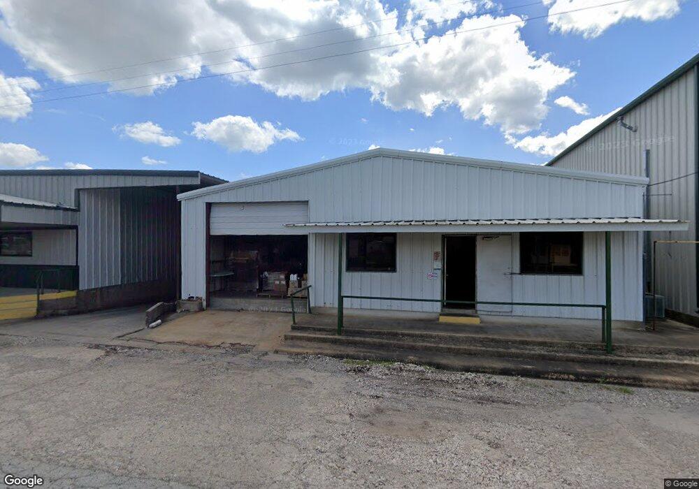
209 Hamilton St Trenton, TX 75490
--
Bed
--
Bath
38,766
Sq Ft
1.47
Acres
About This Home
This home is located at 209 Hamilton St, Trenton, TX 75490. 209 Hamilton St is a home located in Fannin County with nearby schools including Trenton Elementary School, Trenton Middle School, and Trenton High School.
Ownership History
Date
Name
Owned For
Owner Type
Purchase Details
Closed on
Jan 20, 2022
Sold by
Hoffman Michael
Bought by
209 Hamilton Llc
Purchase Details
Closed on
Aug 30, 2017
Sold by
H S M Holdings Ltd
Bought by
Eccxi Inc
Home Financials for this Owner
Home Financials are based on the most recent Mortgage that was taken out on this home.
Original Mortgage
$235,000
Interest Rate
3.96%
Mortgage Type
Purchase Money Mortgage
Purchase Details
Closed on
Feb 20, 2008
Sold by
Agan Machine Products Company Inc
Bought by
H S M Holdings Ltd
Create a Home Valuation Report for This Property
The Home Valuation Report is an in-depth analysis detailing your home's value as well as a comparison with similar homes in the area
Home Values in the Area
Average Home Value in this Area
Purchase History
| Date | Buyer | Sale Price | Title Company |
|---|---|---|---|
| 209 Hamilton Llc | -- | None Listed On Document | |
| 209 Hamilton Llc | -- | None Listed On Document | |
| Eccxi Inc | -- | Fannin County Title Company | |
| H S M Holdings Ltd | -- | None Available |
Source: Public Records
Mortgage History
| Date | Status | Borrower | Loan Amount |
|---|---|---|---|
| Previous Owner | Eccxi Inc | $235,000 |
Source: Public Records
Tax History Compared to Growth
Tax History
| Year | Tax Paid | Tax Assessment Tax Assessment Total Assessment is a certain percentage of the fair market value that is determined by local assessors to be the total taxable value of land and additions on the property. | Land | Improvement |
|---|---|---|---|---|
| 2025 | $19,576 | $1,428,710 | $213,210 | $1,215,500 |
| 2024 | $19,576 | $1,145,210 | $207,430 | $937,780 |
| 2023 | $15,700 | $702,920 | $152,990 | $549,930 |
| 2022 | $12,419 | $551,130 | $67,530 | $483,600 |
| 2021 | $15,208 | $595,770 | $27,560 | $568,210 |
| 2020 | $14,378 | $534,100 | $26,180 | $507,920 |
| 2019 | $14,110 | $500,000 | $16,550 | $483,450 |
| 2018 | $186 | $6,500 | $6,500 | $0 |
| 2017 | $186 | $6,500 | $6,500 | $0 |
| 2016 | $422 | $14,770 | $14,770 | $0 |
| 2015 | -- | $9,930 | $9,930 | $0 |
| 2014 | -- | $9,250 | $9,250 | $0 |
Source: Public Records
Map
Nearby Homes
- TBD Cr 4435
- 210 Carrie Mabrie St
- 104 N 4th St
- 211 Church St
- 513 Augustus St
- 549 Augustus St
- 503 S Pearl St
- 118 Indian Creek
- 1284 Emily Dr
- 1104 Alexander St
- 1286 Emily Dr
- Violet Plan at Anderson Crossing
- Dewberry II Plan at Anderson Crossing
- Magnolia III Plan at Anderson Crossing
- Spring Cress Plan at Anderson Crossing
- Carolina IV Plan at Anderson Crossing
- Bellflower Plan at Anderson Crossing
- Bellflower III Plan at Anderson Crossing
- Rockcress Plan at Anderson Crossing
- Caraway Plan at Anderson Crossing
- 108 S Pearl St
- TBD Orduna St
- Lot1-24 Cr 4620
- 211 N Pearl St
- 209 N Pearl St
- 213 Hamilton St
- 106 N Pearl St
- 217 N Pearl St
- 215 N Pearl St
- CR 4640
- 219 N Pearl St
- 115 N Pearl St
- 106 W Saunders St
- 202 May St
- 308 N Pearl St
- 202 W Saunders St
- 107 May St
- 307 Carrie Mabrie St
- 6700 W State Highway Loop 220 Hwy W
- 306 Carrie Mabrie St