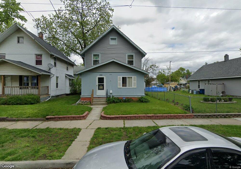
209 Hanover St Toledo, OH 43609
Southside NeighborhoodEstimated Value: $76,305 - $83,000
3
Beds
1
Bath
1,150
Sq Ft
$70/Sq Ft
Est. Value
About This Home
This home is located at 209 Hanover St, Toledo, OH 43609 and is currently estimated at $80,076, approximately $69 per square foot. 209 Hanover St is a home located in Lucas County with nearby schools including Burroughs Elementary School, Bowsher High School, and Explorers Academy of Science and Technology.
Ownership History
Date
Name
Owned For
Owner Type
Purchase Details
Closed on
May 5, 2015
Sold by
Decapua Tim
Bought by
Hundsrucker Gary and Hundsrucker Denise
Current Estimated Value
Purchase Details
Closed on
Jan 9, 2009
Sold by
Hundsrucker Gary D and Dahl Denise L
Bought by
Decapua Tim and 209 Hanover Avenue Trust
Purchase Details
Closed on
Nov 10, 1994
Sold by
Fink Rita A
Bought by
Hundsrucker Gary D and Dahl Denise L
Home Financials for this Owner
Home Financials are based on the most recent Mortgage that was taken out on this home.
Original Mortgage
$31,288
Interest Rate
8.86%
Mortgage Type
New Conventional
Create a Home Valuation Report for This Property
The Home Valuation Report is an in-depth analysis detailing your home's value as well as a comparison with similar homes in the area
Home Values in the Area
Average Home Value in this Area
Purchase History
| Date | Buyer | Sale Price | Title Company |
|---|---|---|---|
| Hundsrucker Gary | $300 | None Available | |
| Decapua Tim | -- | None Available | |
| Hundsrucker Gary D | $31,000 | -- |
Source: Public Records
Mortgage History
| Date | Status | Borrower | Loan Amount |
|---|---|---|---|
| Previous Owner | Hundsrucker Gary D | $31,288 |
Source: Public Records
Tax History
| Year | Tax Paid | Tax Assessment Tax Assessment Total Assessment is a certain percentage of the fair market value that is determined by local assessors to be the total taxable value of land and additions on the property. | Land | Improvement |
|---|---|---|---|---|
| 2025 | $2,172 | $19,950 | $3,990 | $15,960 |
| 2024 | $1,907 | $19,950 | $3,990 | $15,960 |
| 2023 | $895 | $12,320 | $2,975 | $9,345 |
| 2022 | $892 | $12,320 | $2,975 | $9,345 |
| 2021 | $885 | $12,320 | $2,975 | $9,345 |
| 2020 | $923 | $11,130 | $2,765 | $8,365 |
| 2019 | $890 | $11,130 | $2,765 | $8,365 |
| 2018 | $847 | $11,130 | $2,765 | $8,365 |
| 2017 | $2,246 | $9,870 | $3,290 | $6,580 |
| 2016 | $1,778 | $28,200 | $9,400 | $18,800 |
| 2015 | $803 | $28,200 | $9,400 | $18,800 |
| 2014 | $931 | $9,870 | $3,290 | $6,580 |
| 2013 | $621 | $9,870 | $3,290 | $6,580 |
Source: Public Records
Map
Nearby Homes
- 142 S Detroit Ave
- 1936 Airport Hwy
- 131 S Detroit Ave
- 2010 Airport Hwy
- 337 S Detroit Ave
- 1836 Finch St
- 115 Lake Shore Ave
- 140 Whiting Ave
- 119 Whiting Ave
- 415 Mayberry St
- 333 Danberry St
- 2121 Airport Hwy
- 2052 South Ave
- 2019 South Ave
- 511 S Detroit Ave
- 139 Kenmore Ave
- 1601 Airline Ave
- 323 Champion St
- 2335 Airport Hwy
- 317 Eldred Ave
- 211 Hanover St
- 205 Hanover St
- 215 Hanover St
- 1981 Airline Ave
- 1982 Airline Ave
- 217 Hanover St
- 221 Hanover St
- 212 S Fearing Blvd
- 216 S Fearing Blvd
- 223 Hanover St
- 220 S Fearing Blvd
- 206 S Fearing Blvd
- 224 S Fearing Blvd
- 210 Hanover St
- 231 Hanover St
- 214 Hanover St
- 1990 Airline Ave
- 1986 Airline Ave
- 216 Hanover St
- 228 S Fearing Blvd
Your Personal Tour Guide
Ask me questions while you tour the home.