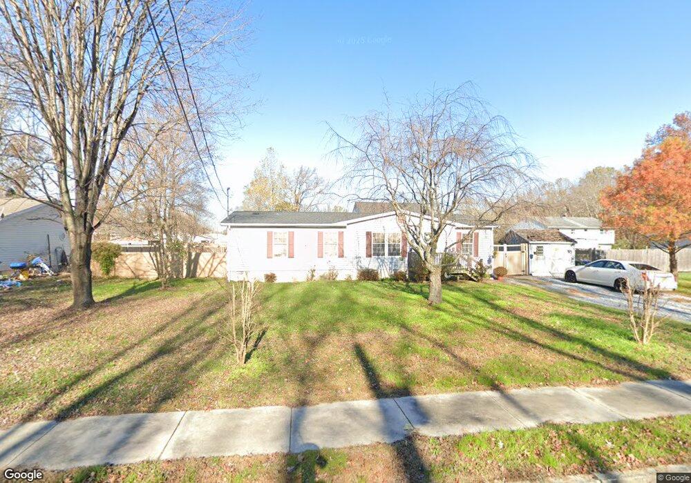
209 Lincoln Ave Glassboro, NJ 08028
Estimated Value: $248,000 - $304,000
--
Bed
--
Bath
1,248
Sq Ft
$222/Sq Ft
Est. Value
About This Home
This home is located at 209 Lincoln Ave, Glassboro, NJ 08028 and is currently estimated at $276,483, approximately $221 per square foot. 209 Lincoln Ave is a home located in Gloucester County with nearby schools including J Harvey Rodgers School, Dorothy L Bullock Elementary, and Glassboro Intermediate School.
Ownership History
Date
Name
Owned For
Owner Type
Purchase Details
Closed on
Apr 12, 2000
Sold by
One Sixteen Inc
Bought by
Morrow Kenneth J and Morrow Susan F
Current Estimated Value
Home Financials for this Owner
Home Financials are based on the most recent Mortgage that was taken out on this home.
Original Mortgage
$79,859
Outstanding Balance
$27,320
Interest Rate
8.21%
Mortgage Type
FHA
Estimated Equity
$249,163
Purchase Details
Closed on
Oct 19, 1994
Sold by
Crescitelli Henry
Bought by
Crescitelli Henry
Create a Home Valuation Report for This Property
The Home Valuation Report is an in-depth analysis detailing your home's value as well as a comparison with similar homes in the area
Home Values in the Area
Average Home Value in this Area
Purchase History
| Date | Buyer | Sale Price | Title Company |
|---|---|---|---|
| Morrow Kenneth J | $79,900 | -- | |
| Crescitelli Henry | -- | -- |
Source: Public Records
Mortgage History
| Date | Status | Borrower | Loan Amount |
|---|---|---|---|
| Open | Morrow Kenneth J | $79,859 |
Source: Public Records
Tax History Compared to Growth
Tax History
| Year | Tax Paid | Tax Assessment Tax Assessment Total Assessment is a certain percentage of the fair market value that is determined by local assessors to be the total taxable value of land and additions on the property. | Land | Improvement |
|---|---|---|---|---|
| 2025 | $5,375 | $152,700 | $37,400 | $115,300 |
| 2024 | $5,343 | $152,700 | $37,400 | $115,300 |
| 2023 | $5,343 | $152,700 | $37,400 | $115,300 |
| 2022 | $5,290 | $152,700 | $37,400 | $115,300 |
| 2021 | $5,003 | $152,700 | $37,400 | $115,300 |
| 2020 | $5,410 | $152,700 | $37,400 | $115,300 |
| 2019 | $5,419 | $152,700 | $37,400 | $115,300 |
| 2018 | $5,422 | $152,700 | $37,400 | $115,300 |
| 2017 | $5,448 | $152,700 | $37,400 | $115,300 |
| 2016 | $5,291 | $152,700 | $37,400 | $115,300 |
| 2015 | $5,177 | $152,700 | $37,400 | $115,300 |
| 2014 | $5,059 | $152,700 | $37,400 | $115,300 |
Source: Public Records
Map
Nearby Homes
- 213 15 S Academy St
- 119 S Academy St
- 1215 S Academy St
- 161 165 S Delsea Dr
- 1200 Walnut St
- 10 Grove St
- 428 Truman Ave
- 301 Mazzeo Dr
- 309 Mazzeo Dr
- 192 Mazzeo Dr
- 1400 Walnut St
- 1504 S Academy St
- 254 Stanger Ave
- 134 S Main St
- 242 Stanger Ave
- 1701 Filbert St
- 47 S Academy St
- 109 Laurel Ave
- 125 Earl Ave
- 252 Stanger Ave
- 205 Lincoln Ave
- 213 Lincoln Ave
- 208 Harding Ave
- 212 Harding Ave
- 400 S Academy St
- 440 S Academy St
- 510 S Academy St
- 409 S Academy St
- 304 S Academy St
- 207 Harding Ave
- 405 S Academy St
- 401 S Academy St
- 211 Harding Ave
- 505 S Academy St
- 300 S Academy St
- 311 S Academy St
- 220 Washington Ave
- 505 Pershing Ave
- 0 Pershing St Unit 1007211120
- 0 Pershing St Unit 6091397