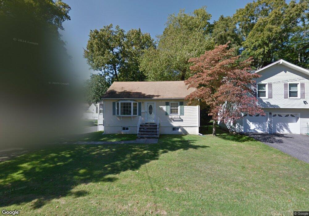
209 Longport Rd Parsippany, NJ 07054
Estimated Value: $379,383 - $518,000
--
Bed
--
Bath
768
Sq Ft
$591/Sq Ft
Est. Value
About This Home
This home is located at 209 Longport Rd, Parsippany, NJ 07054 and is currently estimated at $453,846, approximately $590 per square foot. 209 Longport Rd is a home located in Morris County with nearby schools including Lake Parsippany Elementary School, Brooklawn Middle School, and Parsippany Hills High School.
Ownership History
Date
Name
Owned For
Owner Type
Purchase Details
Closed on
Jan 11, 2000
Sold by
Crownover Clarence and Durish Cecil H
Bought by
Taylor Nancy P and Preta Frances P
Current Estimated Value
Home Financials for this Owner
Home Financials are based on the most recent Mortgage that was taken out on this home.
Original Mortgage
$120,000
Outstanding Balance
$40,019
Interest Rate
8.5%
Estimated Equity
$413,827
Create a Home Valuation Report for This Property
The Home Valuation Report is an in-depth analysis detailing your home's value as well as a comparison with similar homes in the area
Home Values in the Area
Average Home Value in this Area
Purchase History
| Date | Buyer | Sale Price | Title Company |
|---|---|---|---|
| Taylor Nancy P | $150,000 | -- |
Source: Public Records
Mortgage History
| Date | Status | Borrower | Loan Amount |
|---|---|---|---|
| Open | Taylor Nancy P | $120,000 |
Source: Public Records
Tax History Compared to Growth
Tax History
| Year | Tax Paid | Tax Assessment Tax Assessment Total Assessment is a certain percentage of the fair market value that is determined by local assessors to be the total taxable value of land and additions on the property. | Land | Improvement |
|---|---|---|---|---|
| 2025 | $6,697 | $193,400 | $135,200 | $58,200 |
| 2024 | $6,570 | $193,400 | $135,200 | $58,200 |
| 2023 | $6,570 | $193,400 | $135,200 | $58,200 |
| 2022 | $6,129 | $193,400 | $135,200 | $58,200 |
| 2021 | $6,129 | $193,400 | $135,200 | $58,200 |
| 2020 | $5,984 | $193,400 | $135,200 | $58,200 |
| 2019 | $5,823 | $193,400 | $135,200 | $58,200 |
| 2018 | $5,696 | $193,400 | $135,200 | $58,200 |
| 2017 | $5,568 | $193,400 | $135,200 | $58,200 |
| 2016 | $5,471 | $193,400 | $135,200 | $58,200 |
| 2015 | $5,326 | $193,400 | $135,200 | $58,200 |
| 2014 | $5,257 | $193,400 | $135,200 | $58,200 |
Source: Public Records
Map
Nearby Homes
- 206 Atlantic Dr
- 10 Buena Rd
- 14 Braemar Ct
- 581 Allentown Rd
- 59 Kingston Rd
- 1035 Littleton Rd
- 21 Dolly Dr
- 32 Hardwick Ct
- 260 Everett Rd
- 14 Willow Ln
- Rockefeller with Library Plan at Parq
- Rockefeller Plan at Parq
- 51 Willow Ln
- 3 Queen St
- 44 Willow Ln
- 49 Willow Ln
- 711 Park Rd
- 8 Sherwood Dr
- 8 Craven Rd
- 8 Brookstone Cir Unit B8
- 215 Longport Rd
- 207 Longport Rd
- 219 Longport Rd
- 31 Beachwood Rd
- 195 Fieldcrest Rd
- 218 Longport Rd
- 225 Longport Rd
- 205 Fieldcrest Rd
- 206 Longport Rd
- 195 Longport Rd
- 28 Beachwood Rd
- 228 Longport Rd
- 185 Fieldcrest Rd
- 22 Beachwood Rd
- 59 Canton Rd
- 295 Atlantic Dr
- 50 Beachwood Rd
- 236 Longport Rd
- 53 Canton Rd
- 191 Longport Rd