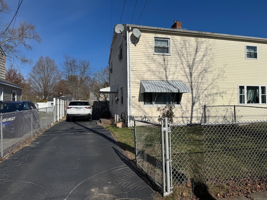
209 Mcgrath Ct Stratford, CT 06615
Stratford Center Historic District NeighborhoodEstimated payment $1,358/month
About This Home
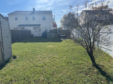
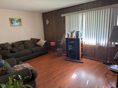
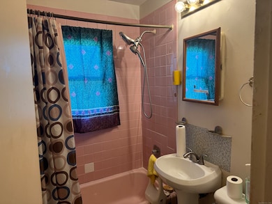
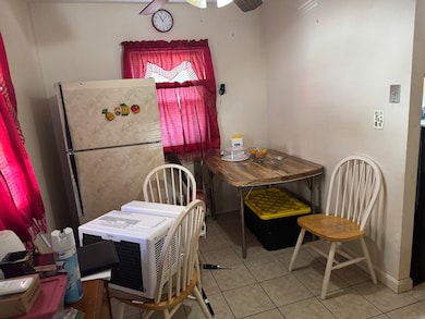
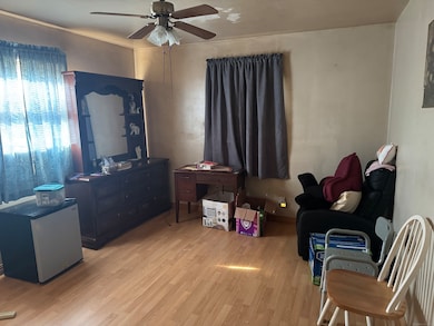
Welcome to this charming multi-family home located in the desirable South End neighborhood of Stratford! This well-maintained property features two spacious bedrooms and a full bathroom, making it perfect for families or as an investment opportunity. The property is conveniently situated near local amenities, parks, and schools, providing a great community feel. Property subject to court probate approval. Don't miss your chance to own this lovely home in a vibrant neighborhood!
Listing Agent
Las Americas Real Estate Brokerage Phone: (203) 209-8370 License #REB.0759279 Listed on: 11/15/2025
Home Details
Home Type
- Single Family
Est. Annual Taxes
- $3,766
Year Built
- Built in 1955
Lot Details
- 3,920 Sq Ft Lot
- Level Lot
- Property is zoned RM-1
Home Design
- Concrete Foundation
- Frame Construction
- Asphalt Shingled Roof
- Vinyl Siding
Interior Spaces
- 952 Sq Ft Home
- Crawl Space
Bedrooms and Bathrooms
- 2 Bedrooms
- 1 Full Bathroom
Utilities
- Cooling System Mounted In Outer Wall Opening
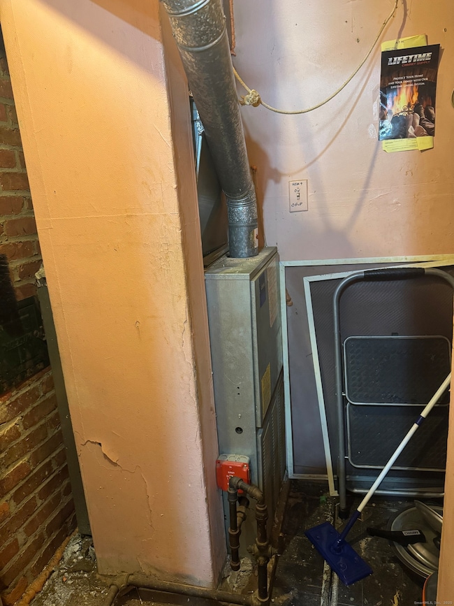
- Heating System Uses Natural Gas
Listing and Financial Details
- Assessor Parcel Number 373904
Map
Home Values in the Area
Average Home Value in this Area
Tax History
| Year | Tax Paid | Tax Assessment Tax Assessment Total Assessment is a certain percentage of the fair market value that is determined by local assessors to be the total taxable value of land and additions on the property. | Land | Improvement |
|---|---|---|---|---|
| 2025 | $3,766 | $93,680 | $34,320 | $59,360 |
| 2024 | $3,766 | $93,680 | $34,320 | $59,360 |
| 2023 | $3,766 | $93,680 | $34,320 | $59,360 |
| 2022 | $3,697 | $93,680 | $34,320 | $59,360 |
| 2021 | $3,698 | $93,680 | $34,320 | $59,360 |
| 2020 | $3,713 | $93,680 | $34,320 | $59,360 |
| 2019 | $2,186 | $54,820 | $21,640 | $33,180 |
| 2018 | $2,187 | $54,820 | $21,640 | $33,180 |
| 2017 | $2,191 | $54,820 | $21,640 | $33,180 |
| 2016 | $2,137 | $54,820 | $21,640 | $33,180 |
| 2015 | $2,027 | $54,820 | $21,640 | $33,180 |
| 2014 | $2,060 | $57,810 | $22,600 | $35,210 |
Property History
| Date | Event | Price | List to Sale | Price per Sq Ft |
|---|---|---|---|---|
| 11/15/2025 11/15/25 | For Sale | $199,000 | -- | $209 / Sq Ft |
Purchase History
| Date | Type | Sale Price | Title Company |
|---|---|---|---|
| Deed | $47,000 | -- |
Mortgage History
| Date | Status | Loan Amount | Loan Type |
|---|---|---|---|
| Open | $111,264 | No Value Available | |
| Closed | $109,620 | No Value Available | |
| Closed | $80,000 | No Value Available | |
| Closed | $70,000 | No Value Available |
Source: SmartMLS
MLS Number: 24140551
APN: STRA-000406-000009-000083
Disclaimer: Certain information contained herein is derived from information provided by parties other than Homes.com. All information provided is deemed reliable, but is not guaranteed to be accurate and should be independently verified.
![]() IDX information is provided exclusively for personal, non-commercial use, and may not be used for any purpose other than to identify prospective properties consumers may be interested in purchasing. Information is deemed reliable but not guaranteed.
IDX information is provided exclusively for personal, non-commercial use, and may not be used for any purpose other than to identify prospective properties consumers may be interested in purchasing. Information is deemed reliable but not guaranteed.
- 79 Wooster Ave
- 291 Birdseye St
- 1260 Elm St
- 366 Columbus Ave
- 909 Main St
- 325 Mckinley Ave
- 270 Roosevelt Ave
- 394 Harding Ave
- 238 Larkin Ct
- 107 Dewey St
- 1170 South Ave
- 216 Mckinley Ave
- 1460 Elm St Unit 322
- 88 Boswell St
- 50 Birdseye St Unit 104
- 28 Frash St
- 208 Harding Ave
- 148 Columbus Ave
- 126 Garibaldi Ave
- 32 Harbour View Place
- 619 Birdseye St
- 1168 Main St Unit C3
- 1168 Main St Unit C7
- 30 Priscilla Ln Unit 1
- 115 Everett St Unit 115 Everett Street
- 213 Larkin Ct
- 1460 Elm St Unit 333
- 1460 Elm St
- 490 Sherwood Place
- 35 Harding Ave
- 1111 Stratford Ave Unit 231.1412591
- 1111 Stratford Ave Unit 107.1412592
- 1621 Stratford Ave Unit 3
- 1111 Stratford Ave
- 121 Milford Ave
- 1537 W Broad St
- 941 E Broadway Unit 2
- 446-556 Hollister St
- 57 King St
- 225 Lordship Blvd
