Estimated Value: $582,000 - $626,000
4
Beds
3
Baths
2,104
Sq Ft
$289/Sq Ft
Est. Value
About This Home
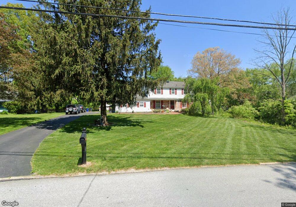
This home is located at 209 Mitchell Rd, Exton, PA 19341 and is currently estimated at $607,038, approximately $288 per square foot. 209 Mitchell Rd is a home located in Chester County with nearby schools including Lionville Elementary School, Lionville Middle School, and Downingtown High School East.
Ownership History
Date
Name
Owned For
Owner Type
Purchase Details
Closed on
Mar 25, 2025
Sold by
Micucci Michael T and Micucci Gail G
Bought by
Micucci Living Trust and Micucci
Current Estimated Value
Purchase Details
Closed on
Sep 4, 1998
Sold by
Hanson Barbara T and Beacham Barbara
Bought by
Micucci Michael T and Micucci Gail G
Home Financials for this Owner
Home Financials are based on the most recent Mortgage that was taken out on this home.
Original Mortgage
$143,600
Interest Rate
6.87%
Purchase Details
Closed on
Sep 8, 1994
Sold by
Beacham William R and Beacham Barbara
Bought by
Hanson Barbara T
Create a Home Valuation Report for This Property
The Home Valuation Report is an in-depth analysis detailing your home's value as well as a comparison with similar homes in the area
Home Values in the Area
Average Home Value in this Area
Purchase History
| Date | Buyer | Sale Price | Title Company |
|---|---|---|---|
| Micucci Living Trust | -- | None Listed On Document | |
| Micucci Living Trust | -- | None Listed On Document | |
| Micucci Michael T | $179,500 | -- | |
| Hanson Barbara T | -- | -- |
Source: Public Records
Mortgage History
| Date | Status | Borrower | Loan Amount |
|---|---|---|---|
| Previous Owner | Micucci Michael T | $143,600 | |
| Closed | Micucci Michael T | $18,025 |
Source: Public Records
Tax History Compared to Growth
Tax History
| Year | Tax Paid | Tax Assessment Tax Assessment Total Assessment is a certain percentage of the fair market value that is determined by local assessors to be the total taxable value of land and additions on the property. | Land | Improvement |
|---|---|---|---|---|
| 2025 | $5,673 | $165,740 | $42,760 | $122,980 |
| 2024 | $5,673 | $165,740 | $42,760 | $122,980 |
| 2023 | $5,507 | $165,740 | $42,760 | $122,980 |
| 2022 | $5,369 | $165,740 | $42,760 | $122,980 |
| 2021 | $5,279 | $165,740 | $42,760 | $122,980 |
| 2020 | $5,249 | $165,740 | $42,760 | $122,980 |
| 2019 | $5,249 | $165,740 | $42,760 | $122,980 |
| 2018 | $5,249 | $165,740 | $42,760 | $122,980 |
| 2017 | $5,249 | $165,740 | $42,760 | $122,980 |
| 2016 | $4,883 | $165,740 | $42,760 | $122,980 |
| 2015 | $4,883 | $165,740 | $42,760 | $122,980 |
| 2014 | $4,883 | $165,740 | $42,760 | $122,980 |
Source: Public Records
Map
Nearby Homes
- 208 Morris Rd
- 510 Woodview Dr
- 261 Watch Hill Rd
- 208 Lucy Cir
- 207 Lucy Cir
- Santorini Plan at Worthington Farm - Luxury Single-Family Homes
- Monaco Plan at Worthington Farm - Luxury Single-Family Homes
- Lisbon Plan at Worthington Farm - Luxury Single-Family Homes
- 432 Carmarthen Ct
- 315 Oak Ln W
- 417 Windsong Ln
- 420 Oakland Dr
- 524 Sherbrook Dr
- 447 Lee Place
- 524 E Saxony Dr Unit 524
- 427 Vineyard Ln Unit 64
- 468 Lionville Station Rd
- 577 Pewter Dr
- 913 Grandview Dr
- 122 Garris Rd
- 211 Mitchell Rd
- 207 Mitchell Rd
- 205 Mitchell Rd
- 97 Glendale Rd
- 206 Mitchell Rd
- 208 Mitchell Rd
- 95 Glendale Rd
- 99 Glendale Rd
- 204 Mitchell Rd
- 203 Mitchell Rd
- 101 Glendale Rd
- 430 Village Walk
- 93 Glendale Rd
- 139 Baker Dr
- 105 Glendale Rd
- 202 Mitchell Rd
- 141 Baker Dr
- 107 Glendale Rd
- 102 Glendale Rd
- 201 Mitchell Rd
