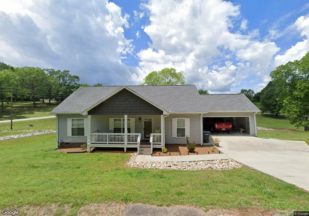
209 N Johnson St Walhalla, SC 29691
Estimated Value: $243,000 - $295,000
3
Beds
2
Baths
1,564
Sq Ft
$177/Sq Ft
Est. Value
About This Home
This home is located at 209 N Johnson St, Walhalla, SC 29691 and is currently estimated at $277,522, approximately $177 per square foot. 209 N Johnson St is a home with nearby schools including Walhalla Elementary School, Walhalla Middle School, and Walhalla High School.
Ownership History
Date
Name
Owned For
Owner Type
Purchase Details
Closed on
Jun 22, 2017
Sold by
Jenkins Edward
Bought by
Hoekstra Talia B
Current Estimated Value
Home Financials for this Owner
Home Financials are based on the most recent Mortgage that was taken out on this home.
Original Mortgage
$110,000
Interest Rate
3.78%
Mortgage Type
New Conventional
Purchase Details
Closed on
Feb 22, 2017
Sold by
Bruce Tiffany M
Bought by
Hoekstra Talia B
Purchase Details
Closed on
Jul 29, 2009
Sold by
Jenkins Howard Melvin and Moore Laverne J
Bought by
Bruce Tiffany M
Create a Home Valuation Report for This Property
The Home Valuation Report is an in-depth analysis detailing your home's value as well as a comparison with similar homes in the area
Home Values in the Area
Average Home Value in this Area
Purchase History
| Date | Buyer | Sale Price | Title Company |
|---|---|---|---|
| Hoekstra Talia B | -- | None Available | |
| Hoekstra Talia B | -- | None Available | |
| Bruce Tiffany M | -- | -- |
Source: Public Records
Mortgage History
| Date | Status | Borrower | Loan Amount |
|---|---|---|---|
| Previous Owner | Hoekstra Talia B | $110,000 |
Source: Public Records
Tax History Compared to Growth
Tax History
| Year | Tax Paid | Tax Assessment Tax Assessment Total Assessment is a certain percentage of the fair market value that is determined by local assessors to be the total taxable value of land and additions on the property. | Land | Improvement |
|---|---|---|---|---|
| 2025 | $1,337 | $6,933 | $477 | $6,456 |
| 2024 | $1,324 | $6,933 | $477 | $6,456 |
| 2023 | $1,299 | $6,933 | $477 | $6,456 |
| 2022 | $1,299 | $6,933 | $477 | $6,456 |
| 2021 | $115 | $6,611 | $477 | $6,134 |
| 2020 | $717 | $0 | $0 | $0 |
| 2019 | $717 | $0 | $0 | $0 |
| 2018 | $158 | $0 | $0 | $0 |
| 2017 | $115 | $0 | $0 | $0 |
| 2016 | $115 | $0 | $0 | $0 |
| 2015 | -- | $0 | $0 | $0 |
| 2014 | -- | $394 | $394 | $0 |
| 2013 | -- | $0 | $0 | $0 |
Source: Public Records
Map
Nearby Homes
- 412 N Spring St
- 00 Keowee St
- 209 Moore Ave
- 208 Branch St
- 00 Branch St
- 320 Jaynes St
- 00 S Spring St
- 204 Friendship Dr
- 301 Shadybrook Dr Unit B
- 00 N Church St
- 203 Tulip Dr
- 2423 Westminster Hwy
- 606 W South Broad St
- 2539 Blue Ridge Blvd
- 00 Fox Run Rd
- Lot 57 Fox Run Rd
- 221 Cub Cove Dr
- 117 Edney Dr
- 804 W North Broad St
- 000 Anderson St
- 208 N Johnson St
- 212 N Johnson St
- 221 N Johnson St
- 200 N John St
- 202 N John St
- 208 N John St
- 39 Biemann St
- 222 N John St
- 212 N John St
- 203 Bulwinkle Dr
- 207 Bulwinkle Dr
- 220 N John St
- 201 Bulwinkle Dr
- 207 N John St
- 209 Bulwinkle Dr
- 22 Biemann St
- 211 Bulwinkle Dr
- 503 E Main St Unit 2
- 503 E Main St
- 211 N John St