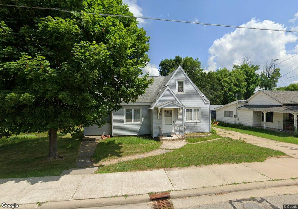
209 S 5th St Roscommon, MI 48653
Estimated Value: $90,000 - $180,000
3
Beds
2
Baths
2,076
Sq Ft
$62/Sq Ft
Est. Value
About This Home
This home is located at 209 S 5th St, Roscommon, MI 48653 and is currently estimated at $129,389, approximately $62 per square foot. 209 S 5th St is a home with nearby schools including Roscommon Elementary School, Roscommon Middle School, and Roscommon High School.
Ownership History
Date
Name
Owned For
Owner Type
Purchase Details
Closed on
Aug 19, 2016
Sold by
Miller Shelley
Bought by
Stilson William V
Current Estimated Value
Home Financials for this Owner
Home Financials are based on the most recent Mortgage that was taken out on this home.
Original Mortgage
$30,848
Outstanding Balance
$24,589
Interest Rate
3.45%
Mortgage Type
New Conventional
Estimated Equity
$104,800
Purchase Details
Closed on
Feb 1, 2014
Sold by
Miller Shelley A
Bought by
Stilson William Vann
Purchase Details
Closed on
Oct 24, 2013
Sold by
County Of Roscommon
Bought by
Miller Shelley A
Purchase Details
Closed on
Jul 15, 2008
Sold by
Noel Jackie A and The Lesko Family Trust
Bought by
Noel Jackie A
Create a Home Valuation Report for This Property
The Home Valuation Report is an in-depth analysis detailing your home's value as well as a comparison with similar homes in the area
Home Values in the Area
Average Home Value in this Area
Purchase History
| Date | Buyer | Sale Price | Title Company |
|---|---|---|---|
| Stilson William V | $32,000 | None Available | |
| Stilson William Vann | $32,000 | -- | |
| Miller Shelley A | $3,000 | -- | |
| Noel Jackie A | -- | None Available |
Source: Public Records
Mortgage History
| Date | Status | Borrower | Loan Amount |
|---|---|---|---|
| Open | Stilson William V | $30,848 |
Source: Public Records
Tax History Compared to Growth
Tax History
| Year | Tax Paid | Tax Assessment Tax Assessment Total Assessment is a certain percentage of the fair market value that is determined by local assessors to be the total taxable value of land and additions on the property. | Land | Improvement |
|---|---|---|---|---|
| 2025 | $1,377 | $47,500 | $0 | $0 |
| 2024 | $905 | $51,700 | $0 | $0 |
| 2023 | $864 | $51,700 | $0 | $0 |
| 2022 | $1,684 | $42,900 | $0 | $0 |
| 2021 | $1,609 | $40,700 | $0 | $0 |
| 2020 | $1,578 | $40,600 | $0 | $0 |
| 2019 | $1,164 | $39,200 | $0 | $0 |
| 2018 | $1,475 | $36,200 | $0 | $0 |
| 2016 | $741 | $16,000 | $0 | $0 |
| 2015 | -- | $15,500 | $0 | $0 |
| 2014 | -- | $17,400 | $0 | $0 |
| 2013 | -- | $29,700 | $0 | $0 |
Source: Public Records
Map
Nearby Homes
- 305 S Main St
- 0 N Main St Unit 20251028047
- N Everett Rd
- V/L 1.22AC N 4th St
- 1362 Esther Ct
- 306 Acre Ct
- 38 S Eugene Dr
- 0 Walker Dr Unit 50184928
- 11491 Pines Trail
- 0 Beaver Creek Trail Unit 25064697
- 0 Beaver Creek Trail Unit 24974184
- 11269 Tanglewood Dr
- 11427 Huntinghorn Rd
- 11282 Steckert Bridge Rd
- 9841 N Wheeler Rd
- V/L Steckert Bridge Rd
- E Huntinghorn Rd
- 115 S Hunting Horn Dr
- Silverbow Ln
- Lot # 21 W Roberta Dr