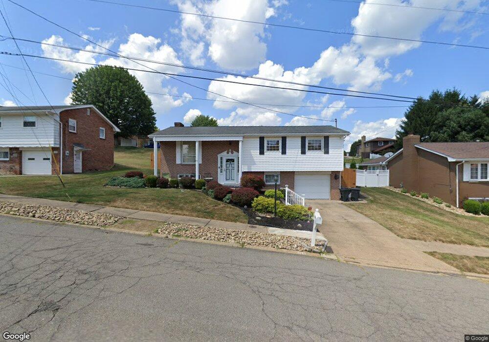
209 S Circle Dr Weirton, WV 26062
Estimated Value: $239,041 - $249,000
3
Beds
1
Bath
1,448
Sq Ft
$169/Sq Ft
Est. Value
About This Home
This home is located at 209 S Circle Dr, Weirton, WV 26062 and is currently estimated at $244,010, approximately $168 per square foot. 209 S Circle Dr is a home located in Hancock County with nearby schools including St. Joseph the Worker Grade School, Tri-State Christian Academy, and Weirton Christian Academy.
Ownership History
Date
Name
Owned For
Owner Type
Purchase Details
Closed on
Mar 18, 2025
Sold by
Cuomo Evan
Bought by
Rovira Emily and Rovira Amy
Current Estimated Value
Home Financials for this Owner
Home Financials are based on the most recent Mortgage that was taken out on this home.
Original Mortgage
$240,562
Outstanding Balance
$239,350
Interest Rate
6.95%
Mortgage Type
FHA
Estimated Equity
$4,660
Purchase Details
Closed on
Mar 15, 2023
Sold by
Balog Steve R
Bought by
Cuomo Evan Michael
Home Financials for this Owner
Home Financials are based on the most recent Mortgage that was taken out on this home.
Original Mortgage
$144,000
Interest Rate
6.09%
Mortgage Type
New Conventional
Create a Home Valuation Report for This Property
The Home Valuation Report is an in-depth analysis detailing your home's value as well as a comparison with similar homes in the area
Home Values in the Area
Average Home Value in this Area
Purchase History
| Date | Buyer | Sale Price | Title Company |
|---|---|---|---|
| Rovira Emily | $245,000 | None Listed On Document | |
| Cuomo Evan Michael | $180,000 | -- | |
| Cuomo Evan Michael | $180,000 | None Listed On Document |
Source: Public Records
Mortgage History
| Date | Status | Borrower | Loan Amount |
|---|---|---|---|
| Open | Rovira Emily | $240,562 | |
| Previous Owner | Cuomo Evan Michael | $144,000 |
Source: Public Records
Tax History Compared to Growth
Tax History
| Year | Tax Paid | Tax Assessment Tax Assessment Total Assessment is a certain percentage of the fair market value that is determined by local assessors to be the total taxable value of land and additions on the property. | Land | Improvement |
|---|---|---|---|---|
| 2024 | $1,384 | $87,960 | $25,920 | $62,040 |
| 2023 | $1,342 | $87,960 | $25,920 | $62,040 |
| 2022 | $1,052 | $87,960 | $25,920 | $62,040 |
| 2021 | $1,013 | $85,260 | $23,880 | $61,380 |
| 2020 | $953 | $81,600 | $22,680 | $58,920 |
| 2019 | $953 | $80,880 | $22,680 | $58,200 |
| 2018 | $914 | $78,120 | $21,600 | $56,520 |
| 2017 | $885 | $75,780 | $20,640 | $55,140 |
| 2016 | $873 | $75,120 | $19,980 | $55,140 |
| 2015 | $703 | $73,080 | $19,980 | $53,100 |
| 2014 | $703 | $73,080 | $16,080 | $57,000 |
Source: Public Records
Map
Nearby Homes
- 103 Kathleen Way
- 260 Scenery Dr
- 152 Phillips St
- 101 Denese Dr
- 205 Millsop Dr
- 3465 Pennsylvania Ave
- 3466 Pennsylvania Ave
- 131 Forest Rd
- 249 Greenlawn Blvd
- 107 Middle Ave
- 133 Bass Dr
- 231 Miller Ave
- 103 Marie Ave
- 114 Stroud Ave
- 16 Devils Den Rd
- TBD Marie Ave
- 175 Gilson Ave
- 345 Ritchie Ave
- 132 Pamela Dr
- 126 Pike St
- 205 S Circle Dr
- 213 S Circle Dr
- 208 Scenery Dr
- 201 S Circle Dr
- 212 Scenery Dr
- 204 Scenery Dr
- 101 Sherwood Dr
- 217 S Circle Dr
- 216 Scenery Dr
- 200 Scenery Dr
- 221 S Circle Dr
- 154 Circle Dr
- 109 Sherwood Dr
- 220 Scenery Dr
- 220 S Circle Dr
- 225 S Circle Dr
- 177179 Circle Dr
- 113 Sherwood Dr
- 209 Scenery Dr
- 224 S Circle Dr