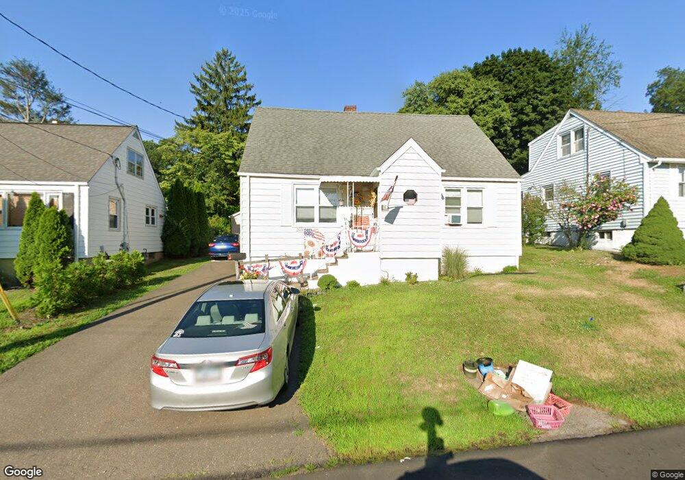
209 Sampson St Bridgeport, CT 06606
Brooklawn-Saint Vincent NeighborhoodEstimated Value: $394,000 - $474,000
About This Home
This home is located at 209 Sampson St, Bridgeport, CT 06606 and is currently estimated at $429,339, approximately $303 per square foot. 209 Sampson St is a home located in Fairfield County with nearby schools including Blackham School, Central High School, and Assumption Catholic School.
Ownership History
We collect this data history from publicly available records. To have your information removed, we recommend requesting removal directly through your county’s website.
Purchase Details
Home Values in the Area
Average Home Value in this Area
Purchase History
We collect this data history from publicly available records. To have your information removed, we recommend requesting removal directly through your county’s website.
| Date | Buyer | Sale Price | Title Company |
|---|---|---|---|
| -- | None Available | ||
| -- | None Available | ||
| -- | None Available |
Tax History
We collect this data history from publicly available records. To have your information removed, we recommend requesting removal directly through your county’s website.
| Year | Tax Paid | Tax Assessment Tax Assessment Total Assessment is a certain percentage of the fair market value that is determined by local assessors to be the total taxable value of land and additions on the property. | Land | Improvement |
|---|---|---|---|---|
| 2025 | $6,455 | $148,570 | $70,570 | $78,000 |
| 2024 | $6,455 | $148,570 | $70,570 | $78,000 |
| 2023 | $6,455 | $148,570 | $70,570 | $78,000 |
| 2022 | $6,455 | $148,570 | $70,570 | $78,000 |
| 2021 | $6,455 | $148,570 | $70,570 | $78,000 |
| 2020 | $5,562 | $103,010 | $36,870 | $66,140 |
| 2019 | $5,562 | $103,010 | $36,870 | $66,140 |
| 2018 | $5,601 | $103,010 | $36,870 | $66,140 |
| 2017 | $5,601 | $103,010 | $36,870 | $66,140 |
| 2016 | $5,601 | $103,010 | $36,870 | $66,140 |
| 2015 | $5,578 | $132,170 | $44,610 | $87,560 |
| 2014 | $5,578 | $132,170 | $44,610 | $87,560 |
Map
- 11 Myron Ave
- 25 Myron Ave
- 221 Truman St
- 150-152 Alexander Dr
- 66-68 Alexander Dr
- 175 Alexander Dr
- 380 Harlem Ave
- 1103-1105 Capitol Ave
- 2625 Park Ave Unit PHD
- 2625 Park Ave Unit 7S
- 2625 Park Ave Unit 14J
- 315-317 Alexander Ave
- 152 Jackson Ave
- 190-192 Garfield Ave
- 405 Westfield Ave
- 278 Federal St Unit 280
- 371 Northfield Dr
- 283 Salem St
- 92 Lincoln Ave
- 228 Westfield Ave
- 198 Sampson St
- 184 Sampson St
- 197 Sampson St
- 172 Sampson St
- 214 Sampson St
- 176 Holroyd St
- 128 Perth St
- 173 Sampson St
- 224 Sampson St
- 226 Sampson St
- 228 Sampson St
- 142 Holroyd St
- 142 Holroyd St Unit 1
- 142 Holroyd St Unit 2
- 142 Holroyd St Unit 3
- 159 Sampson St Unit 161
- 217 Sampson St
- 160 Sampson St
- 109 Holroyd St
- 225 Sampson St
Ask me questions while you tour the home.