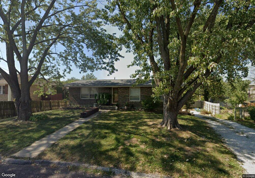
209 Snead Dr Columbia, MO 65202
Estimated Value: $179,000 - $206,000
3
Beds
2
Baths
1,108
Sq Ft
$179/Sq Ft
Est. Value
About This Home
This home is located at 209 Snead Dr, Columbia, MO 65202 and is currently estimated at $198,064, approximately $178 per square foot. 209 Snead Dr is a home located in Boone County with nearby schools including Eliot Battle Elementary School, John B. Lange Middle School, and Muriel W. Battle High School.
Ownership History
Date
Name
Owned For
Owner Type
Purchase Details
Closed on
Sep 22, 2008
Sold by
Anderson Gary W and Anderson Qunnah K
Bought by
Gallaher Anthony T
Current Estimated Value
Home Financials for this Owner
Home Financials are based on the most recent Mortgage that was taken out on this home.
Original Mortgage
$91,500
Outstanding Balance
$61,093
Interest Rate
6.6%
Mortgage Type
VA
Estimated Equity
$136,971
Create a Home Valuation Report for This Property
The Home Valuation Report is an in-depth analysis detailing your home's value as well as a comparison with similar homes in the area
Home Values in the Area
Average Home Value in this Area
Purchase History
| Date | Buyer | Sale Price | Title Company |
|---|---|---|---|
| Gallaher Anthony T | -- | Boone Central Title Company |
Source: Public Records
Mortgage History
| Date | Status | Borrower | Loan Amount |
|---|---|---|---|
| Open | Gallaher Anthony T | $91,500 |
Source: Public Records
Tax History Compared to Growth
Tax History
| Year | Tax Paid | Tax Assessment Tax Assessment Total Assessment is a certain percentage of the fair market value that is determined by local assessors to be the total taxable value of land and additions on the property. | Land | Improvement |
|---|---|---|---|---|
| 2025 | $1,081 | $14,953 | $2,831 | $12,122 |
| 2024 | $1,081 | $14,953 | $2,831 | $12,122 |
| 2023 | $1,072 | $14,953 | $2,831 | $12,122 |
| 2022 | $1,071 | $14,953 | $2,831 | $12,122 |
| 2021 | $1,073 | $14,953 | $2,831 | $12,122 |
| 2020 | $1,053 | $13,851 | $2,831 | $11,020 |
| 2019 | $1,053 | $13,851 | $2,831 | $11,020 |
| 2018 | $1,060 | $0 | $0 | $0 |
| 2017 | $1,048 | $13,851 | $2,831 | $11,020 |
| 2016 | $1,046 | $13,851 | $2,831 | $11,020 |
| 2015 | $966 | $13,851 | $2,831 | $11,020 |
| 2014 | -- | $13,851 | $2,831 | $11,020 |
Source: Public Records
Map
Nearby Homes
- 6007 E Saint Charles Rd
- 6003 E St Charles Rd
- 1312 N Lake of the Woods Rd
- 1312 N Lake of the Wood
- 1537 N Lake of the Woods Rd
- 6077 E Locust Grove Dr
- 300 Searsport Dr
- 5800 Oswago Cir
- 5802 Islip Dr
- 1887 Waterfront Dr N Unit F
- 5724 Black Gum Ct
- 1999 Waterfront Dr N Unit G
- 1999 Waterfront Dr N Unit H
- 2032 Waterfront Dr N Unit C
- 1997 Waterfront Dr N Unit D
- 5904 Freeport Way
- 1710 Kassem Dr
- 5301 Gasconade Dr
- 2009 Waterfront Dr N Unit E
- 2009 Waterfront Dr N Unit A1
- 207 Snead Dr
- 211 Snead Dr
- 101 Sanders Ct
- 1201-1203 Player Place
- 1201 Player Place Unit 1203
- 205 Snead Dr
- 103 Sanders Ct
- 210 Snead Dr
- 212 Snead Dr
- 215 Snead Dr
- 1205-1207 Player Place
- 203 Snead Dr
- 214 Snead Dr
- 1205 Player Place Unit 1207
- 105 Sanders Ct
- 1200-1202 Player Place
- 1200 Player Place Unit 1202
- 100 Sanders Ct
- 204 Snead Dr
- 201 Snead Dr