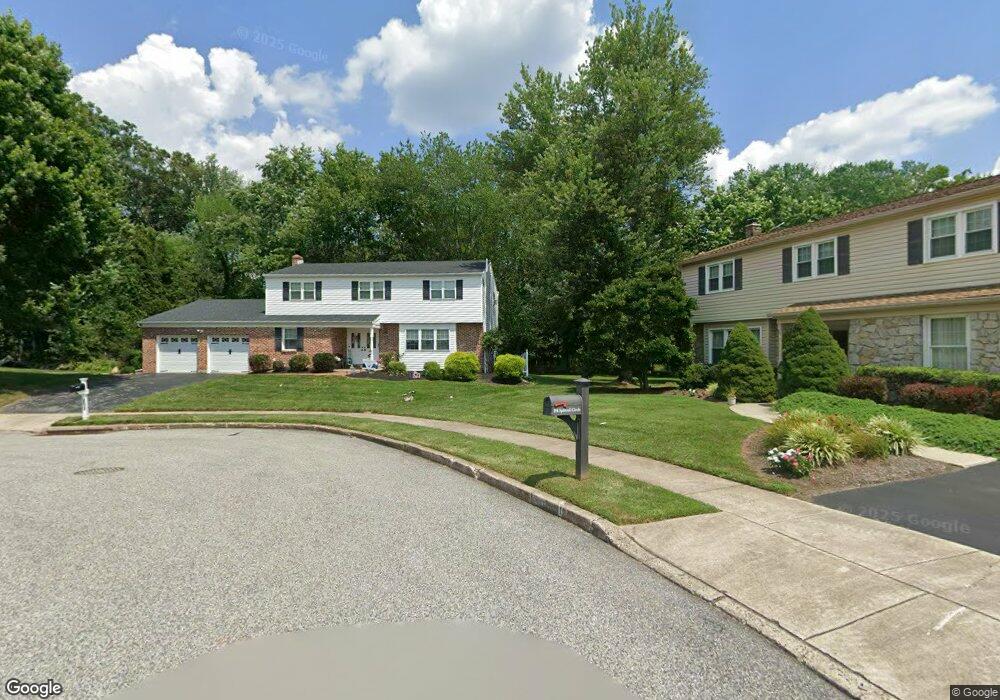
209 Splitrail Cir Norristown, PA 19403
West Norriton Township NeighborhoodEstimated Value: $519,000 - $552,000
4
Beds
3
Baths
2,353
Sq Ft
$227/Sq Ft
Est. Value
About This Home
This home is located at 209 Splitrail Cir, Norristown, PA 19403 and is currently estimated at $534,735, approximately $227 per square foot. 209 Splitrail Cir is a home located in Montgomery County with nearby schools including Whitehall Elementary School, Charles Blockson Middle School, and East Norriton Middle School.
Ownership History
Date
Name
Owned For
Owner Type
Purchase Details
Closed on
Aug 22, 2008
Sold by
Buno Francis and Buno Joanne
Bought by
Tornetta James A and Tornetta Dana
Current Estimated Value
Home Financials for this Owner
Home Financials are based on the most recent Mortgage that was taken out on this home.
Original Mortgage
$323,000
Outstanding Balance
$215,705
Interest Rate
6.69%
Estimated Equity
$319,030
Create a Home Valuation Report for This Property
The Home Valuation Report is an in-depth analysis detailing your home's value as well as a comparison with similar homes in the area
Home Values in the Area
Average Home Value in this Area
Purchase History
| Date | Buyer | Sale Price | Title Company |
|---|---|---|---|
| Tornetta James A | $340,000 | None Available |
Source: Public Records
Mortgage History
| Date | Status | Borrower | Loan Amount |
|---|---|---|---|
| Open | Tornetta James A | $323,000 |
Source: Public Records
Tax History Compared to Growth
Tax History
| Year | Tax Paid | Tax Assessment Tax Assessment Total Assessment is a certain percentage of the fair market value that is determined by local assessors to be the total taxable value of land and additions on the property. | Land | Improvement |
|---|---|---|---|---|
| 2025 | $7,302 | $149,440 | $42,010 | $107,430 |
| 2024 | $7,302 | $149,440 | $42,010 | $107,430 |
| 2023 | $7,219 | $149,440 | $42,010 | $107,430 |
| 2022 | $7,172 | $149,440 | $42,010 | $107,430 |
| 2021 | $7,128 | $149,440 | $42,010 | $107,430 |
| 2020 | $6,915 | $149,440 | $42,010 | $107,430 |
| 2019 | $6,761 | $149,440 | $42,010 | $107,430 |
| 2018 | $5,270 | $149,440 | $42,010 | $107,430 |
| 2017 | $6,383 | $149,440 | $42,010 | $107,430 |
| 2016 | $6,325 | $149,440 | $42,010 | $107,430 |
| 2015 | $5,860 | $149,440 | $42,010 | $107,430 |
| 2014 | $5,860 | $149,440 | $42,010 | $107,430 |
Source: Public Records
Map
Nearby Homes
- 2020 Sterigere St
- 1613 Countryside Ln
- 2158 Alexander Dr
- 2020 Davis Dr
- 2504 Rockwood Dr
- 2515 Fieldcrest Ave
- 1905 Davis Dr
- 00 Arden Dr Unit METHACTON SCHOOL
- 1104 Arden Dr Unit METHACTON SCHOOL
- 32 Miami Rd
- 2055 W Marshall St
- 37 Burnside Ave
- 68 Jefferson Ave
- 709 Middleton Place
- 805 Stonybrook Dr
- 930 Heritage Dr
- 304 Middleton Place
- 1803 Sweet Gum Dr
- 166 Hoover Ave
- 1219 Stonybrook Dr Unit 1219
- 210 Paddock Cir
- 213 Splitrail Cir
- 214 Paddock Cir
- 205 Splitrail Cir
- 206 Paddock Cir
- 214 Splitrail Cir
- 210 Splitrail Cir
- 201 Splitrail Cir
- 213 Paddock Cir
- 202 Paddock Cir
- 206 Splitrail Cir
- 209 Paddock Cir
- 202 Splitrail Cir
- 205 Paddock Cir
- 201 Paddock Cir
- 2201 Ronald Dr Unit LOT 41
- 2201 Ronald Dr
- 2203 Ronald Dr
- 2203 Ronald Dr Unit LOT 42
- 2205 Ronald Dr