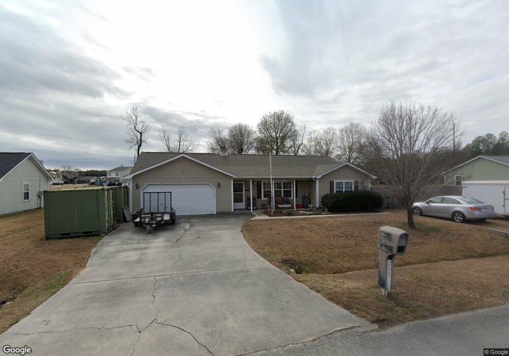
209 Stag Ct Hubert, NC 28539
Hubert NeighborhoodEstimated Value: $241,000 - $268,663
About This Home
This home is located at 209 Stag Ct, Hubert, NC 28539 and is currently estimated at $256,666, approximately $159 per square foot. 209 Stag Ct is a home located in Onslow County with nearby schools including Sand Ridge Elementary School, Swansboro Middle School, and Swansboro High School.
Ownership History
We collect this data history from publicly available records. To have your information removed, we recommend requesting removal directly through your county’s website.
Purchase Details
Home Financials for this Owner
Home Financials are based on the most recent Mortgage that was taken out on this home.Home Values in the Area
Average Home Value in this Area
Purchase History
We collect this data history from publicly available records. To have your information removed, we recommend requesting removal directly through your county’s website.
| Date | Buyer | Sale Price | Title Company |
|---|---|---|---|
| $157,000 | None Available |
Mortgage History
We collect this data history from publicly available records. To have your information removed, we recommend requesting removal directly through your county’s website.
| Date | Status | Borrower | Loan Amount |
|---|---|---|---|
| Open | $160,350 |
Tax History
We collect this data history from publicly available records. To have your information removed, we recommend requesting removal directly through your county’s website.
| Year | Tax Paid | Tax Assessment Tax Assessment Total Assessment is a certain percentage of the fair market value that is determined by local assessors to be the total taxable value of land and additions on the property. | Land | Improvement |
|---|---|---|---|---|
| 2025 | $1,017 | $200,204 | $40,000 | $160,204 |
| 2024 | $974 | $193,764 | $40,000 | $153,764 |
| 2023 | $974 | $193,764 | $40,000 | $153,764 |
| 2022 | $969 | $192,958 | $40,000 | $152,958 |
| 2021 | $720 | $147,160 | $30,000 | $117,160 |
| 2020 | $716 | $146,540 | $30,000 | $116,540 |
| 2019 | $716 | $146,540 | $30,000 | $116,540 |
| 2018 | $692 | $143,110 | $30,000 | $113,110 |
| 2017 | $679 | $145,570 | $30,000 | $115,570 |
| 2016 | $679 | $100,570 | $0 | $0 |
| 2015 | $679 | $100,570 | $0 | $0 |
| 2014 | $983 | $145,570 | $0 | $0 |
Map
- 638 Sand Ridge Rd
- 115 Daphne Dr
- 442 Dion Dr
- 143 Glenwood Dr
- 134 Parnell Rd
- 123 Daphne Dr
- 622 Sand Ridge Rd
- 618 Sand Ridge Rd
- 300 Foxtrace Ln
- 406 Foxtrace Ln Unit A&B
- 164 Glenwood Dr
- 203 W Volant St
- 826 Sand Ridge Rd
- 243 Parnell Rd
- 266 Surfside Landing Blvd Unit Lot 108
- 500 Bogue View Rd Unit Lot 97
- 262 Surfside Landing Blvd Unit Lot 106
- 502 Bogue View Rd Unit Lot 98
- 309 Crown Point Rd
- 504 Bogue View Dr Unit Lot 99
Ask me questions while you tour the home.