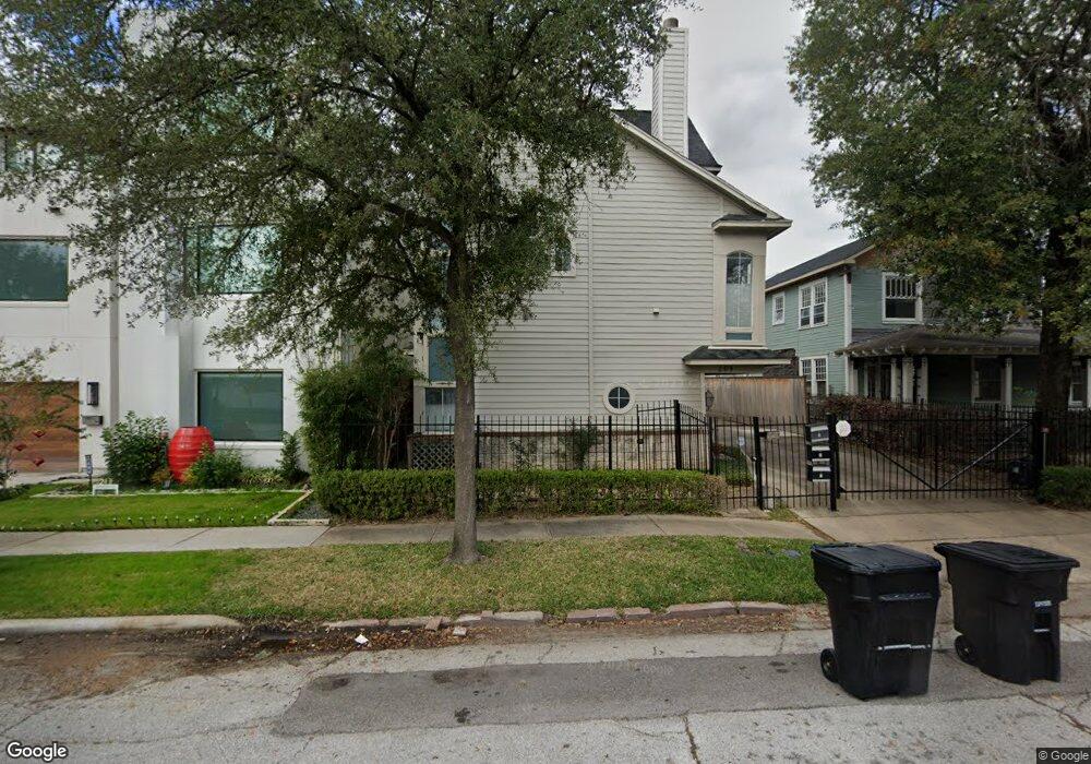
209 Stratford St Unit B Houston, TX 77006
Montrose NeighborhoodEstimated Value: $406,681 - $470,000
3
Beds
3
Baths
1,866
Sq Ft
$238/Sq Ft
Est. Value
About This Home
This home is located at 209 Stratford St Unit B, Houston, TX 77006 and is currently estimated at $443,420, approximately $237 per square foot. 209 Stratford St Unit B is a home located in Harris County with nearby schools including Gregory-Lincoln Ed Center, Wharton Dual Language Academy, and Lamar High School.
Ownership History
Date
Name
Owned For
Owner Type
Purchase Details
Closed on
Nov 15, 2016
Sold by
Thornton Dennis M and Thornton Christina Reid
Bought by
Henry Pamela M
Current Estimated Value
Home Financials for this Owner
Home Financials are based on the most recent Mortgage that was taken out on this home.
Original Mortgage
$281,000
Outstanding Balance
$222,556
Interest Rate
3%
Mortgage Type
Adjustable Rate Mortgage/ARM
Estimated Equity
$220,864
Create a Home Valuation Report for This Property
The Home Valuation Report is an in-depth analysis detailing your home's value as well as a comparison with similar homes in the area
Home Values in the Area
Average Home Value in this Area
Purchase History
| Date | Buyer | Sale Price | Title Company |
|---|---|---|---|
| Henry Pamela M | -- | Metropolitan Title & Escrow |
Source: Public Records
Mortgage History
| Date | Status | Borrower | Loan Amount |
|---|---|---|---|
| Open | Henry Pamela M | $281,000 |
Source: Public Records
Tax History Compared to Growth
Tax History
| Year | Tax Paid | Tax Assessment Tax Assessment Total Assessment is a certain percentage of the fair market value that is determined by local assessors to be the total taxable value of land and additions on the property. | Land | Improvement |
|---|---|---|---|---|
| 2025 | $5,077 | $377,717 | $110,880 | $266,837 |
| 2024 | $5,077 | $354,549 | $110,880 | $243,669 |
| 2023 | $5,077 | $362,875 | $110,880 | $251,995 |
| 2022 | $7,266 | $329,985 | $104,720 | $225,265 |
| 2021 | $7,297 | $313,100 | $98,560 | $214,540 |
| 2020 | $7,589 | $313,393 | $98,560 | $214,833 |
| 2019 | $7,930 | $313,393 | $98,560 | $214,833 |
| 2018 | $6,385 | $328,704 | $86,240 | $242,464 |
| 2017 | $8,722 | $328,704 | $86,240 | $242,464 |
| 2016 | $8,560 | $328,704 | $86,240 | $242,464 |
| 2015 | $5,332 | $328,704 | $86,240 | $242,464 |
| 2014 | $5,332 | $283,900 | $86,240 | $197,660 |
Source: Public Records
Map
Nearby Homes
- 211 Stratford St
- 2703 Mason St Unit 16
- 2703 Mason St Unit 13
- 215 Avondale St
- 12 Hyde Park Blvd Unit 7
- 12 Hyde Park Blvd Unit 5
- 309 Stratford St Unit 18
- 234 Westheimer Rd Unit 8
- 98 Drew St Unit B
- 239 Westheimer Rd Unit 1
- 2514 Morgan St
- 201 Westheimer Rd Unit E
- 2404 Fairview St Unit C
- 2223 Taft St
- 10 Courtlandt Place
- 415 Fairview St
- 209 W Drew St
- 501 Avondale St
- 2716 Baldwin St
- 402 Tuam St Unit 2
- 209 Stratford St Unit A
- 209 Stratford St Unit C
- 209 Stratford St Unit A
- 209 Stratford St
- 209 Stratford St
- 209C Stratford St
- 109 Pacific St
- 11 Hyde Park Blvd
- 11 Hyde Park Blvd
- 11 Hyde Park Blvd
- 11 Hyde Park Blvd Unit A
- 11 Hyde Park Blvd Unit C
- 211 Stratford St Unit 2
- 211 Stratford St Unit 6
- 213 Stratford St Unit 2
- 213 Stratford St Unit 1
- 213 Stratford St Unit 3
- 113 Pacific St Unit 1
- 113 Pacific St Unit 2
- 113 Pacific St Unit 3