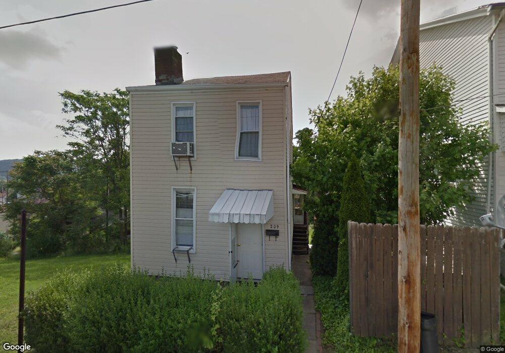
209 Summit Way Clairton, PA 15025
Estimated Value: $69,059 - $73,000
2
Beds
1
Bath
1,244
Sq Ft
$57/Sq Ft
Est. Value
About This Home
This home is located at 209 Summit Way, Clairton, PA 15025 and is currently estimated at $71,030, approximately $57 per square foot. 209 Summit Way is a home located in Allegheny County with nearby schools including Clairton Elementary School, Clairton Middle School/High School, and Cornerstone Leadership Academy.
Ownership History
Date
Name
Owned For
Owner Type
Purchase Details
Closed on
Jan 23, 2024
Sold by
Yogan Kirk and Yogan Kirk W
Bought by
Pittsburgh S F R Portfolio 2 A L L C
Current Estimated Value
Purchase Details
Closed on
Jan 17, 2024
Sold by
Yogan Kirk W
Bought by
Pittsburgh Sfr Portfolio 2A Llc
Purchase Details
Closed on
Jul 8, 2020
Sold by
Payden Real Estate Invests L L C
Bought by
Yogan Kirk W
Purchase Details
Closed on
Jul 27, 2010
Sold by
Della Valle Ralph
Bought by
Krupp Mathew D
Create a Home Valuation Report for This Property
The Home Valuation Report is an in-depth analysis detailing your home's value as well as a comparison with similar homes in the area
Home Values in the Area
Average Home Value in this Area
Purchase History
| Date | Buyer | Sale Price | Title Company |
|---|---|---|---|
| Pittsburgh Sfr Portfolio 2A Llc | $3,442,531 | -- | |
| Yogan Kirk W | $175,000 | None Available | |
| Krupp Mathew D | $7,500 | -- | |
| Pittsburgh S F R Portfolio 2 A L L C | $2,122,354 | -- | |
| Pittsburgh S F R Portfolio 2 A L L C | $2,122,354 | -- | |
| Pittsburgh S F R Portfolio 2 A | $2,122,354 | -- |
Source: Public Records
Tax History
| Year | Tax Paid | Tax Assessment Tax Assessment Total Assessment is a certain percentage of the fair market value that is determined by local assessors to be the total taxable value of land and additions on the property. | Land | Improvement |
|---|---|---|---|---|
| 2025 | $610 | $12,600 | $8,500 | $4,100 |
| 2024 | $610 | $12,600 | $8,500 | $4,100 |
| 2023 | $578 | $12,600 | $8,500 | $4,100 |
| 2022 | $578 | $12,600 | $8,500 | $4,100 |
| 2021 | $1,128 | $12,600 | $8,500 | $4,100 |
| 2020 | $574 | $12,600 | $8,500 | $4,100 |
| 2019 | $199 | $12,600 | $8,500 | $4,100 |
| 2017 | $195 | $12,600 | $8,500 | $4,100 |
Source: Public Records
Map
Nearby Homes
- 203 Elm St
- 416 Walnut Ave
- 122 Walnut Ave
- 502 Walnut Ave
- 124 Carnegie Ave
- 300 Locust Ave
- 514 Walnut Ave
- 320 N 4th St
- 409 Mendelssohn Ave
- 371 Ohio Ave
- 447 Ohio Ave
- 574 State Route 885
- 357 Ohio Ave
- 1017 Pennsylvania Ave
- 1019 Pennsylvania Ave
- 1045 Pennsylvania Ave
- 627 Park Ave
- 519 Wilson Ave
- 412 5th St
- 624 Park Ave
Your Personal Tour Guide
Ask me questions while you tour the home.