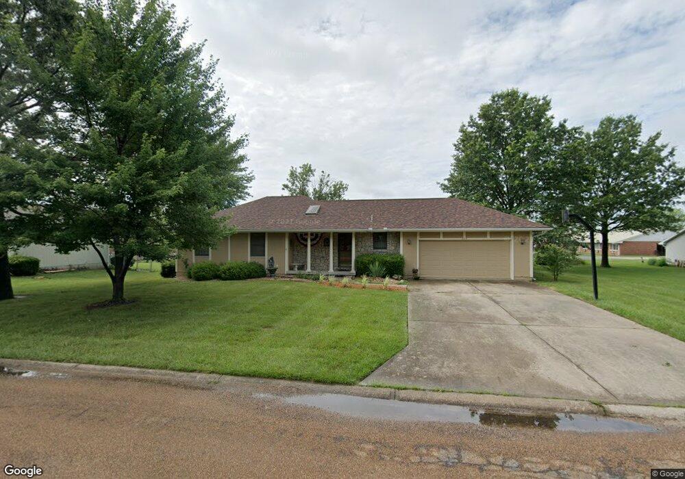
209 W 20th St Holden, MO 64040
Estimated Value: $219,000 - $239,777
3
Beds
2
Baths
2,014
Sq Ft
$114/Sq Ft
Est. Value
About This Home
This home is located at 209 W 20th St, Holden, MO 64040 and is currently estimated at $229,389, approximately $113 per square foot. 209 W 20th St is a home located in Johnson County with nearby schools including Holden Elementary School, Holden Middle School, and Holden High School.
Ownership History
Date
Name
Owned For
Owner Type
Purchase Details
Closed on
Apr 30, 2010
Sold by
Lohe David J and Lohe Sherri L
Bought by
Cooper Lanita L
Current Estimated Value
Home Financials for this Owner
Home Financials are based on the most recent Mortgage that was taken out on this home.
Original Mortgage
$93,600
Outstanding Balance
$62,305
Interest Rate
4.91%
Mortgage Type
New Conventional
Estimated Equity
$167,084
Purchase Details
Closed on
Oct 23, 2007
Sold by
Lohe John
Bought by
Lohe David J and Lohe Sherri L
Create a Home Valuation Report for This Property
The Home Valuation Report is an in-depth analysis detailing your home's value as well as a comparison with similar homes in the area
Home Values in the Area
Average Home Value in this Area
Purchase History
| Date | Buyer | Sale Price | Title Company |
|---|---|---|---|
| Cooper Lanita L | -- | None Available | |
| Lohe David J | -- | -- | |
| Lohe John | -- | -- |
Source: Public Records
Mortgage History
| Date | Status | Borrower | Loan Amount |
|---|---|---|---|
| Open | Cooper Lanita L | $93,600 |
Source: Public Records
Tax History Compared to Growth
Tax History
| Year | Tax Paid | Tax Assessment Tax Assessment Total Assessment is a certain percentage of the fair market value that is determined by local assessors to be the total taxable value of land and additions on the property. | Land | Improvement |
|---|---|---|---|---|
| 2024 | $1,477 | $21,659 | $0 | $0 |
| 2023 | $1,477 | $21,659 | $0 | $0 |
| 2022 | $1,427 | $20,721 | $0 | $0 |
| 2021 | $1,392 | $20,721 | $0 | $0 |
| 2020 | $1,345 | $19,783 | $0 | $0 |
| 2019 | $1,349 | $19,783 | $0 | $0 |
| 2017 | $1,330 | $19,783 | $0 | $0 |
| 2016 | $1,356 | $19,783 | $0 | $0 |
| 2015 | $1,342 | $19,783 | $0 | $0 |
| 2014 | $1,341 | $19,783 | $0 | $0 |
Source: Public Records
Map
Nearby Homes
- 1404 S Market St
- 1405 S Vine St
- 1013 S Main St
- 1103 S Olive St
- 902 S Main St
- 1019 Rawlins Dr
- 805 S Pine St
- 904 S Clay St
- 704 S Olive St
- 1014 Golden Eagle Cir
- 609 S Lexington St
- 610 S Vine St
- 602 E 10th St
- 607 Saint Charles St
- 606 Niagara St
- 606 E 10th St
- 0 Missouri 58
- 0 58 Hwy Unit 2194764
- 303 S Lexington St
- 307 E 4th St
- 207 W 20th St
- 208 W 20th St
- 204 W 20th St
- 205 W 20th St
- 1906 S Lexington St
- 210 W 20th St
- 202 W 20th St
- 1905 S Lexington St
- 211 W 20th St
- 201 W 20th St
- 200 W 20th St
- 2000 S Lexington St
- 207 W 19th St
- 1901 S Lexington St
- 203 W 19th St
- 201 W 19th St
- 216 W 19th St
- 210 W 19th St
- 212 W 19th St
- 208 W 19th St