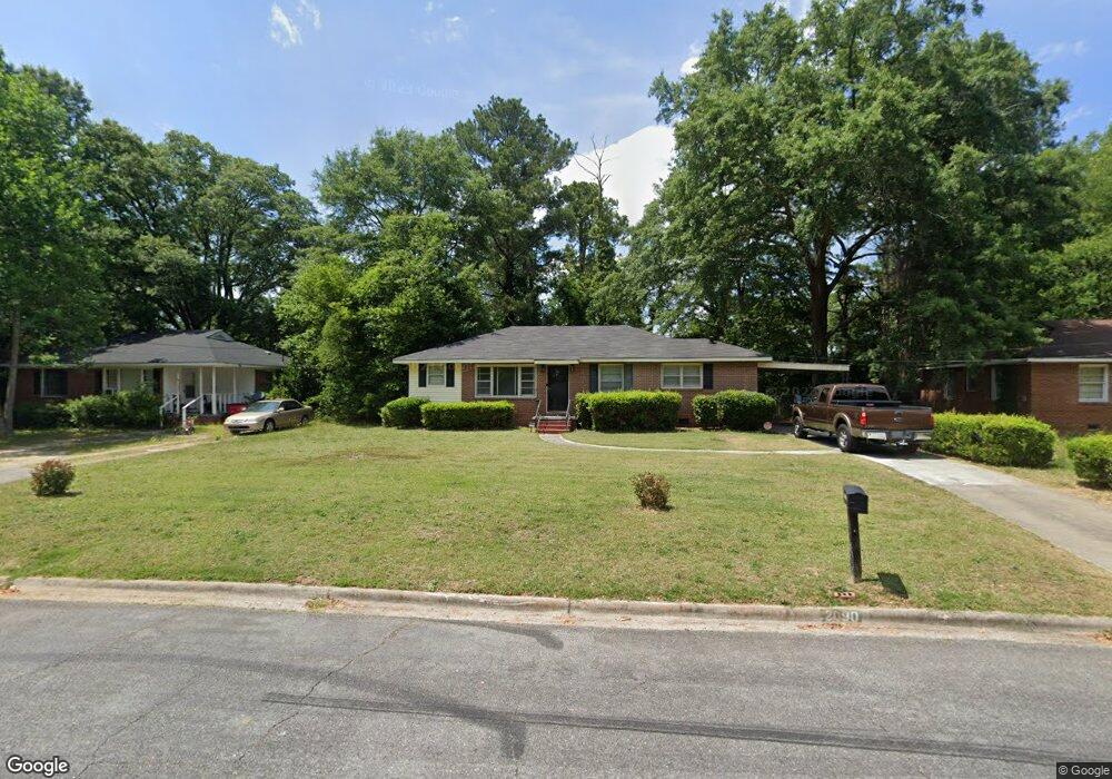
2090 Knightsbridge Rd Macon, GA 31211
Estimated Value: $115,000 - $133,811
3
Beds
2
Baths
1,482
Sq Ft
$85/Sq Ft
Est. Value
About This Home
This home is located at 2090 Knightsbridge Rd, Macon, GA 31211 and is currently estimated at $126,453, approximately $85 per square foot. 2090 Knightsbridge Rd is a home located in Bibb County with nearby schools including Martin Luther King Jr. Elementary School, Appling Middle School, and Northeast High School.
Ownership History
Date
Name
Owned For
Owner Type
Purchase Details
Closed on
Jun 30, 2023
Sold by
Sherman Shea
Bought by
Sfr3-020 Llc
Current Estimated Value
Purchase Details
Closed on
Apr 23, 2012
Sold by
Wilson Thomas Darryl
Bought by
Sherman Shea
Purchase Details
Closed on
Apr 3, 2012
Sold by
King Ezekiel and King Marquetta
Bought by
Wilson Thomas Darryl
Purchase Details
Closed on
Sep 17, 2009
Sold by
Wilson Thomas Darryl
Bought by
King Ezekiel and King Marquetta
Home Financials for this Owner
Home Financials are based on the most recent Mortgage that was taken out on this home.
Original Mortgage
$63,000
Interest Rate
5.15%
Mortgage Type
Seller Take Back
Purchase Details
Closed on
Dec 28, 2007
Sold by
Powell Mary Winifred and Powell Mary W
Bought by
Wilson T Darryl
Create a Home Valuation Report for This Property
The Home Valuation Report is an in-depth analysis detailing your home's value as well as a comparison with similar homes in the area
Purchase History
| Date | Buyer | Sale Price | Title Company |
|---|---|---|---|
| Sfr3-020 Llc | $53,500 | None Listed On Document | |
| Sfr3-020 Llc | $53,500 | None Listed On Document | |
| Sherman Shea | $52,000 | None Available | |
| Wilson Thomas Darryl | -- | None Available | |
| King Ezekiel | $65,000 | None Available | |
| Wilson T Darryl | $41,250 | None Available |
Source: Public Records
Mortgage History
| Date | Status | Borrower | Loan Amount |
|---|---|---|---|
| Previous Owner | King Ezekiel | $63,000 |
Source: Public Records
Tax History
| Year | Tax Paid | Tax Assessment Tax Assessment Total Assessment is a certain percentage of the fair market value that is determined by local assessors to be the total taxable value of land and additions on the property. | Land | Improvement |
|---|---|---|---|---|
| 2025 | $1,491 | $60,670 | $4,160 | $56,510 |
| 2024 | $543 | $27,341 | $2,600 | $24,741 |
| 2023 | $807 | $31,783 | $1,560 | $30,223 |
| 2022 | $769 | $22,213 | $2,600 | $19,613 |
| 2021 | $639 | $16,814 | $1,658 | $15,156 |
| 2020 | $584 | $15,031 | $1,658 | $13,373 |
| 2019 | $588 | $15,031 | $1,658 | $13,373 |
| 2018 | $1,081 | $15,031 | $1,658 | $13,373 |
| 2017 | $563 | $15,031 | $1,658 | $13,373 |
| 2016 | $520 | $15,031 | $1,658 | $13,373 |
| 2015 | $641 | $13,096 | $1,658 | $11,438 |
| 2014 | $995 | $17,662 | $2,412 | $15,250 |
Source: Public Records
Map
Nearby Homes
- 2630 Pauladale Dr
- 2639 Tredway Dr
- 2675 Pauladale Dr
- 2721 Kensington Place
- 2458 Tredway Dr
- 2418 Tredway Dr
- 2557 Hyde Park Rd
- 2504 Bedford Place
- 2361 Ollie Dr
- 2285 New Clinton Rd
- 240 Neptune Ct
- 1977 Thomas Dr
- 155 Alton Rd
- 2229 New Clinton Rd
- 2161 Melton Ave
- 131 Sun Valley Dr
- 2066 Melton Ave
- 837 Artic Cir
- 2740 Millerfield Rd
- 1038 Sun Valley Ct Unit C57
- 2084 Knightsbridge Rd
- 2096 Knightsbridge Rd
- 2106 Knightsbridge Rd
- 2078 Knightsbridge Rd
- 2619 Pauladale Dr
- 2625 Pauladale Dr
- 2087 Knightsbridge Rd
- 2093 Knightsbridge Rd
- 2615 Knightsbridge Place
- 2081 Knightsbridge Rd
- 2112 Knightsbridge Rd
- 2615 Knightsbridge Place
- 2631 Pauladale Dr
- 2103 Knightsbridge Rd
- 2613 Pauladale Dr
- 2071 Knightsbridge Rd
- 2109 Knightsbridge Rd
- 2637 Pauladale Dr
- 2120 Knightsbridge Rd
- 2072 Knightsbridge Rd
Your Personal Tour Guide
Ask me questions while you tour the home.