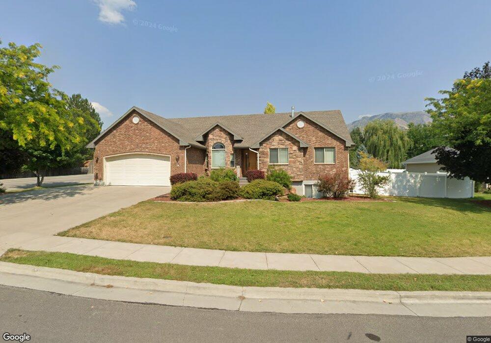
2090 N 950 E North Logan, UT 84341
Estimated Value: $618,723 - $674,000
6
Beds
4
Baths
3,560
Sq Ft
$183/Sq Ft
Est. Value
About This Home
This home is located at 2090 N 950 E, North Logan, UT 84341 and is currently estimated at $653,181, approximately $183 per square foot. 2090 N 950 E is a home located in Cache County with nearby schools including Greenville School, Cedar Ridge School, and North Cache Middle School.
Ownership History
Date
Name
Owned For
Owner Type
Purchase Details
Closed on
Jul 13, 2011
Sold by
Leonhardt Fernando and Villacorta Maria Daniela
Bought by
Leonhardt Fernando H
Current Estimated Value
Home Financials for this Owner
Home Financials are based on the most recent Mortgage that was taken out on this home.
Original Mortgage
$264,000
Outstanding Balance
$180,882
Interest Rate
4.5%
Mortgage Type
New Conventional
Estimated Equity
$472,299
Purchase Details
Closed on
Aug 9, 2005
Sold by
Rocky Ridge Construction & Development I
Bought by
Echols Ryan
Home Financials for this Owner
Home Financials are based on the most recent Mortgage that was taken out on this home.
Original Mortgage
$55,743
Interest Rate
5.61%
Mortgage Type
Stand Alone Second
Create a Home Valuation Report for This Property
The Home Valuation Report is an in-depth analysis detailing your home's value as well as a comparison with similar homes in the area
Home Values in the Area
Average Home Value in this Area
Purchase History
| Date | Buyer | Sale Price | Title Company |
|---|---|---|---|
| Leonhardt Fernando H | -- | Heritage Title | |
| Echols Ryan | -- | Cache Title Company | |
| Rocky Ridge Construction & Development I | -- | Cache Title Company |
Source: Public Records
Mortgage History
| Date | Status | Borrower | Loan Amount |
|---|---|---|---|
| Open | Leonhardt Fernando H | $264,000 | |
| Closed | Echols Ryan | $55,743 | |
| Closed | Rocky Ridge Construction & Development I | $55,743 | |
| Closed | Echols Ryan | $222,972 |
Source: Public Records
Tax History
| Year | Tax Paid | Tax Assessment Tax Assessment Total Assessment is a certain percentage of the fair market value that is determined by local assessors to be the total taxable value of land and additions on the property. | Land | Improvement |
|---|---|---|---|---|
| 2025 | $2,329 | $326,045 | $0 | $0 |
| 2024 | $2,776 | $361,545 | $0 | $0 |
| 2023 | $2,667 | $325,135 | $0 | $0 |
| 2022 | $2,792 | $325,135 | $0 | $0 |
| 2021 | $2,710 | $489,385 | $82,300 | $407,085 |
| 2020 | $2,580 | $436,880 | $82,300 | $354,580 |
| 2019 | $2,702 | $436,879 | $82,300 | $354,579 |
| 2018 | $2,317 | $363,230 | $54,900 | $308,330 |
| 2017 | $2,234 | $184,360 | $0 | $0 |
| 2016 | $2,269 | $184,360 | $0 | $0 |
| 2015 | $1,729 | $139,970 | $0 | $0 |
| 2014 | $1,688 | $139,970 | $0 | $0 |
| 2013 | -- | $139,970 | $0 | $0 |
Source: Public Records
Map
Nearby Homes
- 1593 N 110 W Unit 201
- 611 E 2450 N Unit 1
- 1593 N 110 W Unit 202
- 1593 N 110 W Unit 204
- 1200 W 1400 N
- 2950 N Mahogony Valley Rd E Unit 7
- 1598 N Sharptail Cir
- 1000 W 2500 N
- 2168 N 750 E
- 1100 E 1900 N Unit 10
- 1872 N 515 W
- 710 E 2160 N
- 741 E 2200 N
- 2284 N 740 E
- 1185 E 2500 N
- 2469 N 620 E Unit 3
- 2477 N 620 E Unit 4
- 1495 E 2300 N
- 2025 N 1550 E
- 2048 N 350 E
Your Personal Tour Guide
Ask me questions while you tour the home.