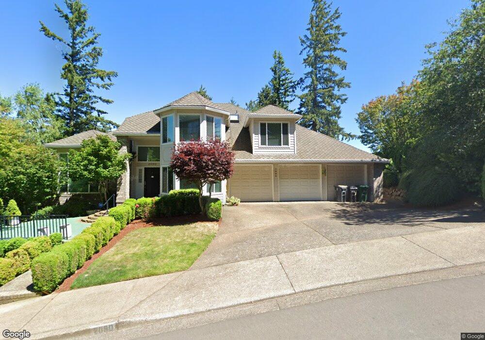
2090 Ridge Pointe Dr Lake Oswego, OR 97034
Palisades NeighborhoodEstimated Value: $1,583,381 - $1,893,000
5
Beds
4
Baths
4,186
Sq Ft
$416/Sq Ft
Est. Value
About This Home
This home is located at 2090 Ridge Pointe Dr, Lake Oswego, OR 97034 and is currently estimated at $1,742,095, approximately $416 per square foot. 2090 Ridge Pointe Dr is a home located in Clackamas County with nearby schools including Westridge Elementary School, Lakeridge Middle School, and Lakeridge High School.
Ownership History
Date
Name
Owned For
Owner Type
Purchase Details
Closed on
Mar 2, 2018
Sold by
Woodworth John M
Bought by
Woodworth John M and John M Woodworth Living Trust
Current Estimated Value
Purchase Details
Closed on
Jul 22, 2004
Sold by
Bell Shirley F
Bought by
Woodworth John M and Woodworth Charlene
Home Financials for this Owner
Home Financials are based on the most recent Mortgage that was taken out on this home.
Original Mortgage
$500,000
Outstanding Balance
$248,833
Interest Rate
6.27%
Mortgage Type
Purchase Money Mortgage
Estimated Equity
$1,493,262
Create a Home Valuation Report for This Property
The Home Valuation Report is an in-depth analysis detailing your home's value as well as a comparison with similar homes in the area
Home Values in the Area
Average Home Value in this Area
Purchase History
| Date | Buyer | Sale Price | Title Company |
|---|---|---|---|
| Woodworth John M | -- | None Available | |
| Woodworth John M | $625,000 | Transnation Title |
Source: Public Records
Mortgage History
| Date | Status | Borrower | Loan Amount |
|---|---|---|---|
| Open | Woodworth John M | $500,000 | |
| Closed | Woodworth John M | $62,500 |
Source: Public Records
Tax History Compared to Growth
Tax History
| Year | Tax Paid | Tax Assessment Tax Assessment Total Assessment is a certain percentage of the fair market value that is determined by local assessors to be the total taxable value of land and additions on the property. | Land | Improvement |
|---|---|---|---|---|
| 2025 | $17,247 | $900,036 | -- | -- |
| 2024 | $16,787 | $873,822 | -- | -- |
| 2023 | $16,787 | $848,371 | $0 | $0 |
| 2022 | $15,810 | $823,662 | $0 | $0 |
| 2021 | $14,601 | $799,672 | $0 | $0 |
| 2020 | $14,234 | $776,381 | $0 | $0 |
| 2019 | $12,772 | $693,401 | $0 | $0 |
| 2018 | $12,145 | $673,205 | $0 | $0 |
| 2017 | $11,719 | $653,597 | $0 | $0 |
| 2016 | $10,667 | $634,560 | $0 | $0 |
| 2015 | $10,306 | $616,078 | $0 | $0 |
| 2014 | $10,097 | $598,134 | $0 | $0 |
Source: Public Records
Map
Nearby Homes
- 2306 Mayors Ln
- 17958 Saint Clair Dr
- 17901 Hillside Dr
- 1849 Cloverleaf Rd
- 17349 Banyan Ln
- 17677 Westview Dr
- 1951 Greentree Rd
- 17360 Alpine Way
- 2627 Park Rd
- 2255 Glen Haven Rd
- 1931 Park Forest Ct
- 12 Dover Way
- 17422 Blue Heron Rd
- 16878 Canyon Dr
- 17035 Westview Dr
- 0 S Shore Blvd
- 1847 Woodland Terrace
- 6 Westminster Dr
- 17447 Blue Heron Rd
- 731 Clara Ct
- 2080 Ridge Pointe Dr
- 2100 Ridge Pointe Dr
- 2105 Ridge Pointe Dr
- 1925 Cheryl Ct
- 2110 Ridge Pointe Dr
- 1913 Cheryl Ct
- 2065 Ridge Pointe Dr
- 2115 Ridge Pointe Dr
- 2075 Ridge Pointe Dr
- 2060 Ridge Pointe Dr
- 1937 Cheryl Ct
- 18021 Meadowlark Ln
- 18031 Meadowlark Ln
- 2055 Ridge Pointe Dr
- 18460 Ray Ridge Dr
- 17981 Meadowlark Ln
- 2125 Ridge Pointe Dr
- 2085 Ridge Pointe Dr
- 1924 Cheryl Ct
- 1949 Cheryl Ct