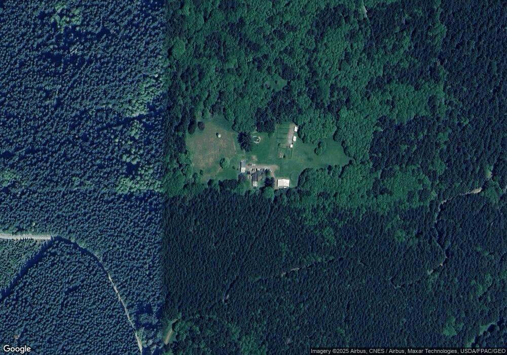
20900 Drewry Rd SW Rochester, WA 98579
Estimated Value: $477,332 - $539,000
1
Bed
2
Baths
400
Sq Ft
$1,259/Sq Ft
Est. Value
About This Home
This home is located at 20900 Drewry Rd SW, Rochester, WA 98579 and is currently estimated at $503,777, approximately $1,259 per square foot. 20900 Drewry Rd SW is a home located in Thurston County with nearby schools including Rochester Primary School, Grand Mound Elementary School, and Rochester Middle School.
Ownership History
Date
Name
Owned For
Owner Type
Purchase Details
Closed on
Oct 13, 2006
Sold by
Conrad Reid W
Bought by
Hoey Lees Susan C and Lees David A
Current Estimated Value
Home Financials for this Owner
Home Financials are based on the most recent Mortgage that was taken out on this home.
Original Mortgage
$100,000
Outstanding Balance
$9,260
Interest Rate
6.39%
Mortgage Type
Credit Line Revolving
Estimated Equity
$494,517
Purchase Details
Closed on
Jul 7, 2005
Sold by
Conrad Victoria L
Bought by
Conrad Reid W
Home Financials for this Owner
Home Financials are based on the most recent Mortgage that was taken out on this home.
Original Mortgage
$300,000
Interest Rate
6.04%
Mortgage Type
Seller Take Back
Create a Home Valuation Report for This Property
The Home Valuation Report is an in-depth analysis detailing your home's value as well as a comparison with similar homes in the area
Home Values in the Area
Average Home Value in this Area
Purchase History
| Date | Buyer | Sale Price | Title Company |
|---|---|---|---|
| Hoey Lees Susan C | $375,000 | Transnation Title Insuran | |
| Conrad Reid W | -- | None Available |
Source: Public Records
Mortgage History
| Date | Status | Borrower | Loan Amount |
|---|---|---|---|
| Open | Hoey Lees Susan C | $100,000 | |
| Open | Hoey Lees Susan C | $215,000 | |
| Previous Owner | Conrad Reid W | $300,000 |
Source: Public Records
Tax History Compared to Growth
Tax History
| Year | Tax Paid | Tax Assessment Tax Assessment Total Assessment is a certain percentage of the fair market value that is determined by local assessors to be the total taxable value of land and additions on the property. | Land | Improvement |
|---|---|---|---|---|
| 2024 | $2,667 | $332,600 | $210,300 | $122,300 |
| 2023 | $2,667 | $302,100 | $172,500 | $129,600 |
| 2022 | $2,419 | $256,200 | $139,600 | $116,600 |
| 2021 | $1,898 | $230,100 | $144,000 | $86,100 |
| 2020 | $2,033 | $164,500 | $102,400 | $62,100 |
| 2019 | $1,777 | $147,200 | $86,600 | $60,600 |
| 2018 | $1,925 | $130,800 | $80,300 | $50,500 |
| 2017 | $1,724 | $117,600 | $71,300 | $46,300 |
| 2016 | $1,801 | $108,700 | $68,400 | $40,300 |
| 2014 | -- | $121,100 | $81,100 | $40,000 |
Source: Public Records
Map
Nearby Homes
- 10346 210th Ln SW
- 20449 Michigan Hill Rd SW
- 10630 Lundeen Rd SW
- 10931 Lundeen Rd SW
- 9727 Lundeen Rd SW
- 105.33 Lincoln Creek Rd
- 0 105.33 Lincoln Creek Rd
- 0 Lincoln Creek Rd Unit NWM2428149
- 9605 Prather Rd SW
- 10239 185th Ave SW Unit 45
- 9538 184th Ave SW
- 8815 Prather Rd SW
- 18602 Paulson St SW
- 0 Roseburg St SW Unit NWM2371565
- 18525 Paulson St SW
- 1604 Lincoln Creek Rd
- 18125 Albany St SW
- 18549 Roseburg St SW
- 12630 183rd Ave SW
- 12624 183rd Ave SW
- 20940 Drewry Rd SW
- 20940 Drewry Rd SW
- 20215 Michigan Hill Rd SW
- 11246 Langworthy Rd SW
- 11238 Langworthy Rd SW
- 20211 Michigan Hill Rd SW
- 11430 Langworthy Rd SW
- 11221 Langworthy Rd SW
- 11220 Langworthy Rd SW
- 20035 Michigan Hill Rd SW
- 11613 Langworthy Rd SW
- 11021 Langworthy Rd SW
- 20021 Michigan Hill Rd SW Unit SW
- 10747 Langworthy Rd SW
- 20133 Michigan Hill Rd SW
- 11135 Langworthy Rd SW
- 11228 Langworthy Rd SW
- 21147 Michigan Hill Rd SW
- 10648 Langworthy Rd SW
- 10404 210th Ln SW
