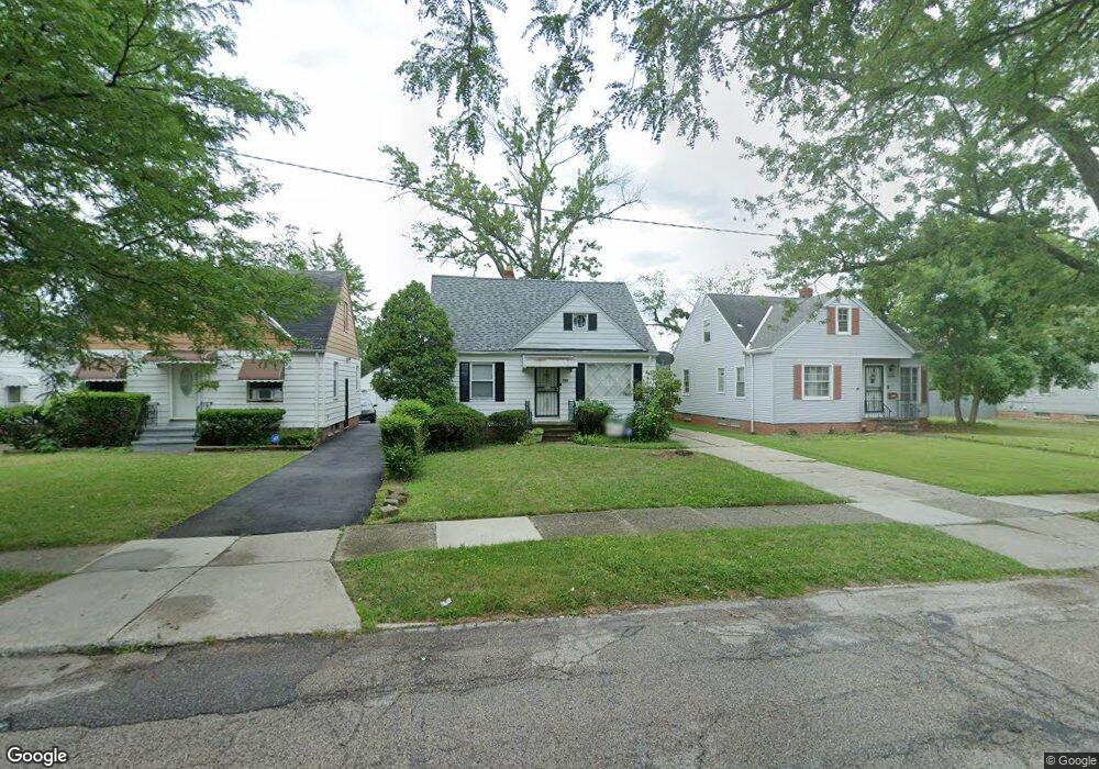
20900 Raymond St Maple Heights, OH 44137
Estimated Value: $89,000 - $156,000
3
Beds
1
Bath
1,212
Sq Ft
$94/Sq Ft
Est. Value
About This Home
This home is located at 20900 Raymond St, Maple Heights, OH 44137 and is currently estimated at $114,104, approximately $94 per square foot. 20900 Raymond St is a home located in Cuyahoga County with nearby schools including Abraham Lincoln Elementary School, Rockside/ J.F. Kennedy School, and Italy High School.
Ownership History
Date
Name
Owned For
Owner Type
Purchase Details
Closed on
Jul 18, 1997
Sold by
Lamantia Joel
Bought by
Mathews Terry
Current Estimated Value
Home Financials for this Owner
Home Financials are based on the most recent Mortgage that was taken out on this home.
Original Mortgage
$75,150
Outstanding Balance
$11,191
Interest Rate
7.94%
Mortgage Type
FHA
Estimated Equity
$102,913
Purchase Details
Closed on
Oct 22, 1979
Sold by
Martino Joseph and Martino Fay
Bought by
Lamantia Joel
Purchase Details
Closed on
Jan 1, 1975
Bought by
Martino Joseph and Martino Fay
Create a Home Valuation Report for This Property
The Home Valuation Report is an in-depth analysis detailing your home's value as well as a comparison with similar homes in the area
Home Values in the Area
Average Home Value in this Area
Purchase History
| Date | Buyer | Sale Price | Title Company |
|---|---|---|---|
| Mathews Terry | $76,888 | -- | |
| Lamantia Joel | $46,500 | -- | |
| Martino Joseph | -- | -- |
Source: Public Records
Mortgage History
| Date | Status | Borrower | Loan Amount |
|---|---|---|---|
| Open | Mathews Terry | $75,150 |
Source: Public Records
Tax History Compared to Growth
Tax History
| Year | Tax Paid | Tax Assessment Tax Assessment Total Assessment is a certain percentage of the fair market value that is determined by local assessors to be the total taxable value of land and additions on the property. | Land | Improvement |
|---|---|---|---|---|
| 2024 | $2,592 | $27,125 | $7,000 | $20,125 |
| 2023 | $2,085 | $18,560 | $4,240 | $14,320 |
| 2022 | $2,077 | $18,550 | $4,240 | $14,320 |
| 2021 | $2,212 | $18,550 | $4,240 | $14,320 |
| 2020 | $1,899 | $14,070 | $3,220 | $10,850 |
| 2019 | $1,888 | $40,200 | $9,200 | $31,000 |
| 2018 | $1,878 | $14,070 | $3,220 | $10,850 |
| 2017 | $1,843 | $13,450 | $2,980 | $10,470 |
| 2016 | $1,783 | $13,450 | $2,980 | $10,470 |
| 2015 | $1,777 | $13,450 | $2,980 | $10,470 |
| 2014 | $1,777 | $14,780 | $3,260 | $11,520 |
Source: Public Records
Map
Nearby Homes
- 20814 Watson Rd
- 20907 Watson Rd
- 21102 Raymond St
- 20715 Watson Rd
- 21207 Franklin Rd
- 20814 Kenyon Dr
- 20701 Kenyon Dr
- 20120 Mccracken Rd
- 20510 Mountville Dr
- 21416 Gardenview Dr
- 20107 Libby Rd
- 19807 Gardenview Dr
- 19806 Mountville Dr
- 19520 Maple Heights Blvd
- 19812 Stockton Ave
- 19309 Nitra Ave
- 5165 Camden Rd
- 19289 Stafford Ave
- 5285 Mardale Ave
- 5301 Mardale Ave
- 20904 Raymond St
- 20814 Raymond St
- 20908 Raymond St
- 20810 Raymond St
- 20912 Raymond St
- 20901 Franklin Rd
- 20903 Franklin Rd
- 20817 Franklin Rd
- 20916 Raymond St
- 20806 Raymond St
- 20905 Franklin Rd
- 20913 Franklin Rd
- 20813 Franklin Rd
- 20903 Raymond St
- 20819 Raymond St
- 20909 Raymond St
- 20815 Raymond St
- 21002 Raymond St
- 20802 Raymond St
- 20917 Franklin Rd