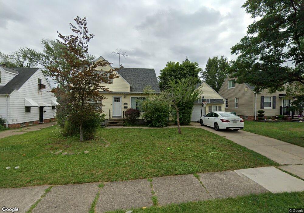
20904 Franklin Rd Maple Heights, OH 44137
Estimated Value: $95,000 - $158,000
3
Beds
1
Bath
1,159
Sq Ft
$104/Sq Ft
Est. Value
About This Home
This home is located at 20904 Franklin Rd, Maple Heights, OH 44137 and is currently estimated at $121,069, approximately $104 per square foot. 20904 Franklin Rd is a home located in Cuyahoga County with nearby schools including Abraham Lincoln Elementary School, Rockside/ J.F. Kennedy School, and Italy High School.
Ownership History
Date
Name
Owned For
Owner Type
Purchase Details
Closed on
Feb 17, 2015
Sold by
Lewis Ryan and Lewis Heather L
Bought by
Andesite Residential Opportunity Fund Ll
Current Estimated Value
Purchase Details
Closed on
Oct 4, 2006
Sold by
Hunt Donna J and Hunt Vernon D
Bought by
Lewis Ryan K and Lewis Heather L
Home Financials for this Owner
Home Financials are based on the most recent Mortgage that was taken out on this home.
Original Mortgage
$19,600
Interest Rate
6.15%
Mortgage Type
Stand Alone Second
Purchase Details
Closed on
Jul 30, 2003
Sold by
Molzan Howard A and Molzan Margaret
Bought by
Schmidt Janice M and Hunt Donna J
Purchase Details
Closed on
Jan 1, 1975
Bought by
Molzan Howard A and Molzan Margaret
Create a Home Valuation Report for This Property
The Home Valuation Report is an in-depth analysis detailing your home's value as well as a comparison with similar homes in the area
Home Values in the Area
Average Home Value in this Area
Purchase History
| Date | Buyer | Sale Price | Title Company |
|---|---|---|---|
| Andesite Residential Opportunity Fund Ll | $20,000 | Attorney | |
| Lewis Ryan K | $98,000 | Enterprise Title Agency | |
| Schmidt Janice M | -- | Ctic | |
| Molzan Howard A | -- | -- |
Source: Public Records
Mortgage History
| Date | Status | Borrower | Loan Amount |
|---|---|---|---|
| Previous Owner | Lewis Ryan K | $19,600 | |
| Previous Owner | Lewis Ryan K | $78,400 |
Source: Public Records
Tax History Compared to Growth
Tax History
| Year | Tax Paid | Tax Assessment Tax Assessment Total Assessment is a certain percentage of the fair market value that is determined by local assessors to be the total taxable value of land and additions on the property. | Land | Improvement |
|---|---|---|---|---|
| 2024 | $3,144 | $32,550 | $9,625 | $22,925 |
| 2023 | $2,517 | $22,160 | $5,810 | $16,350 |
| 2022 | $2,508 | $22,160 | $5,810 | $16,350 |
| 2021 | $2,670 | $22,160 | $5,810 | $16,350 |
| 2020 | $2,295 | $16,800 | $4,410 | $12,390 |
| 2019 | $2,277 | $48,000 | $12,600 | $35,400 |
| 2018 | $2,265 | $16,800 | $4,410 | $12,390 |
| 2017 | $2,152 | $15,410 | $4,100 | $11,310 |
| 2016 | $2,077 | $15,410 | $4,100 | $11,310 |
| 2015 | $2,023 | $15,410 | $4,100 | $11,310 |
| 2014 | $2,023 | $16,910 | $4,520 | $12,390 |
Source: Public Records
Map
Nearby Homes
- 21102 Raymond St
- 21207 Franklin Rd
- 20814 Watson Rd
- 20907 Watson Rd
- 20715 Watson Rd
- 20814 Kenyon Dr
- 20701 Kenyon Dr
- 20510 Mountville Dr
- 21416 Gardenview Dr
- 20107 Libby Rd
- 20120 Mccracken Rd
- 19807 Gardenview Dr
- 19806 Mountville Dr
- 19812 Stockton Ave
- 19520 Maple Heights Blvd
- 19309 Nitra Ave
- 19289 Stafford Ave
- 5165 Camden Rd
- 20750 Bowling Green Rd
- 5285 Mardale Ave
- 20908 Franklin Rd
- 20816 Franklin Rd
- 20912 Franklin Rd
- 20812 Franklin Rd
- 20905 Hillgrove Ave
- 20901 Hillgrove Ave
- 20916 Franklin Rd
- 20909 Hillgrove Ave
- 20817 Hillgrove Ave
- 20808 Franklin Rd
- 20913 Hillgrove Ave
- 20813 Hillgrove Ave
- 21000 Franklin Rd
- 20905 Franklin Rd
- 20903 Franklin Rd
- 20901 Franklin Rd
- 20917 Hillgrove Ave
- 20804 Franklin Rd
- 20809 Hillgrove Ave
- 20817 Franklin Rd