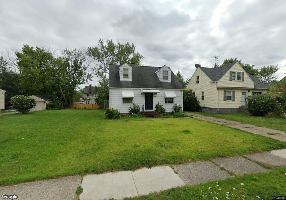
20908 Franklin Rd Maple Heights, OH 44137
Estimated Value: $91,000 - $126,000
2
Beds
1
Bath
728
Sq Ft
$149/Sq Ft
Est. Value
About This Home
This home is located at 20908 Franklin Rd, Maple Heights, OH 44137 and is currently estimated at $108,364, approximately $148 per square foot. 20908 Franklin Rd is a home located in Cuyahoga County with nearby schools including Abraham Lincoln Elementary School, Rockside/ J.F. Kennedy School, and Barack Obama School.
Ownership History
Date
Name
Owned For
Owner Type
Purchase Details
Closed on
Jan 28, 2026
Sold by
Freeman Ilona
Bought by
Reeves Roman
Current Estimated Value
Purchase Details
Closed on
Jun 15, 1990
Sold by
Ekl Curtis M
Bought by
Reeves Gregory B
Purchase Details
Closed on
Aug 13, 1985
Sold by
Andrassy Julius and Andrassy Diane
Bought by
Ekl Curtis M
Purchase Details
Closed on
Jan 1, 1975
Bought by
Andrassy Julius and Andrassy Diane
Create a Home Valuation Report for This Property
The Home Valuation Report is an in-depth analysis detailing your home's value as well as a comparison with similar homes in the area
Home Values in the Area
Average Home Value in this Area
Purchase History
| Date | Buyer | Sale Price | Title Company |
|---|---|---|---|
| Reeves Roman | -- | None Listed On Document | |
| Reeves Gregory B | $57,000 | -- | |
| Ekl Curtis M | $46,500 | -- | |
| Andrassy Julius | -- | -- |
Source: Public Records
Tax History
| Year | Tax Paid | Tax Assessment Tax Assessment Total Assessment is a certain percentage of the fair market value that is determined by local assessors to be the total taxable value of land and additions on the property. | Land | Improvement |
|---|---|---|---|---|
| 2024 | $2,760 | $29,925 | $7,000 | $22,925 |
| 2023 | $1,834 | $16,250 | $4,240 | $12,010 |
| 2022 | $1,827 | $16,240 | $4,240 | $12,010 |
| 2021 | $1,942 | $16,240 | $4,240 | $12,010 |
| 2020 | $1,674 | $12,320 | $3,220 | $9,100 |
| 2019 | $1,663 | $35,200 | $9,200 | $26,000 |
| 2018 | $1,563 | $12,320 | $3,220 | $9,100 |
| 2017 | $1,600 | $11,560 | $2,980 | $8,580 |
| 2016 | $1,548 | $11,560 | $2,980 | $8,580 |
| 2015 | $1,534 | $11,560 | $2,980 | $8,580 |
| 2014 | $1,534 | $12,710 | $3,260 | $9,450 |
Source: Public Records
Map
Nearby Homes
- 21207 Franklin Rd
- 21202 Hillgrove Ave
- 20715 Watson Rd
- 20806 Clare Ave
- 20517 Raymond St
- 5147 Warrensville Center Rd
- 21600 Franklin Rd
- 21202 Gardenview Dr
- 19931 Raymond St
- 21607 Libby Rd
- 21860 Louis Rd
- 19520 Maple Heights Blvd
- 5165 Camden Rd
- 19289 Stafford Ave
- 20732 Applegate Rd
- 5194 Homewood Ave
- 18851 Raymond St
- 18909 Maple Heights Blvd
- 18704 Longview Ave
- 19113 Watercrest Ave
- 20912 Franklin Rd
- 20904 Franklin Rd
- 20916 Franklin Rd
- 20816 Franklin Rd
- 21000 Franklin Rd
- 20909 Hillgrove Ave
- 20905 Hillgrove Ave
- 20913 Hillgrove Ave
- 20901 Hillgrove Ave
- 20917 Hillgrove Ave
- 20812 Franklin Rd
- 21002 Franklin Rd
- 20905 Franklin Rd
- 20817 Hillgrove Ave
- 21001 Hillgrove Ave
- 20903 Franklin Rd
- 20913 Franklin Rd
- 20901 Franklin Rd
- 20808 Franklin Rd
- 20917 Franklin Rd