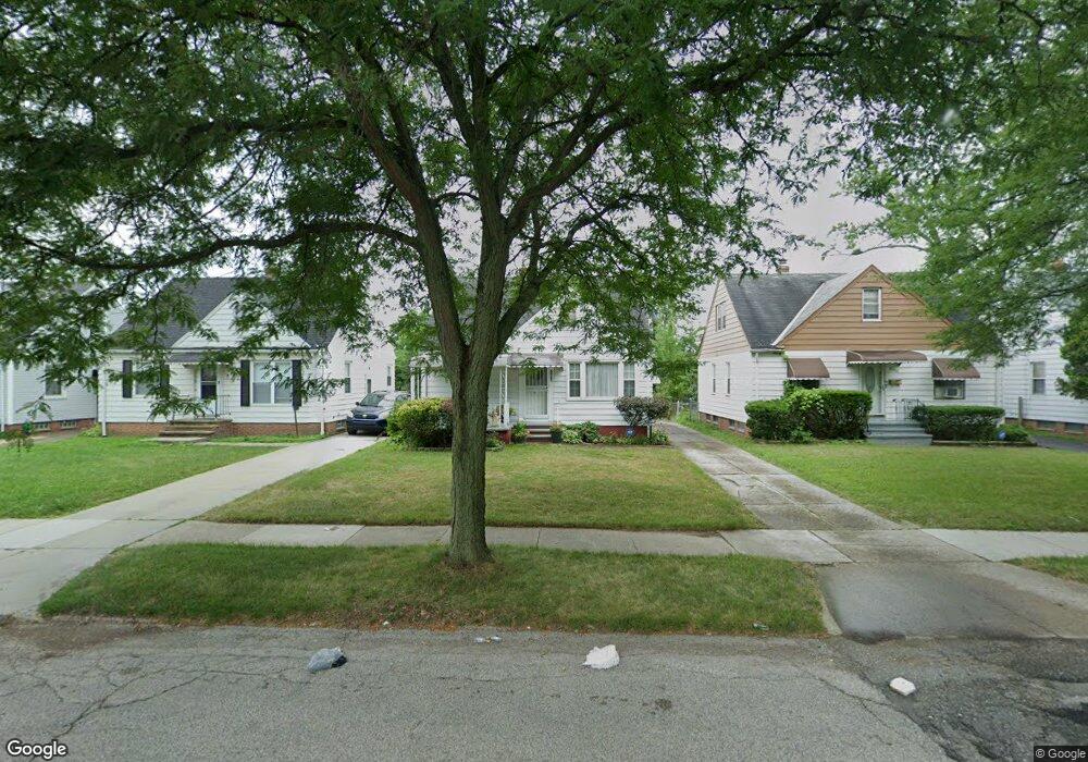
20908 Raymond St Maple Heights, OH 44137
Estimated Value: $108,000 - $123,000
3
Beds
2
Baths
1,092
Sq Ft
$104/Sq Ft
Est. Value
About This Home
This home is located at 20908 Raymond St, Maple Heights, OH 44137 and is currently estimated at $113,948, approximately $104 per square foot. 20908 Raymond St is a home located in Cuyahoga County with nearby schools including Abraham Lincoln Elementary School, Rockside/ J.F. Kennedy School, and Barack Obama School.
Ownership History
Date
Name
Owned For
Owner Type
Purchase Details
Closed on
May 10, 1994
Sold by
Kuczmarski Michele M
Bought by
Frazier David Msr
Current Estimated Value
Purchase Details
Closed on
Nov 2, 1993
Sold by
Helen M Flynn
Bought by
Cunningham Joann M
Purchase Details
Closed on
Jun 20, 1983
Sold by
Flynn William J and Flynn Helen M
Bought by
Helen M Flynn
Purchase Details
Closed on
Jan 1, 1975
Bought by
Flynn William J and Flynn Helen M
Create a Home Valuation Report for This Property
The Home Valuation Report is an in-depth analysis detailing your home's value as well as a comparison with similar homes in the area
Home Values in the Area
Average Home Value in this Area
Purchase History
| Date | Buyer | Sale Price | Title Company |
|---|---|---|---|
| Frazier David Msr | -- | -- | |
| Kuczmarski Michele M | $57,000 | -- | |
| Cunningham Joann M | -- | -- | |
| Helen M Flynn | -- | -- | |
| Flynn William J | -- | -- |
Source: Public Records
Tax History
| Year | Tax Paid | Tax Assessment Tax Assessment Total Assessment is a certain percentage of the fair market value that is determined by local assessors to be the total taxable value of land and additions on the property. | Land | Improvement |
|---|---|---|---|---|
| 2024 | $2,957 | $32,410 | $7,000 | $25,410 |
| 2023 | $2,030 | $18,420 | $4,240 | $14,180 |
| 2022 | $2,023 | $18,410 | $4,240 | $14,180 |
| 2021 | $2,152 | $18,410 | $4,240 | $14,180 |
| 2020 | $1,849 | $13,970 | $3,220 | $10,750 |
| 2019 | $1,838 | $39,900 | $9,200 | $30,700 |
| 2018 | $1,698 | $13,970 | $3,220 | $10,750 |
| 2017 | $1,702 | $12,500 | $2,980 | $9,520 |
| 2016 | $1,646 | $12,500 | $2,980 | $9,520 |
| 2015 | $1,635 | $12,500 | $2,980 | $9,520 |
| 2014 | $1,635 | $13,730 | $3,260 | $10,470 |
Source: Public Records
Map
Nearby Homes
- 20715 Watson Rd
- 21207 Franklin Rd
- 21202 Hillgrove Ave
- 20517 Raymond St
- 20806 Clare Ave
- 5147 Warrensville Center Rd
- 21600 Franklin Rd
- 21202 Gardenview Dr
- 19931 Raymond St
- 21860 Louis Rd
- 21607 Libby Rd
- 19520 Maple Heights Blvd
- 5165 Camden Rd
- 19289 Stafford Ave
- 5194 Homewood Ave
- 20732 Applegate Rd
- 18851 Raymond St
- 18704 Longview Ave
- 18909 Maple Heights Blvd
- 5424 Fairtree Rd
- 20912 Raymond St
- 20904 Raymond St
- 20916 Raymond St
- 20900 Raymond St
- 21002 Raymond St
- 20814 Raymond St
- 20913 Franklin Rd
- 20903 Franklin Rd
- 20905 Franklin Rd
- 20901 Franklin Rd
- 20917 Franklin Rd
- 21006 Raymond St
- 20821 Franklin Rd
- 21001 Franklin Rd
- 20909 Raymond St
- 20913 Raymond St
- 20903 Raymond St
- 20810 Raymond St
- 20917 Raymond St
- 21010 Raymond St
Your Personal Tour Guide
Ask me questions while you tour the home.