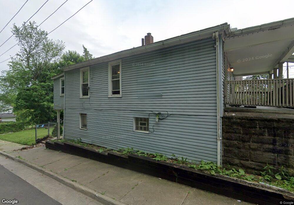
2091 6th St SW Akron, OH 44314
Kenmore NeighborhoodEstimated Value: $91,218 - $121,000
2
Beds
1
Bath
860
Sq Ft
$125/Sq Ft
Est. Value
About This Home
This home is located at 2091 6th St SW, Akron, OH 44314 and is currently estimated at $107,805, approximately $125 per square foot. 2091 6th St SW is a home located in Summit County with nearby schools including Pfeiffer Elementary School, Kenmore Garfield Community Learning Center, and Sam Salem Community Learning Center.
Ownership History
Date
Name
Owned For
Owner Type
Purchase Details
Closed on
Nov 22, 2016
Sold by
Coffee Jennfer J and Sullinger Audrey B
Bought by
Cromwell Aatments Llc
Current Estimated Value
Purchase Details
Closed on
Apr 25, 2014
Sold by
Smoak Katherine D
Bought by
Sullinger Audrey B and Caffee Jennifer J
Purchase Details
Closed on
Mar 19, 2012
Sold by
Estate Of Lonnie C Boyett
Bought by
Boyett Kathy
Create a Home Valuation Report for This Property
The Home Valuation Report is an in-depth analysis detailing your home's value as well as a comparison with similar homes in the area
Home Values in the Area
Average Home Value in this Area
Purchase History
| Date | Buyer | Sale Price | Title Company |
|---|---|---|---|
| Cromwell Aatments Llc | $15,000 | America Land Title Affiliate | |
| Sullinger Audrey B | -- | None Available | |
| Boyett Kathy | -- | None Available |
Source: Public Records
Tax History Compared to Growth
Tax History
| Year | Tax Paid | Tax Assessment Tax Assessment Total Assessment is a certain percentage of the fair market value that is determined by local assessors to be the total taxable value of land and additions on the property. | Land | Improvement |
|---|---|---|---|---|
| 2025 | $1,398 | $22,058 | $5,737 | $16,321 |
| 2024 | $1,398 | $22,058 | $5,737 | $16,321 |
| 2023 | $1,398 | $22,058 | $5,737 | $16,321 |
| 2022 | $1,088 | $13,370 | $3,479 | $9,891 |
| 2021 | $1,253 | $13,370 | $3,479 | $9,891 |
| 2020 | $1,075 | $13,370 | $3,480 | $9,890 |
| 2019 | $1,127 | $12,860 | $4,350 | $8,510 |
| 2018 | $1,214 | $12,860 | $4,350 | $8,510 |
| 2017 | $1,291 | $12,860 | $4,350 | $8,510 |
| 2016 | $1,292 | $15,080 | $5,100 | $9,980 |
| 2015 | $1,291 | $15,080 | $5,100 | $9,980 |
| 2014 | $1,252 | $15,080 | $5,100 | $9,980 |
| 2013 | $1,234 | $15,140 | $5,100 | $10,040 |
Source: Public Records
Map
Nearby Homes
- 622 Polk Ave
- 2134 7th St SW
- 1907 Manchester Rd
- 2186 5th St SW
- 2045 9th St SW
- 639 Chester Ave
- 1975 9th St SW
- 773 Montana Ave
- 2104 11th St SW
- 2246 7th St SW
- 1940 8th St SW
- 2137 12th St SW
- 2171 12th St SW
- 1734 Manchester Rd
- 2286 6th St SW
- 1725 Manchester Rd
- 2041 13th St SW
- 1702 Leighton Ave
- 2086 13th St SW
- 2001 13th St SW
- 2095 6th St SW Unit 2097
- 2099 6th St SW
- 2092 5th St SW
- 2065 6th St SW Unit 2067
- 2096 5th St SW
- 2096 6th St SW
- 2109 6th St SW
- 2067 6th St SW
- 2100 6th St SW
- 2106 5th St SW
- 2110 5th St SW
- 2065 2067 6th St SW
- 2106 6th St SW
- 2113 6th St SW
- 602 Sharon St
- 2070 6th St SW
- 2070 6th St SW
- 2070 6th St SW
- 2070 6th St SW
- 2070 6th St SW