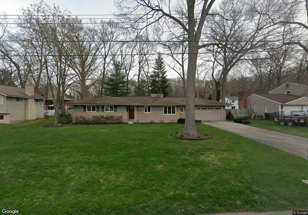
2091 Carter Dr Norton Shores, MI 49441
Estimated Value: $298,000 - $345,874
3
Beds
3
Baths
2,240
Sq Ft
$145/Sq Ft
Est. Value
About This Home
This home is located at 2091 Carter Dr, Norton Shores, MI 49441 and is currently estimated at $325,219, approximately $145 per square foot. 2091 Carter Dr is a home located in Muskegon County with nearby schools including Mona Shores High School, Muskegon Montessori Academy for Environmental Change, and St. Francis De Sales Elementary School.
Ownership History
Date
Name
Owned For
Owner Type
Purchase Details
Closed on
Jan 25, 2021
Sold by
Galvin Michael J and Galvin Trust
Bought by
Galvin Michael J and Timmerman Maria Anna
Current Estimated Value
Purchase Details
Closed on
Jul 16, 2009
Sold by
Galvin Michael J
Bought by
Galvin Michael J and Galvin Trust
Purchase Details
Closed on
Sep 8, 2006
Sold by
Grasman Steve and Grasman Wendi
Bought by
Galvin Michael J and Galvin Anna M
Home Financials for this Owner
Home Financials are based on the most recent Mortgage that was taken out on this home.
Original Mortgage
$76,000
Interest Rate
6.59%
Mortgage Type
Purchase Money Mortgage
Purchase Details
Closed on
Sep 17, 2004
Sold by
Robert J Mckinley Trust
Bought by
Grasman Steve and Grasman Wendi
Home Financials for this Owner
Home Financials are based on the most recent Mortgage that was taken out on this home.
Original Mortgage
$119,920
Interest Rate
5.93%
Mortgage Type
Purchase Money Mortgage
Create a Home Valuation Report for This Property
The Home Valuation Report is an in-depth analysis detailing your home's value as well as a comparison with similar homes in the area
Home Values in the Area
Average Home Value in this Area
Purchase History
| Date | Buyer | Sale Price | Title Company |
|---|---|---|---|
| Galvin Michael J | -- | None Available | |
| Galvin Michael J | -- | None Available | |
| Galvin Michael J | -- | None Available | |
| Grasman Steve | -- | Harbor Title |
Source: Public Records
Mortgage History
| Date | Status | Borrower | Loan Amount |
|---|---|---|---|
| Closed | Galvin Michael J | $76,000 | |
| Previous Owner | Grasman Steve | $119,920 | |
| Closed | Grasman Steve | $22,485 |
Source: Public Records
Tax History Compared to Growth
Tax History
| Year | Tax Paid | Tax Assessment Tax Assessment Total Assessment is a certain percentage of the fair market value that is determined by local assessors to be the total taxable value of land and additions on the property. | Land | Improvement |
|---|---|---|---|---|
| 2025 | $2,892 | $156,800 | $0 | $0 |
| 2024 | $2,267 | $132,700 | $0 | $0 |
| 2023 | $2,166 | $115,700 | $0 | $0 |
| 2022 | $2,640 | $100,100 | $0 | $0 |
| 2021 | $2,565 | $90,400 | $0 | $0 |
| 2020 | $2,536 | $85,000 | $0 | $0 |
| 2019 | $2,489 | $75,800 | $0 | $0 |
| 2018 | $2,431 | $71,900 | $0 | $0 |
| 2017 | $2,375 | $69,600 | $0 | $0 |
| 2016 | $1,839 | $64,500 | $0 | $0 |
| 2015 | -- | $61,600 | $0 | $0 |
| 2014 | $2,206 | $61,400 | $0 | $0 |
| 2013 | -- | $57,200 | $0 | $0 |
Source: Public Records
Map
Nearby Homes
- 2115 Garland Dr
- 2059 Garland Dr
- 2044 Belmont Dr
- 1947 Spencer Dr
- 2298 Norcrest Dr
- 2290 Blissfield Ct
- 1905 Crestwood Ln
- 3658 Lake Harbor Rd
- 4057 Dunes Pkwy
- 2097 Geneva Ln
- 3283 Mccracken St
- 1812 Ritter Hills Dr
- 3891 Wickham Dr
- 1744 W Norton Ave
- 1936 Lawnel Ave
- 2263 Lawnel Ave
- 2280 Arbor Ave
- 3681 Brentwood St Unit 24
- 1733 Woodside Rd
- 2278 Reneer Ave
- 2109 Carter Dr
- 2079 Carter Dr
- 2100 Belmont Dr
- 2125 Carter Dr
- 2090 Carter Dr
- 2084 Belmont Dr
- 2108 Carter Dr
- 2108 Belmont Dr
- 2078 Carter Dr
- 2061 Carter Dr
- 2074 Belmont Dr
- 2124 Carter Dr
- 2060 Carter Dr
- 2103 Garland Dr
- 2089 Garland Dr
- 2060 Belmont Dr
- 2077 Garland Dr
- 3725 Farmwood Dr
- 2049 Carter Dr
- 2091 Belmont Dr