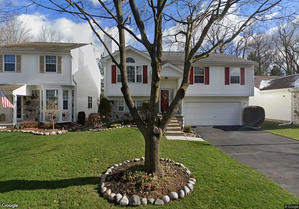
2091 E Butler Cir Westland, MI 48186
Estimated Value: $294,000 - $325,000
--
Bed
2
Baths
1,597
Sq Ft
$191/Sq Ft
Est. Value
About This Home
This home is located at 2091 E Butler Cir, Westland, MI 48186 and is currently estimated at $305,084, approximately $191 per square foot. 2091 E Butler Cir is a home located in Wayne County with nearby schools including Adams Middle School, Benjamin Franklin Middle School, and Adlai Stevenson Middle School.
Ownership History
Date
Name
Owned For
Owner Type
Purchase Details
Closed on
May 14, 1998
Sold by
Pilkington Patricia A
Bought by
Faison Laurita A
Current Estimated Value
Purchase Details
Closed on
Jun 18, 1996
Sold by
Patricia A Pilkington
Bought by
Lovelace Donald F and Lovelace Lois V
Purchase Details
Closed on
May 6, 1994
Sold by
Brian D Kelly
Bought by
Lovelace Donald F and Lovelace Lois V
Home Financials for this Owner
Home Financials are based on the most recent Mortgage that was taken out on this home.
Original Mortgage
$65,000
Interest Rate
8.48%
Mortgage Type
New Conventional
Create a Home Valuation Report for This Property
The Home Valuation Report is an in-depth analysis detailing your home's value as well as a comparison with similar homes in the area
Home Values in the Area
Average Home Value in this Area
Purchase History
| Date | Buyer | Sale Price | Title Company |
|---|---|---|---|
| Faison Laurita A | $135,000 | -- | |
| Lovelace Donald F | $127,000 | -- | |
| Lovelace Donald F | $101,000 | -- |
Source: Public Records
Mortgage History
| Date | Status | Borrower | Loan Amount |
|---|---|---|---|
| Previous Owner | Lovelace Donald F | $65,000 |
Source: Public Records
Tax History Compared to Growth
Tax History
| Year | Tax Paid | Tax Assessment Tax Assessment Total Assessment is a certain percentage of the fair market value that is determined by local assessors to be the total taxable value of land and additions on the property. | Land | Improvement |
|---|---|---|---|---|
| 2025 | $2,594 | $131,300 | $0 | $0 |
| 2024 | $2,594 | $122,200 | $0 | $0 |
| 2023 | $2,477 | $98,500 | $0 | $0 |
| 2022 | $2,813 | $92,800 | $0 | $0 |
| 2021 | $2,742 | $86,300 | $0 | $0 |
| 2020 | $2,714 | $79,900 | $0 | $0 |
| 2019 | $2,615 | $74,800 | $0 | $0 |
| 2018 | $2,038 | $68,100 | $0 | $0 |
| 2017 | $836 | $62,700 | $0 | $0 |
| 2016 | $2,521 | $59,600 | $0 | $0 |
| 2015 | $5,011 | $56,380 | $0 | $0 |
| 2013 | $4,854 | $50,830 | $0 | $0 |
| 2012 | $2,372 | $49,520 | $0 | $0 |
Source: Public Records
Map
Nearby Homes
- 2011 S Brandon St
- 38692 Watson Cir
- 3329 S Newburgh Rd
- 38290 Avondale St
- 1519 S Dowling St
- 38775 Laurenwood St
- 1786 Daisy Ln
- 39260 Phlox Ln Unit 12
- 00000 Avondale St
- 36255 Manila Ave
- 3020 Rivers Edge Dr
- 1825 Liddicot Ave
- 3018 Rivers Edge Dr N
- 36675 Thinbark St
- 39250 Northampton St
- 36012 Manila Ave
- 38386 Maes St
- 2618 Hannan Rd
- 36323 Monroe Ave
- 35833 Farragut Ave
- 2071 E Butler Cir
- 2111 E Butler Cir
- 2051 E Butler Cir
- 2131 E Butler Cir
- 37632 S Butler Cir Unit 213
- 2080 E Butler Cir Unit 214
- 2031 E Butler Cir Unit 194
- 2096 Martin St
- 37623 N Butler Cir Unit 215
- 2072 Martin St
- 2120 Martin St
- 2151 E Butler Cir Unit 200
- 37644 S Butler Cir
- 2048 Martin St
- 2144 Martin St Unit 7
- 37613 S Butler Cir
- 37635 N Butler Cir Unit 216
- 37625 S Butler Cir
- 0 S Butler Cir
- 37600 N Butler Cir