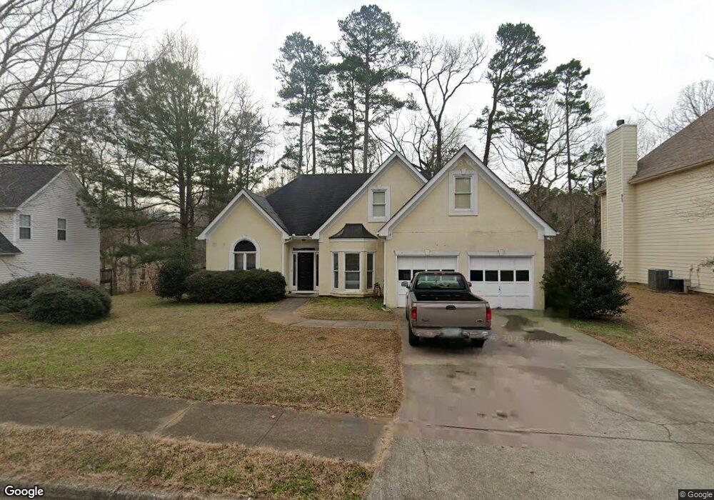
2091 Little River Dr Suwanee, GA 30024
Estimated Value: $378,000 - $396,821
4
Beds
3
Baths
1,658
Sq Ft
$234/Sq Ft
Est. Value
About This Home
This home is located at 2091 Little River Dr, Suwanee, GA 30024 and is currently estimated at $388,455, approximately $234 per square foot. 2091 Little River Dr is a home located in Gwinnett County with nearby schools including Walnut Grove Elementary School, Creekland Middle School, and Collins Hill High School.
Ownership History
Date
Name
Owned For
Owner Type
Purchase Details
Closed on
Jan 12, 2009
Sold by
Morgan Stanley Trust 2004-He6
Bought by
Lee Danny A
Current Estimated Value
Home Financials for this Owner
Home Financials are based on the most recent Mortgage that was taken out on this home.
Original Mortgage
$141,038
Outstanding Balance
$87,892
Interest Rate
5.08%
Mortgage Type
FHA
Estimated Equity
$300,563
Purchase Details
Closed on
Aug 5, 2008
Sold by
Kim Chester K M
Bought by
Morgan Stanley Trust 2004-He6
Purchase Details
Closed on
Aug 26, 1999
Sold by
Kay Shayna
Bought by
Kim Sang H
Home Financials for this Owner
Home Financials are based on the most recent Mortgage that was taken out on this home.
Original Mortgage
$150,500
Interest Rate
7.5%
Mortgage Type
New Conventional
Purchase Details
Closed on
Aug 28, 1996
Sold by
Ccm Prop Inc
Bought by
Kay Shayna
Create a Home Valuation Report for This Property
The Home Valuation Report is an in-depth analysis detailing your home's value as well as a comparison with similar homes in the area
Home Values in the Area
Average Home Value in this Area
Purchase History
| Date | Buyer | Sale Price | Title Company |
|---|---|---|---|
| Lee Danny A | $142,900 | -- | |
| Morgan Stanley Trust 2004-He6 | $131,750 | -- | |
| Kim Sang H | $158,500 | -- | |
| Kay Shayna | $142,000 | -- |
Source: Public Records
Mortgage History
| Date | Status | Borrower | Loan Amount |
|---|---|---|---|
| Open | Lee Danny A | $141,038 | |
| Previous Owner | Kim Sang H | $150,500 | |
| Closed | Kay Shayna | $0 |
Source: Public Records
Tax History Compared to Growth
Tax History
| Year | Tax Paid | Tax Assessment Tax Assessment Total Assessment is a certain percentage of the fair market value that is determined by local assessors to be the total taxable value of land and additions on the property. | Land | Improvement |
|---|---|---|---|---|
| 2025 | $3,836 | $129,960 | $28,000 | $101,960 |
| 2024 | $3,962 | $130,240 | $42,400 | $87,840 |
| 2023 | $3,962 | $116,520 | $35,600 | $80,920 |
| 2022 | $3,641 | $116,520 | $35,600 | $80,920 |
| 2021 | $2,907 | $79,440 | $22,000 | $57,440 |
| 2020 | $2,924 | $79,440 | $22,000 | $57,440 |
| 2019 | $2,827 | $79,440 | $22,000 | $57,440 |
| 2018 | $2,827 | $79,440 | $22,000 | $57,440 |
| 2016 | $2,451 | $66,440 | $19,600 | $46,840 |
| 2015 | $2,475 | $66,440 | $19,600 | $46,840 |
| 2014 | $2,487 | $66,440 | $19,600 | $46,840 |
Source: Public Records
Map
Nearby Homes
- 2167 Merrymount Dr
- 2140 Wildcat Cliffs Way
- 2370 Cape Courage Way
- 2061 Wildcat Cliffs Ln
- 2265 Wildwood Lake Dr
- 2372 Merrymount Dr Unit 2
- 1924 Sidneys Cove
- 1839 Stonebrook Way
- 205 Camden Creek Ct
- 1932 Riverton Dr
- 2205 Parliament Dr
- 2067 York River Way
- 525 Provence Gate Ln
- 2050 Fortuna St
- 2155 Parliament Dr
- 83 Russell Rd
- 1838 Prince Dr
- 2140 Deer Trail
- 81 Russell Rd
- 2081 Little River Dr
- 2101 Little River Dr Unit 1
- 2071 Little River Dr Unit 1
- 2102 Little River Dr
- 2082 Little River Dr Unit 1
- 2116 Richland Cove Way Unit 43
- 2116 Richland Cove Way
- 2061 Little River Dr
- 2072 Little River Dr Unit 1
- 2112 Little River Dr Unit 1
- 2051 Little River Dr
- 2062 Little River Dr Unit 1
- 2111 Little River Dr Unit 1
- 152 Marston Dr
- 2052 Little River Dr
- 2041 Little River Dr
- 162 Marston Dr Unit 1
- 0 Little River Dr Unit 7452948
- 0 Little River Dr Unit 8273081
- 0 Little River Dr Unit 7402438