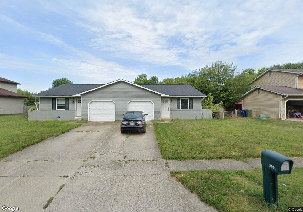
2091 Lynbridge Dr Unit 93 Reynoldsburg, OH 43068
Estimated Value: $282,599 - $311,000
4
Beds
2
Baths
1,830
Sq Ft
$163/Sq Ft
Est. Value
About This Home
This home is located at 2091 Lynbridge Dr Unit 93, Reynoldsburg, OH 43068 and is currently estimated at $297,650, approximately $162 per square foot. 2091 Lynbridge Dr Unit 93 is a home located in Franklin County with nearby schools including Slate Ridge Elementary School, Baldwin Road Junior High School, and Hannah J Ashton Middle School.
Ownership History
Date
Name
Owned For
Owner Type
Purchase Details
Closed on
Jan 29, 2010
Sold by
Gruber Henry W
Bought by
Olzak Daniel
Current Estimated Value
Home Financials for this Owner
Home Financials are based on the most recent Mortgage that was taken out on this home.
Original Mortgage
$101,527
Outstanding Balance
$68,327
Interest Rate
5.37%
Mortgage Type
FHA
Estimated Equity
$229,323
Purchase Details
Closed on
Jun 5, 2001
Sold by
Oberst Paul A and Oberst Rose
Bought by
Gruber Henry W and Gruber Anne E
Home Financials for this Owner
Home Financials are based on the most recent Mortgage that was taken out on this home.
Original Mortgage
$110,000
Interest Rate
7.18%
Purchase Details
Closed on
Nov 13, 1997
Sold by
Williams James K and Williams Vivian F
Bought by
Oberst Paul A and Oberst Rose
Purchase Details
Closed on
Feb 1, 1984
Purchase Details
Closed on
Jan 1, 1984
Create a Home Valuation Report for This Property
The Home Valuation Report is an in-depth analysis detailing your home's value as well as a comparison with similar homes in the area
Home Values in the Area
Average Home Value in this Area
Purchase History
| Date | Buyer | Sale Price | Title Company |
|---|---|---|---|
| Olzak Daniel | $103,400 | Title Co Lt | |
| Gruber Henry W | $145,000 | Chicago Title | |
| Oberst Paul A | $110,000 | Chicago Title | |
| -- | $87,200 | -- | |
| -- | -- | -- |
Source: Public Records
Mortgage History
| Date | Status | Borrower | Loan Amount |
|---|---|---|---|
| Open | Olzak Daniel | $101,527 | |
| Previous Owner | Gruber Henry W | $110,000 |
Source: Public Records
Tax History Compared to Growth
Tax History
| Year | Tax Paid | Tax Assessment Tax Assessment Total Assessment is a certain percentage of the fair market value that is determined by local assessors to be the total taxable value of land and additions on the property. | Land | Improvement |
|---|---|---|---|---|
| 2024 | $4,353 | $84,000 | $20,930 | $63,070 |
| 2023 | $4,307 | $84,000 | $20,930 | $63,070 |
| 2022 | $3,493 | $51,100 | $9,870 | $41,230 |
| 2021 | $3,506 | $51,100 | $9,870 | $41,230 |
| 2020 | $3,574 | $51,100 | $9,870 | $41,230 |
| 2019 | $3,301 | $42,600 | $8,230 | $34,370 |
| 2018 | $3,413 | $42,600 | $8,230 | $34,370 |
| 2017 | $3,276 | $42,600 | $8,230 | $34,370 |
| 2016 | $3,187 | $37,910 | $7,420 | $30,490 |
| 2015 | $3,035 | $37,210 | $7,420 | $29,790 |
| 2014 | $2,998 | $37,210 | $7,420 | $29,790 |
| 2013 | $1,828 | $43,750 | $8,715 | $35,035 |
Source: Public Records
Map
Nearby Homes
- 6549 Santa Cruz Place
- 6348 E Livingston Ave
- 0 Brice Rd
- 6682 Woodsedge Dr
- 0 Radekin Rd Unit 225029852
- 1550 Idlewild Dr
- 6728 Greenbush Dr
- 6772 Gilette Dr
- 6658 Furth Dr
- 6584 Benjamin Dr
- 1888 Birkdale Dr
- 1324 Idlewild Dr
- 1334 Manor Dr
- 1328 Manor Dr
- 1603 Hallworth Ct Unit 16038
- 6775 Centennial Dr
- 6793 Laird Ave
- 1826-1828 Bairsford Dr
- 1748 Sunapple Way Unit 1748
- 6486 Ethan Dr
- 2079 Lynbridge Dr Unit 81
- 2099 Lynbridge Dr Unit 101
- 2098 Lynbridge Dr
- 2090 Lynbridge Dr
- 2065 Lynbridge Dr Unit 67
- 2078 Lynbridge Dr
- 2102 Lynbridge Dr
- 2110 Lynbridge Dr
- 6411 Lanercost Rd
- 2051 Lynbridge Dr Unit 53
- 2121 Lynbridge Dr Unit 123
- 6408 Tamar Ct
- 2120 Lynbridge Dr
- 6416 Tamar Ct
- 6421 Lanercost Rd
- 2052 Lynbridge Dr
- 2041 Lynbridge Dr
- 6417 Tamar Ct
- 6376 Welldon Ct
- 2039 Lynbridge Dr Unit 41