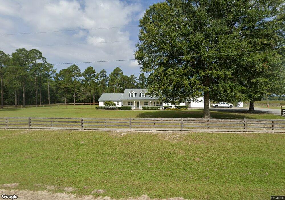
2091 Post Rd Hazlehurst, GA 31539
Estimated Value: $187,000 - $340,000
--
Bed
3
Baths
2,782
Sq Ft
$102/Sq Ft
Est. Value
About This Home
This home is located at 2091 Post Rd, Hazlehurst, GA 31539 and is currently estimated at $284,302, approximately $102 per square foot. 2091 Post Rd is a home located in Jeff Davis County with nearby schools including Jeff Davis Primary School, Jeff Davis Elementary School, and Jeff Davis Middle School.
Ownership History
Date
Name
Owned For
Owner Type
Purchase Details
Closed on
Nov 14, 2006
Sold by
Gary Cothbern
Bought by
Moore Gary R and Moore Steven B Irrevoc
Current Estimated Value
Purchase Details
Closed on
Jun 13, 2003
Sold by
Citifinancial Services Inc
Bought by
Cothern Gary and Cothern Beth
Purchase Details
Closed on
Apr 16, 2003
Sold by
Howard Micheal Allen
Bought by
Citifinancial Services Inc
Purchase Details
Closed on
Apr 1, 1994
Bought by
Howard Micheal Allen
Purchase Details
Closed on
Oct 29, 1991
Bought by
Mims Henry M
Purchase Details
Closed on
Feb 13, 1990
Bought by
Mims Mrs Herny Monroe
Create a Home Valuation Report for This Property
The Home Valuation Report is an in-depth analysis detailing your home's value as well as a comparison with similar homes in the area
Home Values in the Area
Average Home Value in this Area
Purchase History
| Date | Buyer | Sale Price | Title Company |
|---|---|---|---|
| Moore Gary R | $105,000 | -- | |
| Cothern Gary | $69,900 | -- | |
| Citifinancial Services Inc | -- | -- | |
| Howard Micheal Allen | $85,000 | -- | |
| Mims Henry M | -- | -- | |
| Mims Mrs Herny Monroe | -- | -- |
Source: Public Records
Tax History Compared to Growth
Tax History
| Year | Tax Paid | Tax Assessment Tax Assessment Total Assessment is a certain percentage of the fair market value that is determined by local assessors to be the total taxable value of land and additions on the property. | Land | Improvement |
|---|---|---|---|---|
| 2024 | $3,303 | $114,440 | $9,600 | $104,840 |
| 2023 | $1,913 | $67,095 | $5,358 | $61,737 |
| 2022 | $1,912 | $67,095 | $5,358 | $61,737 |
| 2021 | $1,912 | $67,095 | $5,358 | $61,737 |
| 2020 | $1,912 | $67,095 | $5,358 | $61,737 |
| 2019 | $1,912 | $67,095 | $5,358 | $61,737 |
| 2018 | $1,912 | $67,095 | $5,358 | $61,737 |
| 2017 | $1,853 | $66,150 | $5,358 | $60,792 |
| 2016 | $1,821 | $66,150 | $5,358 | $60,792 |
| 2015 | -- | $66,150 | $5,358 | $60,792 |
| 2014 | -- | $67,030 | $5,358 | $61,672 |
Source: Public Records
Map
Nearby Homes
- T M Mims Rd
- 0 Henry-Mimbs Rd Unit 10544748
- 00 Henry Mims Rd
- 0 T M Mims Rd
- 908 Bethel Freewill Rd
- 151 Lake Gloria Ln
- Stewart Cemetery Rd
- 4th Street
- 469 Dyal Rd
- 00 Herrington Rd
- 0 Herrington Rd
- 60 Fred Hutchinson Rd
- W 4th St
- 824 Old Dixie School Rd
- 174 Perch Rd
- 4038 Lake Mayers Rd
- 2612 Buck Head Rd
- 0 Lake Mayers Rd Unit 23695
- 0 Lake Mayers Rd Unit 10628654
- 261 Colorado Rd