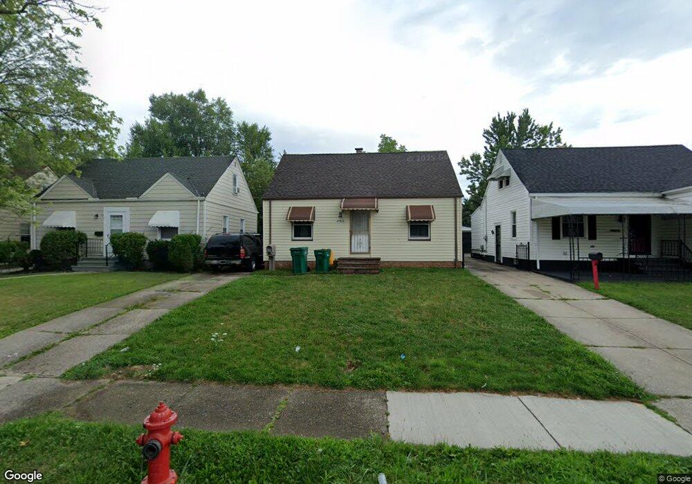
20915 Watson Rd Maple Heights, OH 44137
Estimated Value: $92,000 - $121,000
3
Beds
1
Bath
1,080
Sq Ft
$101/Sq Ft
Est. Value
About This Home
This home is located at 20915 Watson Rd, Maple Heights, OH 44137 and is currently estimated at $109,542, approximately $101 per square foot. 20915 Watson Rd is a home located in Cuyahoga County with nearby schools including Abraham Lincoln Elementary School, Rockside/ J.F. Kennedy School, and Barack Obama School.
Ownership History
Date
Name
Owned For
Owner Type
Purchase Details
Closed on
May 28, 2021
Sold by
Dhillon Sarbjit S and Dhillon Lakhbir K
Bought by
Lakh Holdings Llc
Current Estimated Value
Purchase Details
Closed on
Jun 19, 2003
Sold by
Render Carolyn E
Bought by
Us Bank Na
Purchase Details
Closed on
Jan 25, 1994
Sold by
Smalley David A
Bought by
Render Carolyn E
Purchase Details
Closed on
Dec 11, 1985
Sold by
Hyde Randalle
Bought by
Smalley David A
Purchase Details
Closed on
May 10, 1984
Sold by
Greenwell Gary L and S M
Bought by
Hyde Randalle
Purchase Details
Closed on
Jan 1, 1975
Bought by
Greenwell Gary L and S M
Create a Home Valuation Report for This Property
The Home Valuation Report is an in-depth analysis detailing your home's value as well as a comparison with similar homes in the area
Home Values in the Area
Average Home Value in this Area
Purchase History
| Date | Buyer | Sale Price | Title Company |
|---|---|---|---|
| Lakh Holdings Llc | -- | Martini Elizabeth | |
| Us Bank Na | $65,000 | -- | |
| Render Carolyn E | $63,000 | -- | |
| Smalley David A | $42,000 | -- | |
| Hyde Randalle | $37,000 | -- | |
| Greenwell Gary L | -- | -- |
Source: Public Records
Tax History
| Year | Tax Paid | Tax Assessment Tax Assessment Total Assessment is a certain percentage of the fair market value that is determined by local assessors to be the total taxable value of land and additions on the property. | Land | Improvement |
|---|---|---|---|---|
| 2024 | $2,850 | $30,275 | $6,720 | $23,555 |
| 2023 | $2,090 | $18,620 | $4,060 | $14,560 |
| 2022 | $2,083 | $18,620 | $4,060 | $14,560 |
| 2021 | $2,218 | $18,620 | $4,060 | $14,560 |
| 2020 | $1,903 | $14,110 | $3,080 | $11,030 |
| 2019 | $1,893 | $40,300 | $8,800 | $31,500 |
| 2018 | $1,765 | $14,110 | $3,080 | $11,030 |
| 2017 | $1,936 | $12,920 | $2,870 | $10,050 |
| 2016 | $1,726 | $12,920 | $2,870 | $10,050 |
| 2015 | $1,717 | $12,920 | $2,870 | $10,050 |
| 2014 | $1,717 | $14,180 | $3,150 | $11,030 |
Source: Public Records
Map
Nearby Homes
- 20715 Watson Rd
- 20705 Hansen Rd
- 20600 Watson Rd
- 21207 Franklin Rd
- 21202 Hillgrove Ave
- 20905 Clare Ave
- 20806 Clare Ave
- 5147 Warrensville Center Rd
- 19931 Raymond St
- 21202 Gardenview Dr
- 21860 Louis Rd
- 21607 Libby Rd
- 0 Miles Rd Unit 5188561
- 19520 Maple Heights Blvd
- 5165 Camden Rd
- 19289 Stafford Ave
- 5285 Mardale Ave
- 18990 Raymond St
- 5301 Mardale Ave
- 5194 Homewood Ave
- 21001 Watson Rd
- 20911 Watson Rd
- 21005 Watson Rd
- 21009 Watson Rd
- 20903 Watson Rd
- 20912 Hansen Rd
- 20916 Hansen Rd
- 20908 Hansen Rd
- 20904 Hansen 3 4vb
- 21000 Hansen Rd
- 20904 Hansen Rd
- 20819 Watson Rd
- 21013 Watson Rd
- 20818 Hansen Rd
- 21004 Hansen Rd
- 20914 Watson Rd
- 21000 Watson Rd
- 20906 Watson Rd
- 21004 Watson Rd
- 20815 Watson Rd
Your Personal Tour Guide
Ask me questions while you tour the home.