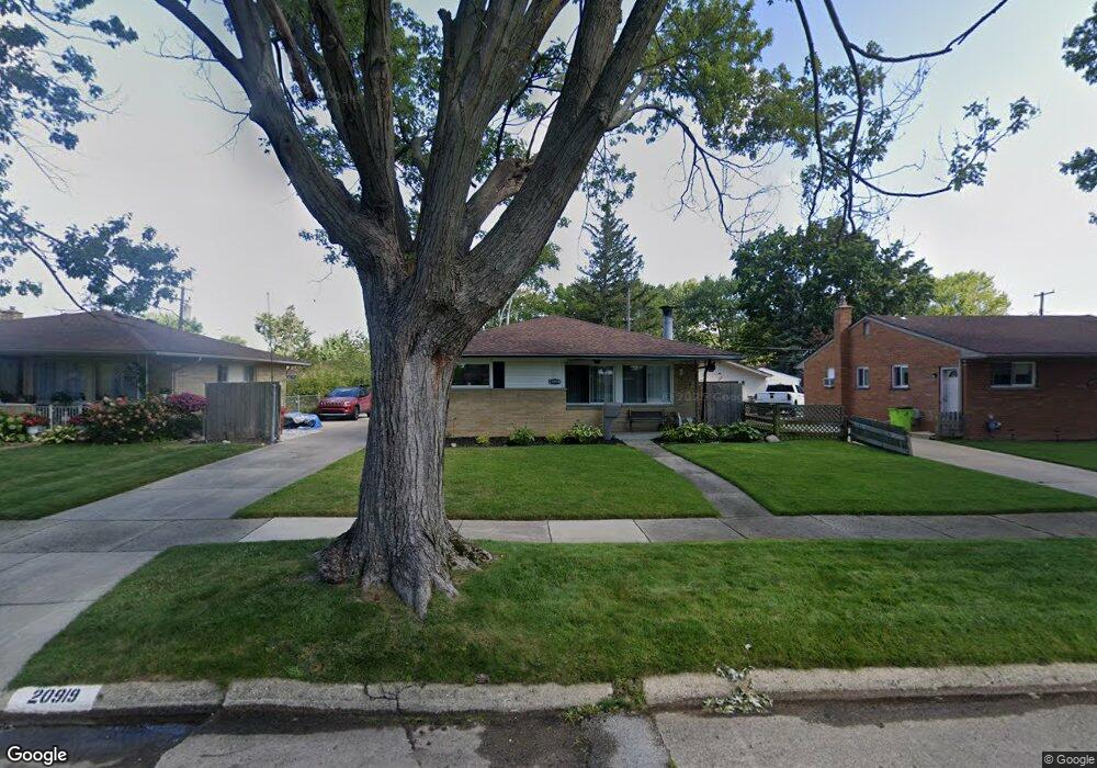
20919 Suffolk St Unit Bldg-Unit Clinton Township, MI 48035
Estimated Value: $243,000 - $252,840
3
Beds
2
Baths
1,058
Sq Ft
$235/Sq Ft
Est. Value
About This Home
This home is located at 20919 Suffolk St Unit Bldg-Unit, Clinton Township, MI 48035 and is currently estimated at $248,460, approximately $234 per square foot. 20919 Suffolk St Unit Bldg-Unit is a home located in Macomb County with nearby schools including Clintondale High School and St. Thecla Catholic School.
Ownership History
Date
Name
Owned For
Owner Type
Purchase Details
Closed on
Mar 8, 2023
Sold by
Webster Randy A
Bought by
Webster Randy A and Webster Diane Karen
Current Estimated Value
Home Financials for this Owner
Home Financials are based on the most recent Mortgage that was taken out on this home.
Original Mortgage
$35,000
Outstanding Balance
$34,000
Interest Rate
6.65%
Mortgage Type
New Conventional
Estimated Equity
$214,460
Purchase Details
Closed on
Nov 16, 2018
Sold by
Skinner Thomas J and Skinner Vanita E
Bought by
Webster Randy A
Purchase Details
Closed on
Feb 15, 2001
Sold by
Tranchida Thomas A
Bought by
Skinner Thomas J
Home Financials for this Owner
Home Financials are based on the most recent Mortgage that was taken out on this home.
Original Mortgage
$113,000
Interest Rate
6.99%
Create a Home Valuation Report for This Property
The Home Valuation Report is an in-depth analysis detailing your home's value as well as a comparison with similar homes in the area
Home Values in the Area
Average Home Value in this Area
Purchase History
| Date | Buyer | Sale Price | Title Company |
|---|---|---|---|
| Webster Randy A | -- | None Listed On Document | |
| Webster Randy A | $148,000 | Ata National Title Group Llc | |
| Skinner Thomas J | $130,000 | -- |
Source: Public Records
Mortgage History
| Date | Status | Borrower | Loan Amount |
|---|---|---|---|
| Open | Webster Randy A | $35,000 | |
| Previous Owner | Skinner Thomas J | $113,000 |
Source: Public Records
Tax History Compared to Growth
Tax History
| Year | Tax Paid | Tax Assessment Tax Assessment Total Assessment is a certain percentage of the fair market value that is determined by local assessors to be the total taxable value of land and additions on the property. | Land | Improvement |
|---|---|---|---|---|
| 2025 | $3,666 | $111,700 | $0 | $0 |
| 2024 | $2,288 | $100,100 | $0 | $0 |
| 2023 | $2,172 | $91,000 | $0 | $0 |
| 2022 | $3,318 | $81,800 | $0 | $0 |
| 2021 | $3,226 | $77,500 | $0 | $0 |
| 2020 | $1,990 | $73,600 | $0 | $0 |
| 2019 | $2,585 | $56,400 | $0 | $0 |
| 2018 | $2,461 | $51,700 | $0 | $0 |
| 2017 | $2,424 | $43,500 | $7,200 | $36,300 |
| 2016 | $2,408 | $43,500 | $0 | $0 |
| 2015 | -- | $38,300 | $0 | $0 |
| 2014 | -- | $36,300 | $0 | $0 |
| 2011 | -- | $41,900 | $11,700 | $30,200 |
Source: Public Records
Map
Nearby Homes
- 35906 Rewa St
- 35903 Little MacK Ave
- 20830 Lantz St
- 35811 Weideman St
- 36027 Vaughn St
- 35403 Seville St
- 36047 Weideman St
- 21640 Hillside #3c Dr
- 35685 Griswald St
- 35501 Griswald St
- 36426 Weideman St
- 21600 Elmway St
- 20176 15 Mile Rd
- 20309 Abrahm St
- 20562 Vermander Ave
- 20550 Vermander Ave
- 0000 Garfield
- 20174 Abrahm St
- 21132 Woodward St
- 21156 Woodward St
- 20919 Suffolk St
- 20891 Suffolk St
- 20935 Suffolk St
- 20951 Suffolk St
- 20871 Suffolk St
- 20920 Wakefield St
- 20900 Wakefield St
- 20936 Wakefield St
- 20952 Wakefield St
- 20872 Wakefield St
- 20967 Suffolk St
- 20918 Suffolk St
- 20851 Suffolk St
- 20934 Suffolk St
- 20900 Suffolk St
- 20960 Wakefield St
- 20950 Suffolk St
- 20870 Suffolk St
- 20852 Wakefield St
- 21001 Suffolk St