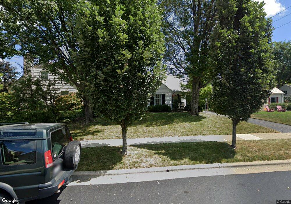
2092 Andover Rd Columbus, OH 43221
Estimated Value: $675,000 - $852,000
3
Beds
3
Baths
2,142
Sq Ft
$350/Sq Ft
Est. Value
About This Home
This home is located at 2092 Andover Rd, Columbus, OH 43221 and is currently estimated at $748,685, approximately $349 per square foot. 2092 Andover Rd is a home located in Franklin County with nearby schools including Barrington Road Elementary School, Jones Middle School, and Upper Arlington High School.
Ownership History
Date
Name
Owned For
Owner Type
Purchase Details
Closed on
Nov 8, 2023
Sold by
Kegg Craig V and Kegg Kelly B
Bought by
Kegg Craig V and Kegg Kelly B
Current Estimated Value
Purchase Details
Closed on
Jul 7, 2006
Sold by
White Francis E
Bought by
Kegg Craig V and Kegg Kelly B
Home Financials for this Owner
Home Financials are based on the most recent Mortgage that was taken out on this home.
Original Mortgage
$230,000
Interest Rate
6.5%
Mortgage Type
New Conventional
Purchase Details
Closed on
Mar 13, 1998
Sold by
Family Revoca Ritter Paul E & M Joan Trustees
Bought by
White Francis E and White Mary P
Create a Home Valuation Report for This Property
The Home Valuation Report is an in-depth analysis detailing your home's value as well as a comparison with similar homes in the area
Home Values in the Area
Average Home Value in this Area
Purchase History
| Date | Buyer | Sale Price | Title Company |
|---|---|---|---|
| Kegg Craig V | -- | None Listed On Document | |
| Kegg Craig V | $287,500 | Talon Group | |
| White Francis E | $195,000 | Chicago Title |
Source: Public Records
Mortgage History
| Date | Status | Borrower | Loan Amount |
|---|---|---|---|
| Previous Owner | Kegg Craig V | $230,000 |
Source: Public Records
Tax History
| Year | Tax Paid | Tax Assessment Tax Assessment Total Assessment is a certain percentage of the fair market value that is determined by local assessors to be the total taxable value of land and additions on the property. | Land | Improvement |
|---|---|---|---|---|
| 2025 | $12,539 | $212,980 | $122,640 | $90,340 |
| 2024 | $12,539 | $212,980 | $122,640 | $90,340 |
| 2023 | $13,082 | $212,980 | $122,640 | $90,340 |
| 2022 | $10,101 | $144,550 | $70,980 | $73,570 |
| 2021 | $8,957 | $144,550 | $70,980 | $73,570 |
| 2020 | $8,862 | $144,550 | $70,980 | $73,570 |
| 2019 | $9,174 | $132,300 | $70,980 | $61,320 |
| 2018 | $8,331 | $132,300 | $70,980 | $61,320 |
| 2017 | $9,104 | $132,300 | $70,980 | $61,320 |
| 2016 | $7,547 | $114,140 | $55,090 | $59,050 |
| 2015 | $7,540 | $114,140 | $55,090 | $59,050 |
| 2014 | $7,549 | $114,140 | $55,090 | $59,050 |
| 2013 | $3,605 | $103,775 | $50,085 | $53,690 |
Source: Public Records
Map
Nearby Homes
- 1621 Waltham Rd Unit B
- 2000 Northwest Blvd Unit D
- 1869 Tewksbury Rd
- 1535 Doone Rd
- 2167 Fairfax Rd
- 1565 Berkshire Rd
- 1810 Ashland Ave
- 1785 Northwest Ct Unit D
- 1835 Northwest Ct Unit 141
- 1799 Kings Ct Unit B
- 1661 Ashland Ave Unit 663
- 2070 Ellington Rd
- 2583 Wexford Rd
- 2015 W 5th Ave Unit 211
- 2015 W 5th Ave Unit 102
- 2015 W 5th Ave Unit 108
- 1631 Roxbury Rd Unit A1
- 1631 Roxbury Rd Unit F3
- 1631 Roxbury Rd Unit B6
- 1579 Arlington Ave Unit 1579B
- 2084 Andover Rd
- 1795 Barrington Rd
- 1783 Barrington Rd
- 2074 Andover Rd
- 1775 Barrington Rd
- 1823 Barrington Rd
- 1767 Barrington Rd
- 1810 Waltham Rd
- 1768 Waltham Rd
- 1780 Waltham Rd
- 1760 Waltham Rd
- 1751 Barrington Rd
- 1754 Waltham Rd
- 1833 Barrington Rd
- 1812 Barrington Rd
- 1830 Waltham Rd
- 1746 Waltham Rd
- 1801 Waltham Rd
- 1818 Barrington Rd
- 1811 Waltham Rd