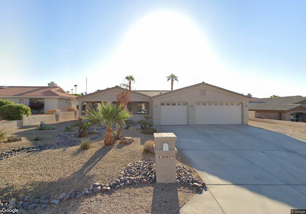
2092 Chip Dr Lake Havasu City, AZ 86406
Estimated Value: $649,605 - $770,000
3
Beds
2
Baths
1,765
Sq Ft
$398/Sq Ft
Est. Value
About This Home
This home is located at 2092 Chip Dr, Lake Havasu City, AZ 86406 and is currently estimated at $702,151, approximately $397 per square foot. 2092 Chip Dr is a home located in Mohave County with nearby schools including Starline Elementary School, Thunderbolt Middle School, and Lake Havasu High School.
Ownership History
Date
Name
Owned For
Owner Type
Purchase Details
Closed on
Sep 28, 2020
Sold by
Nangreave Ryan and Nangreave Jeanette
Bought by
Cosmer Gary and Cosmer Tracy
Current Estimated Value
Home Financials for this Owner
Home Financials are based on the most recent Mortgage that was taken out on this home.
Original Mortgage
$309,500
Outstanding Balance
$275,284
Interest Rate
2.9%
Mortgage Type
New Conventional
Estimated Equity
$426,867
Purchase Details
Closed on
Sep 17, 2014
Sold by
Maurice Karrie and Maurice Canon
Bought by
Nangreave Ryan and Nangreave Jeanette
Home Financials for this Owner
Home Financials are based on the most recent Mortgage that was taken out on this home.
Original Mortgage
$263,200
Interest Rate
4.09%
Mortgage Type
New Conventional
Purchase Details
Closed on
Nov 12, 2013
Sold by
Peters Randall D and Peters Marilyn A
Bought by
Maurice Karrie and Maurice Canon
Home Financials for this Owner
Home Financials are based on the most recent Mortgage that was taken out on this home.
Original Mortgage
$234,400
Interest Rate
4.17%
Mortgage Type
New Conventional
Purchase Details
Closed on
Oct 12, 2005
Sold by
Peters Randall D and Peters Marilyn A
Bought by
Peters Randall D and Peters Marilyn A
Purchase Details
Closed on
May 12, 2005
Sold by
Paquette Joseph P and Paquette Patricia R
Bought by
Peters Randall D and Peters Marilyn A
Purchase Details
Closed on
Mar 12, 2002
Sold by
Burney Charles E and Burney Leigh A
Bought by
Paquette Joe and Paquette Patty
Create a Home Valuation Report for This Property
The Home Valuation Report is an in-depth analysis detailing your home's value as well as a comparison with similar homes in the area
Home Values in the Area
Average Home Value in this Area
Purchase History
| Date | Buyer | Sale Price | Title Company |
|---|---|---|---|
| Cosmer Gary | $509,000 | Chicago Title Agency Inc | |
| Nangreave Ryan | $329,000 | Stewart Title & Trust Of Pho | |
| Maurice Karrie | $293,000 | Stewart Title & Trust Of Pho | |
| Peters Randall D | -- | First American Title Ins Co | |
| Peters Randall D | $165,000 | First American Title Ins Co | |
| Paquette Joe | $45,000 | First American Title |
Source: Public Records
Mortgage History
| Date | Status | Borrower | Loan Amount |
|---|---|---|---|
| Open | Cosmer Gary | $309,500 | |
| Previous Owner | Nangreave Ryan | $263,200 | |
| Previous Owner | Maurice Karrie | $234,400 |
Source: Public Records
Tax History Compared to Growth
Tax History
| Year | Tax Paid | Tax Assessment Tax Assessment Total Assessment is a certain percentage of the fair market value that is determined by local assessors to be the total taxable value of land and additions on the property. | Land | Improvement |
|---|---|---|---|---|
| 2026 | $1,083 | -- | -- | -- |
| 2025 | $2,193 | $51,264 | $0 | $0 |
| 2024 | $2,193 | $54,939 | $0 | $0 |
| 2023 | $2,193 | $46,058 | $0 | $0 |
| 2022 | $2,112 | $38,564 | $0 | $0 |
| 2021 | $2,339 | $34,174 | $0 | $0 |
| 2019 | $2,220 | $31,770 | $0 | $0 |
| 2018 | $2,145 | $30,227 | $0 | $0 |
| 2017 | $2,107 | $29,951 | $0 | $0 |
| 2016 | $1,861 | $30,498 | $0 | $0 |
| 2015 | $1,810 | $25,591 | $0 | $0 |
Source: Public Records
Map
Nearby Homes
- 393 Hagen Way
- 2041 Oak Dr
- 475 Jones Dr
- 2180 Snead Dr
- 2175 Snead Dr Unit 4
- 2175 Snead Dr Unit 6
- 2190 Snead Dr
- 2207 Oliver Ln
- 2139 Palmer Dr
- 565 Jones Dr Unit 3b
- 539 Burkemo Ln Unit A1
- 209 Snead Dr
- 2175 Palmer Dr
- 1881 Pinion Tree Dr
- 220 White Oak Dr
- 2190 Palmer Dr
- 1905 Palmer Dr Unit 1
- 2224 Littler Ln Unit 28
- 2224 Littler Ln Unit 26
- 371 Cottonwood Dr