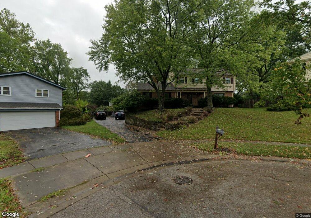
2092 Forestcrest Way Cincinnati, OH 45244
Dry Run NeighborhoodEstimated Value: $429,425 - $525,000
4
Beds
3
Baths
2,354
Sq Ft
$201/Sq Ft
Est. Value
About This Home
This home is located at 2092 Forestcrest Way, Cincinnati, OH 45244 and is currently estimated at $472,606, approximately $200 per square foot. 2092 Forestcrest Way is a home located in Hamilton County with nearby schools including Wilson Elementary School, Nagel Middle School, and Turpin High School.
Ownership History
Date
Name
Owned For
Owner Type
Purchase Details
Closed on
Oct 14, 2010
Sold by
Malone Dennis S and Malone Brigid
Bought by
Diederichs Eric H and Diederichs Anna Muthu
Current Estimated Value
Home Financials for this Owner
Home Financials are based on the most recent Mortgage that was taken out on this home.
Original Mortgage
$181,600
Interest Rate
4.3%
Mortgage Type
Unknown
Purchase Details
Closed on
Nov 17, 1999
Sold by
Roberds Daniel J and Roberds Shirley A
Bought by
Malone Dennis S and Malone Brigid
Home Financials for this Owner
Home Financials are based on the most recent Mortgage that was taken out on this home.
Original Mortgage
$141,500
Interest Rate
8.02%
Create a Home Valuation Report for This Property
The Home Valuation Report is an in-depth analysis detailing your home's value as well as a comparison with similar homes in the area
Home Values in the Area
Average Home Value in this Area
Purchase History
| Date | Buyer | Sale Price | Title Company |
|---|---|---|---|
| Diederichs Eric H | -- | Chicago Title Insurance Comp | |
| Malone Dennis S | $179,900 | First Title Ins Agency Inc |
Source: Public Records
Mortgage History
| Date | Status | Borrower | Loan Amount |
|---|---|---|---|
| Closed | Diederichs Eric H | $181,600 | |
| Closed | Malone Dennis S | $141,500 |
Source: Public Records
Tax History Compared to Growth
Tax History
| Year | Tax Paid | Tax Assessment Tax Assessment Total Assessment is a certain percentage of the fair market value that is determined by local assessors to be the total taxable value of land and additions on the property. | Land | Improvement |
|---|---|---|---|---|
| 2024 | $6,976 | $114,912 | $17,717 | $97,195 |
| 2023 | $6,635 | $114,912 | $17,717 | $97,195 |
| 2022 | $5,691 | $87,767 | $16,111 | $71,656 |
| 2021 | $5,556 | $87,767 | $16,111 | $71,656 |
| 2020 | $5,620 | $87,767 | $16,111 | $71,656 |
| 2019 | $5,034 | $71,355 | $13,097 | $58,258 |
| 2018 | $4,715 | $71,355 | $13,097 | $58,258 |
| 2017 | $4,446 | $71,355 | $13,097 | $58,258 |
| 2016 | $5,622 | $88,190 | $14,539 | $73,651 |
| 2015 | $5,460 | $88,190 | $14,539 | $73,651 |
| 2014 | $5,464 | $88,190 | $14,539 | $73,651 |
| 2013 | $4,655 | $79,450 | $13,097 | $66,353 |
Source: Public Records
Map
Nearby Homes
- 2083 Forestcrest Way
- 8032 Lancelot Dr
- L Clough Pike
- 2193 Forestlake Dr
- 7660 Clough Pike
- 7652 Clough Pike
- 2117 Berrypatch Dr
- 8069 Ashgrove Dr
- 2067 Knightsbridge Dr
- 2161 Knightsbridge Dr
- 1682 Yellowglen Dr
- 8190 Riovista Dr
- 1786 Woodpine Ln
- 1791 Rusticwood Ln
- 8413 Summitridge Dr
- 7827 State Rd
- 2508 Little Dry Run Rd
- 1747 Summithills Dr
- Devonshire II Plan at Clough Chase
- Remington Plan at Clough Chase
- 2084 Forestcrest Way
- 2099 Forestcrest Way
- 2076 Forestcrest Way
- 8041 Lancelot Dr
- 8033 Lancelot Dr
- 2091 Forestcrest Way
- 2068 Forestcrest Way
- 8049 Lancelot Dr
- 8025 Lancelot Dr
- 2075 Forestcrest Way
- 2113 Forestlake Dr
- 2125 Forestlake Dr
- 8017 Lancelot Dr
- 2060 Forestcrest Way
- 2091 Forestlake Dr
- 2137 Forestlake Dr
- 2067 Forestcrest Way
- 8009 Lancelot Dr
- 2149 Forestlake Dr
- 2052 Forestcrest Way