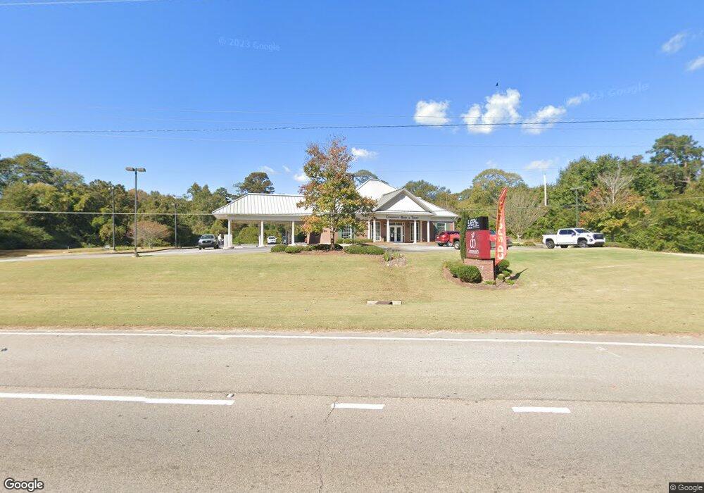
2092 W Point Rd Lagrange, GA 30240
--
Bed
1
Bath
2,860
Sq Ft
1.78
Acres
About This Home
This home is located at 2092 W Point Rd, Lagrange, GA 30240. 2092 W Point Rd is a home located in Troup County with nearby schools including Berta Weathersbee Elementary School, Whitesville Road Elementary School, and Long Cane Elementary School.
Ownership History
Date
Name
Owned For
Owner Type
Purchase Details
Closed on
Dec 30, 2005
Sold by
Red Apple Llc
Bought by
Community Bank & Trust West Ge
Purchase Details
Closed on
Sep 30, 2005
Sold by
Holloway Walter
Bought by
Red Apple Llc
Purchase Details
Closed on
May 5, 1976
Bought by
William Earl Holloway
Purchase Details
Closed on
Apr 13, 1976
Create a Home Valuation Report for This Property
The Home Valuation Report is an in-depth analysis detailing your home's value as well as a comparison with similar homes in the area
Home Values in the Area
Average Home Value in this Area
Purchase History
| Date | Buyer | Sale Price | Title Company |
|---|---|---|---|
| Community Bank & Trust West Ge | -- | -- | |
| Red Apple Llc | $100,000 | -- | |
| William Earl Holloway | $22,000 | -- | |
| -- | -- | -- |
Source: Public Records
Tax History Compared to Growth
Tax History
| Year | Tax Paid | Tax Assessment Tax Assessment Total Assessment is a certain percentage of the fair market value that is determined by local assessors to be the total taxable value of land and additions on the property. | Land | Improvement |
|---|---|---|---|---|
| 2024 | $7,342 | $269,200 | $56,600 | $212,600 |
| 2023 | $7,046 | $258,360 | $56,600 | $201,760 |
| 2022 | $7,211 | $258,360 | $56,600 | $201,760 |
| 2021 | $6,881 | $228,160 | $84,880 | $143,280 |
| 2020 | $6,881 | $228,160 | $84,880 | $143,280 |
| 2019 | $6,965 | $230,920 | $84,880 | $146,040 |
| 2018 | $6,964 | $230,920 | $84,880 | $146,040 |
| 2017 | $6,033 | $200,040 | $56,600 | $143,440 |
| 2016 | $6,133 | $203,352 | $56,600 | $146,752 |
| 2015 | $5,136 | $170,020 | $25,400 | $144,620 |
| 2014 | $5,145 | $170,020 | $25,400 | $144,620 |
| 2013 | -- | $170,020 | $25,400 | $144,620 |
Source: Public Records
Map
Nearby Homes
- 141 Avery Dr
- 0 Unit 10514554
- 212 Aster Way
- 167 S Kight Dr
- 101 Crown St Unit LOT 5
- 102 Crown St Unit LOT 1
- The Rhodes Plan at Crown Street Cottages
- The Truitt Plan at Crown Street Cottages
- The Callaway Plan at Crown Street Cottages
- 802 Monroe St
- 0 Bradfield Dr Unit 10568803
- 205 Grady St
- 37 Overbrook Dr
- 608 Wilburn Ave
- 610 Wilburn Ave
- 107 Clark St
- 119 Jones St
- 211 Moores Hill
- 0 Moores Hill
- 202 Parker Ln
- LOT 9 Morningside Dr
- 9 Morningside Dr
- 2094 W Point Rd
- 11 Sunset Dr
- 11 Sunset Dr Unit 1
- 40 Morningside Dr
- 2063 W Point Rd
- 41 Morningside Dr
- 2106 West Point Rd
- 8 Sunset Dr
- 27 Sunset Dr
- 50 Morningside Dr
- 70 Avery Dr
- 20 Sunset Dr
- 2116 West Point Rd
- 86 Avery Dr
- 59 Morningside Dr
- 46 Avery Dr
- 43 Sunset Dr
- 62 Morningside Dr