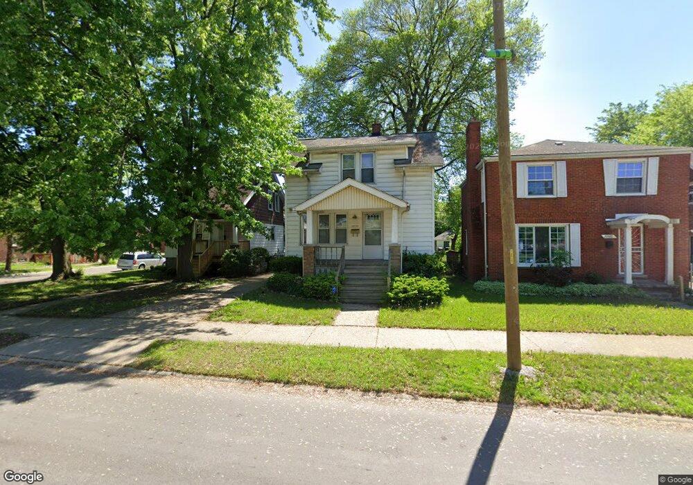
20926 Moross Rd Unit Bldg-Unit Grosse Pointe, MI 48236
Cornerstone Village NeighborhoodEstimated Value: $123,104 - $155,000
--
Bed
1
Bath
1,200
Sq Ft
$113/Sq Ft
Est. Value
About This Home
This home is located at 20926 Moross Rd Unit Bldg-Unit, Grosse Pointe, MI 48236 and is currently estimated at $135,026, approximately $112 per square foot. 20926 Moross Rd Unit Bldg-Unit is a home located in Wayne County with nearby schools including Marquette Elementary-Middle School, Edward 'Duke' Ellington Conservatory of Music and Art, and Charles L. Spain Elementary-Middle School.
Ownership History
Date
Name
Owned For
Owner Type
Purchase Details
Closed on
Apr 30, 2019
Sold by
Schultz Thomas John
Bought by
Uzqueda Jeremy
Current Estimated Value
Purchase Details
Closed on
Mar 19, 2018
Sold by
May Alan A
Bought by
Schultz Thomas John
Purchase Details
Closed on
Apr 10, 2008
Sold by
Raby Joe and Brown Catrina D
Bought by
Wells Fargo Bank Na and Option One Mortgage Loan Trust 2002-A As
Create a Home Valuation Report for This Property
The Home Valuation Report is an in-depth analysis detailing your home's value as well as a comparison with similar homes in the area
Home Values in the Area
Average Home Value in this Area
Purchase History
| Date | Buyer | Sale Price | Title Company |
|---|---|---|---|
| Uzqueda Jeremy | $80,000 | None Available | |
| Schultz Thomas John | $23,000 | None Available | |
| Wells Fargo Bank Na | $63,750 | None Available |
Source: Public Records
Tax History Compared to Growth
Tax History
| Year | Tax Paid | Tax Assessment Tax Assessment Total Assessment is a certain percentage of the fair market value that is determined by local assessors to be the total taxable value of land and additions on the property. | Land | Improvement |
|---|---|---|---|---|
| 2025 | $2,024 | $54,400 | $0 | $0 |
| 2024 | $2,024 | $47,400 | $0 | $0 |
| 2023 | $1,967 | $35,200 | $0 | $0 |
| 2022 | $2,108 | $29,000 | $0 | $0 |
| 2021 | $2,046 | $22,700 | $0 | $0 |
| 2020 | $2,045 | $20,400 | $0 | $0 |
| 2019 | $1,789 | $17,500 | $0 | $0 |
| 2018 | $1,134 | $15,200 | $0 | $0 |
| 2017 | $294 | $15,500 | $0 | $0 |
| 2016 | $1,465 | $20,400 | $0 | $0 |
| 2015 | $2,040 | $20,400 | $0 | $0 |
| 2013 | $2,912 | $29,120 | $0 | $0 |
| 2010 | -- | $42,693 | $850 | $41,843 |
Source: Public Records
Map
Nearby Homes
- 18959 Rockcastle St
- 21111 Moross Rd
- 20717 Moross Rd
- 20715 Moross Rd
- 19126 Tyrone St
- 17817 Chester St
- 17918 Chester St
- 6306 Farmbrook St
- 6300 Radnor St
- 20515 Moross Rd
- 20661 Washtenaw St
- 6301 Lodewyck St
- 21225 Bournemouth St
- 6166 Farmbrook St
- 20454 Kingsville St
- 20444 Kingsville St
- 21248 Newcastle Rd
- 6144 Radnor St
- 6137 Radnor St
- 20605 Kenosha St
- 20926 Moross Rd
- 20934 Moross Rd
- 20920 Moross Rd
- 18959 Rockcastle St
- 20900 Moross Rd Unit Bldg-Unit
- 20900 Moross Rd
- 18952 Alstead St
- 18951 Rockcastle St
- 18951 Rockcastle St
- 20910 Moross Rd
- 21000 Moross Rd
- 18943 Rockcastle St
- 19625 Rockcastle St Unit 21
- 19625 Rockcastle St
- 18942 Alstead St
- 21010 Moross Rd
- 18935 Rockcastle St
- 18935 Rockcastle St
- 18960 Rockcastle St
- 18950 Rockcastle St