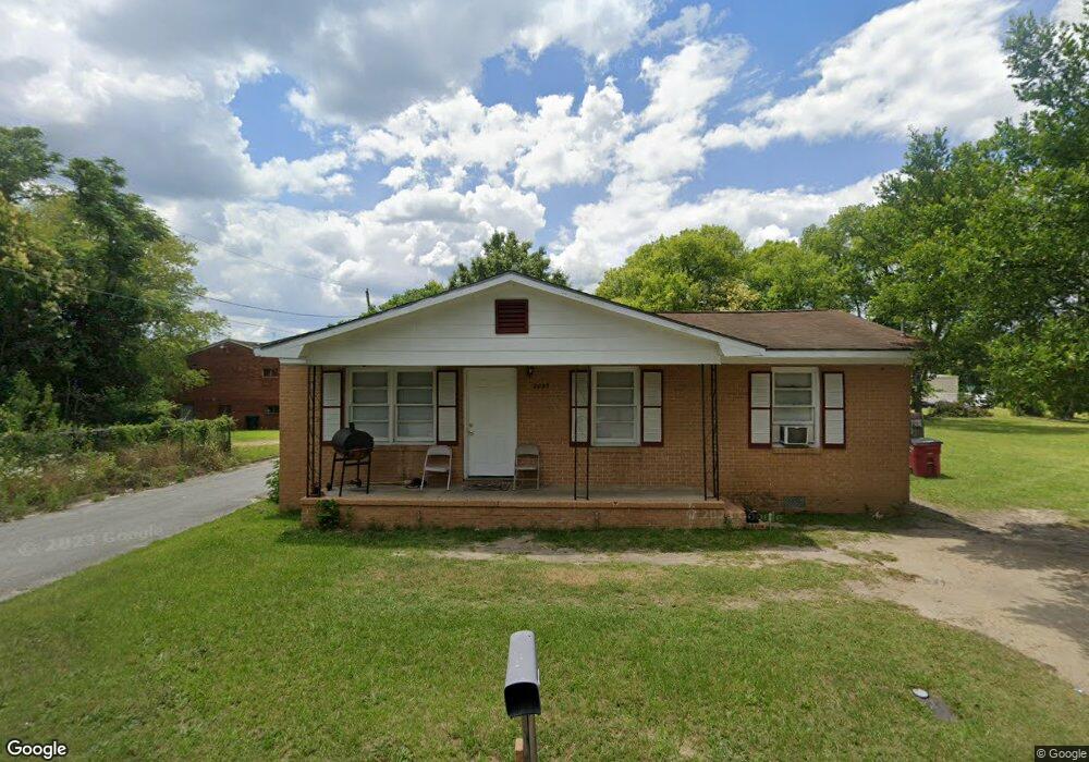
2093 Mason St Macon, GA 31204
Estimated Value: $60,000 - $91,000
2
Beds
2
Baths
1,292
Sq Ft
$58/Sq Ft
Est. Value
About This Home
This home is located at 2093 Mason St, Macon, GA 31204 and is currently estimated at $74,513, approximately $57 per square foot. 2093 Mason St is a home located in Bibb County with nearby schools including Hartley Elementary School, Southwest High School, and Cirrus Charter Academy.
Ownership History
Date
Name
Owned For
Owner Type
Purchase Details
Closed on
Dec 23, 2005
Sold by
Hall Patrice
Bought by
Stephens Johnny C
Current Estimated Value
Purchase Details
Closed on
Oct 25, 2005
Create a Home Valuation Report for This Property
The Home Valuation Report is an in-depth analysis detailing your home's value as well as a comparison with similar homes in the area
Purchase History
| Date | Buyer | Sale Price | Title Company |
|---|---|---|---|
| Stephens Johnny C | $35,000 | -- | |
| -- | $28,000 | -- |
Source: Public Records
Tax History
| Year | Tax Paid | Tax Assessment Tax Assessment Total Assessment is a certain percentage of the fair market value that is determined by local assessors to be the total taxable value of land and additions on the property. | Land | Improvement |
|---|---|---|---|---|
| 2025 | $625 | $25,433 | $1,820 | $23,613 |
| 2024 | $646 | $25,433 | $1,820 | $23,613 |
| 2023 | $646 | $25,433 | $1,820 | $23,613 |
| 2022 | $454 | $13,103 | $1,808 | $11,295 |
| 2021 | $498 | $13,103 | $1,808 | $11,295 |
| 2020 | $509 | $13,103 | $1,808 | $11,295 |
| 2019 | $513 | $13,103 | $1,808 | $11,295 |
| 2018 | $966 | $13,103 | $1,808 | $11,295 |
| 2017 | $491 | $13,103 | $1,808 | $11,295 |
| 2016 | $453 | $13,103 | $1,808 | $11,295 |
| 2015 | $642 | $13,103 | $1,808 | $11,295 |
| 2014 | $738 | $13,103 | $1,808 | $11,295 |
Source: Public Records
Map
Nearby Homes
- 2106 Mason St
- 2164 Monroe Ave
- 2125 Cedar Ave
- 1323 Crawford St
- 210 Moseley Ave
- 1121 Carroll St
- 1144 Carroll St
- 670 Poppy Ave
- 1545 Anthony Rd
- 2249 Lowe St
- 576 Pansy Ave
- 2420 Adams Ave
- 660 Lilly Ave
- 2445 Adams Ave
- 344 Blossom Ave
- 2320 Ballard Dr
- 340 Poppy Ave
- 458 Daffodil St
- 460 Daffodil St
- 284 Grosso Ave
- 2092 Mason St
- 2080 Mason St
- 2086 Pio Nono Ave
- 2145 Mason St
- 2146 Pio Nono Ave
- 2124 Mason St
- 2081 Adams Ave
- 2036 Vining Cir
- 2142 Mason St
- 2032 Vining Cir
- 2115 Adams Ave
- 2115 Adams Ave
- 2115 Adams Ave
- 2055 Adams Ave
- 2044 Pio Nono Ave
- 2028 Vining Cir
- 2135 Adams Ave
- 2024 Vining Cir
- 2157 Mason St
- 2020 Vining Cir
Your Personal Tour Guide
Ask me questions while you tour the home.