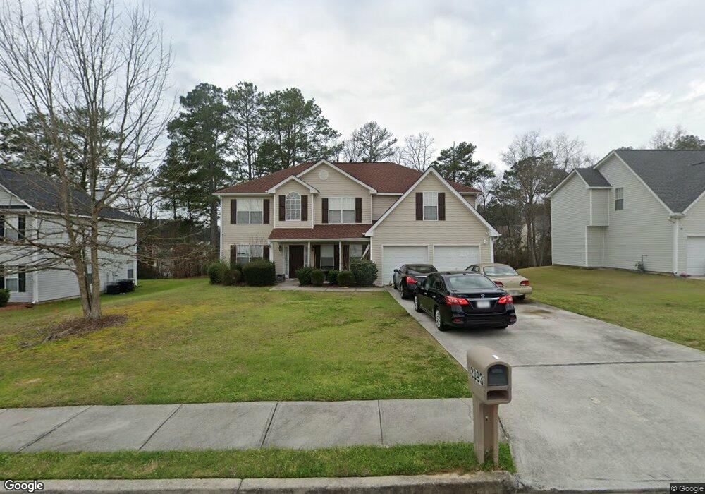
2093 Strang Blvd Lithonia, GA 30058
Estimated Value: $334,766 - $366,000
3
Beds
3
Baths
2,680
Sq Ft
$131/Sq Ft
Est. Value
About This Home
This home is located at 2093 Strang Blvd, Lithonia, GA 30058 and is currently estimated at $351,192, approximately $131 per square foot. 2093 Strang Blvd is a home located in DeKalb County with nearby schools including Rock Chapel Elementary School, Lithonia Middle School, and Lithonia High School.
Ownership History
Date
Name
Owned For
Owner Type
Purchase Details
Closed on
Mar 20, 2002
Sold by
Wayne Thomas Group Inc
Bought by
Mason Derrick and Mason Chauney
Current Estimated Value
Home Financials for this Owner
Home Financials are based on the most recent Mortgage that was taken out on this home.
Original Mortgage
$169,050
Outstanding Balance
$69,573
Interest Rate
6.85%
Mortgage Type
FHA
Estimated Equity
$281,620
Create a Home Valuation Report for This Property
The Home Valuation Report is an in-depth analysis detailing your home's value as well as a comparison with similar homes in the area
Home Values in the Area
Average Home Value in this Area
Purchase History
| Date | Buyer | Sale Price | Title Company |
|---|---|---|---|
| Mason Derrick | $171,800 | -- |
Source: Public Records
Mortgage History
| Date | Status | Borrower | Loan Amount |
|---|---|---|---|
| Open | Mason Derrick | $169,050 |
Source: Public Records
Tax History Compared to Growth
Tax History
| Year | Tax Paid | Tax Assessment Tax Assessment Total Assessment is a certain percentage of the fair market value that is determined by local assessors to be the total taxable value of land and additions on the property. | Land | Improvement |
|---|---|---|---|---|
| 2025 | $3,907 | $133,200 | $20,000 | $113,200 |
| 2024 | $3,984 | $131,520 | $20,000 | $111,520 |
| 2023 | $3,984 | $122,920 | $20,000 | $102,920 |
| 2022 | $3,460 | $110,920 | $20,000 | $90,920 |
| 2021 | $2,865 | $85,120 | $15,000 | $70,120 |
| 2020 | $2,531 | $73,320 | $15,000 | $58,320 |
| 2019 | $2,406 | $70,440 | $15,000 | $55,440 |
| 2018 | $1,965 | $62,960 | $15,000 | $47,960 |
| 2017 | $2,169 | $61,360 | $15,000 | $46,360 |
| 2016 | $1,870 | $54,200 | $5,840 | $48,360 |
| 2014 | $1,595 | $46,400 | $5,840 | $40,560 |
Source: Public Records
Map
Nearby Homes
- 7786 Providence Point Way
- 7492 Ferrara Dr
- 7808 Providence Point Way
- 1862 Oak Hill Springs Blvd
- 1857 Oak Hill Springs Blvd
- 1745 Indian Woods Rd
- 7569 Lowilla Ln
- 7992 Browning Dr
- 2051 Poplar Falls Ave
- 2004 Poplar Falls Rd
- 1716 Indian Woods Rd
- 2442 Harmony Ridge Ct
- 8332 Union Grove Rd
- 7539 Knoll Hollow Rd
- 7667 Gray Pointe Dr
- 7529 Knoll Hollow Rd
- 7523 Poplar Falls Trail
- 7977 Union Grove Rd
- 2391 Harmony Ridge Ct
- 7662 Gray Pointe Dr
- 2099 Strang Blvd
- 2087 Strang Blvd Unit 53
- 2087 Strang Blvd
- 2081 Strang Blvd Unit IIB
- 2105 Strang Blvd
- 2094 Strang Blvd
- 2100 Strang Blvd
- 1954 Pleasant Walk
- 2088 Strang Blvd
- 7678 Pond View Ln
- 2111 Strang Blvd
- 2106 Strang Blvd
- 2077 Strang Blvd Unit 2B
- 2082 Strang Blvd
- 1950 Pleasant Walk
- 2112 Strang Blvd
- 1944 Pleasant Walk
- 7684 Pond View Ln
- 1965 Locksley Terrace Unit 2B
- 1965 Locksley Terrace Unit 33