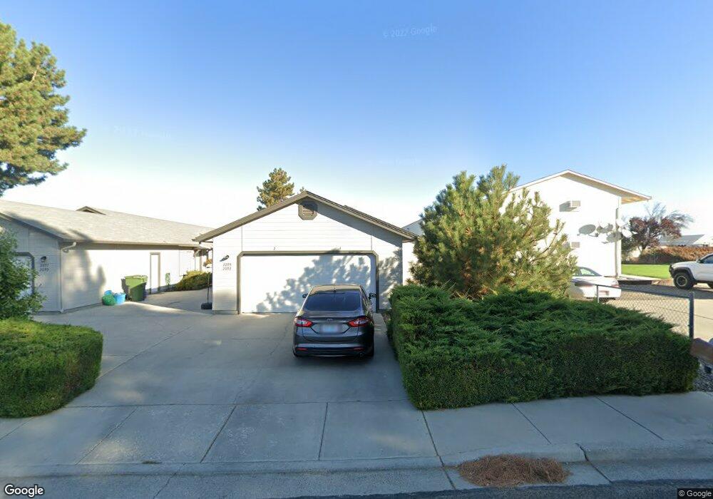
2093 SW 6th Ave Ontario, OR 97914
Estimated Value: $283,000 - $589,000
4
Beds
2
Baths
1,920
Sq Ft
$228/Sq Ft
Est. Value
About This Home
This home is located at 2093 SW 6th Ave, Ontario, OR 97914 and is currently estimated at $436,957, approximately $227 per square foot. 2093 SW 6th Ave is a home located in Malheur County with nearby schools including Ontario High School, Four Rivers Community School, and Treasure Valley Christian School.
Ownership History
Date
Name
Owned For
Owner Type
Purchase Details
Closed on
Feb 9, 2018
Sold by
Smith Patrick A
Bought by
Williams Barnard Jeannine
Current Estimated Value
Home Financials for this Owner
Home Financials are based on the most recent Mortgage that was taken out on this home.
Original Mortgage
$150,000
Outstanding Balance
$127,036
Interest Rate
3.99%
Mortgage Type
New Conventional
Estimated Equity
$309,921
Create a Home Valuation Report for This Property
The Home Valuation Report is an in-depth analysis detailing your home's value as well as a comparison with similar homes in the area
Home Values in the Area
Average Home Value in this Area
Purchase History
| Date | Buyer | Sale Price | Title Company |
|---|---|---|---|
| Williams Barnard Jeannine | $200,000 | Malheur County Title Company |
Source: Public Records
Mortgage History
| Date | Status | Borrower | Loan Amount |
|---|---|---|---|
| Open | Williams Barnard Jeannine | $150,000 |
Source: Public Records
Tax History Compared to Growth
Tax History
| Year | Tax Paid | Tax Assessment Tax Assessment Total Assessment is a certain percentage of the fair market value that is determined by local assessors to be the total taxable value of land and additions on the property. | Land | Improvement |
|---|---|---|---|---|
| 2024 | $5,659 | $366,223 | $48,866 | $317,357 |
| 2023 | $5,511 | $355,557 | $41,961 | $313,596 |
| 2022 | $5,364 | $345,201 | $48,611 | $296,590 |
| 2021 | $5,228 | $335,147 | $51,586 | $283,561 |
| 2020 | $5,088 | $325,386 | $49,705 | $275,681 |
| 2019 | $4,956 | $315,909 | $38,775 | $277,134 |
| 2018 | $4,526 | $306,708 | $38,961 | $267,747 |
| 2017 | $4,382 | $297,775 | $37,163 | $260,612 |
| 2016 | $4,290 | $289,102 | $36,080 | $253,022 |
| 2015 | $4,224 | $280,682 | $37,155 | $243,527 |
| 2014 | $4,066 | $272,507 | $39,635 | $232,872 |
Source: Public Records
Map
Nearby Homes
- 1921 Arcata Way
- 1863 SW 1st Ave
- 2578 SW 2nd Ave
- 41 N Dorian Dr
- 49 NW 19th St
- 2562 Lauren Dr
- 1488 W Idaho Ave
- 2543 Lauren Dr
- 1371 SW 11th Ave
- 247 SW 13th St
- 2048 NW 3rd Ave
- 1425 W Idaho Ave
- 335 NW 19th St
- 1225 SW 8th Ave
- 1293 Alameda Dr
- 563 NW 18th St
- 1135 SW 9th Ave
- 1154 SW 2nd Ave
- 1192 SW 12th Ave
- 770 N Dorian Dr
- 2097 SW 6th Ave
- 2049 SW 6th Ave
- 2049 SW 6th Ave Unit 1
- 2155 SW 6th Ave
- 624 Skylane Dr
- 1991 SW 6th Ave
- 1991 SW 6th Ave Unit 1
- 2162 SW 6th Ave
- 623 Skyhawk Dr
- 2190 SW 6th Ave
- 1965 SW 6th Ave
- 658 Skylane Dr
- 657 Skylane Dr
- 661 Skyhawk Dr
- 624 Skyhawk Dr
- 1947 SW 6th Ave Unit 1
- 1947 SW 6th Ave
- 692 Skylane Dr
- 628 Skyhawk Dr
- 628 Skyhawk Dr