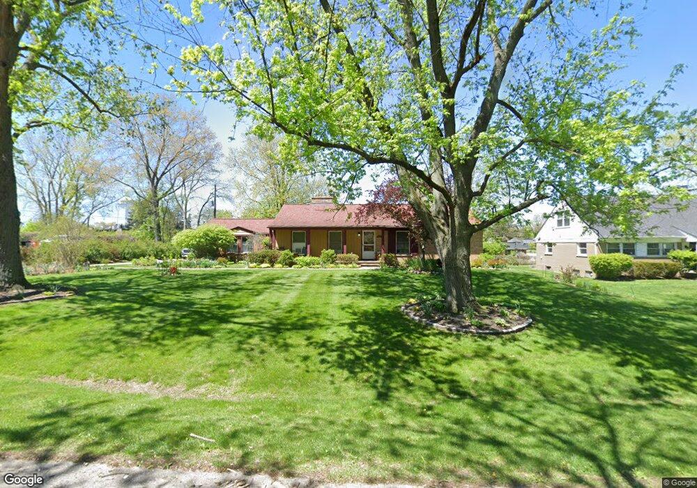
2094 Lake Wind Dr West Bloomfield, MI 48324
Estimated Value: $318,091 - $358,000
3
Beds
2
Baths
1,406
Sq Ft
$237/Sq Ft
Est. Value
About This Home
This home is located at 2094 Lake Wind Dr, West Bloomfield, MI 48324 and is currently estimated at $333,773, approximately $237 per square foot. 2094 Lake Wind Dr is a home located in Oakland County with nearby schools including Walt Whitman Elementary School, Pontiac Middle School, and Pontiac High School.
Ownership History
Date
Name
Owned For
Owner Type
Purchase Details
Closed on
May 3, 2023
Sold by
Robert E Dabrowski Living Trust
Bought by
Ely Rebecca J
Current Estimated Value
Purchase Details
Closed on
May 2, 2023
Sold by
Ely Rebecca J
Bought by
Robert E Dabrowski Living Trust
Purchase Details
Closed on
Jul 1, 1997
Sold by
Hoffman Ruth E
Bought by
Dabrowski Robert E
Home Financials for this Owner
Home Financials are based on the most recent Mortgage that was taken out on this home.
Original Mortgage
$88,000
Interest Rate
8%
Create a Home Valuation Report for This Property
The Home Valuation Report is an in-depth analysis detailing your home's value as well as a comparison with similar homes in the area
Home Values in the Area
Average Home Value in this Area
Purchase History
| Date | Buyer | Sale Price | Title Company |
|---|---|---|---|
| Ely Rebecca J | -- | None Listed On Document | |
| Robert E Dabrowski Living Trust | -- | None Listed On Document | |
| Dabrowski Robert E | $148,000 | -- |
Source: Public Records
Mortgage History
| Date | Status | Borrower | Loan Amount |
|---|---|---|---|
| Previous Owner | Dabrowski Robert E | $88,000 |
Source: Public Records
Tax History Compared to Growth
Tax History
| Year | Tax Paid | Tax Assessment Tax Assessment Total Assessment is a certain percentage of the fair market value that is determined by local assessors to be the total taxable value of land and additions on the property. | Land | Improvement |
|---|---|---|---|---|
| 2024 | $2,469 | $141,960 | $0 | $0 |
| 2022 | $1,533 | $124,400 | $40,130 | $84,270 |
| 2021 | $2,462 | $120,250 | $0 | $0 |
| 2020 | $1,378 | $118,110 | $40,130 | $77,980 |
| 2018 | $2,359 | $101,510 | $29,990 | $71,520 |
| 2015 | -- | $76,400 | $0 | $0 |
| 2014 | -- | $70,590 | $0 | $0 |
| 2011 | -- | $71,870 | $0 | $0 |
Source: Public Records
Map
Nearby Homes
- 1796 Briarcliff St
- 1785 Ward Rd
- 1253 Atkinson Ave
- 2216 Middlebelt Rd
- 2230 Middlebelt Rd
- 2468 Walce Dr
- 2084 Woodrow Wilson Blvd Unit A6
- 1968 Maplewood Ave
- 1160 Dorchester Ave
- 1675 Dell Rose Dr
- 1775 Woodland Ave
- 1947 Maplewood Ave
- 0000 Ward Road Ward Rd
- 1061 Dorchester Ave
- 1205 Leinbach Ave
- 2630 Depew Dr
- 2820 Wall St
- 2825 Wall St
- 49 Canal Dr Unit 300-049
- 1075 Canterbury Dr
- 2124 Lake Wind Dr
- 2081 Lake Wind Dr
- 2117 Lake Wind Dr
- 2142 Lake Wind Dr
- 2034 Lake Wind Dr
- 2072 Birchland St
- 1999 Birchland Dr
- 2166 Lake Wind Dr
- 2066 N Hammond Lake Rd
- 2100 N Hammond Lake Rd
- 2010 Lake Wind Dr
- 2038 N Hammond Lake Rd
- 2038 N Hammond Lake Rd
- 2210 Lake Wind Dr
- 2041 Birchland Dr
- 2071 Birchland Dr
- 1979 Lakewind Dr
- 1984 Lakewind Dr
- 1984 Lakewind Dr
- 2180 N Hammond Lake Rd