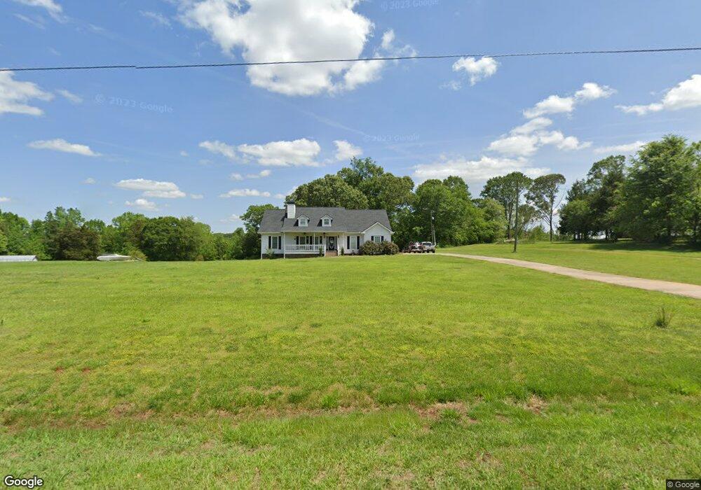
2094 McFarlin Bridge Rd Carnesville, GA 30521
Estimated Value: $400,272 - $482,000
3
Beds
2
Baths
1,756
Sq Ft
$248/Sq Ft
Est. Value
About This Home
This home is located at 2094 McFarlin Bridge Rd, Carnesville, GA 30521 and is currently estimated at $435,318, approximately $247 per square foot. 2094 McFarlin Bridge Rd is a home located in Franklin County with nearby schools including Franklin County High School.
Ownership History
Date
Name
Owned For
Owner Type
Purchase Details
Closed on
May 22, 2020
Sold by
Harvey Derrick R
Bought by
Harvey Derrick R and Harvey Anna K
Current Estimated Value
Purchase Details
Closed on
Mar 8, 2018
Sold by
Brown Toni D
Bought by
Harvey Derrick R
Purchase Details
Closed on
Mar 7, 2017
Sold by
Brown John Milla
Bought by
Brown Toni D and Brown John Milla
Purchase Details
Closed on
May 12, 2016
Sold by
Brown Toni D
Bought by
Brown John Milla
Purchase Details
Closed on
Feb 1, 2007
Sold by
Daugherty Robert T
Bought by
Childress Toni
Purchase Details
Closed on
Feb 6, 2004
Sold by
Ward William B
Bought by
Daugherty Robert T
Create a Home Valuation Report for This Property
The Home Valuation Report is an in-depth analysis detailing your home's value as well as a comparison with similar homes in the area
Purchase History
| Date | Buyer | Sale Price | Title Company |
|---|---|---|---|
| Harvey Derrick R | -- | -- | |
| Harvey Derrick R | $220,000 | -- | |
| Brown Toni D | -- | -- | |
| Brown John Milla | -- | -- | |
| Childress Toni | $60,000 | -- | |
| Daugherty Robert T | $100,000 | -- |
Source: Public Records
Tax History
| Year | Tax Paid | Tax Assessment Tax Assessment Total Assessment is a certain percentage of the fair market value that is determined by local assessors to be the total taxable value of land and additions on the property. | Land | Improvement |
|---|---|---|---|---|
| 2025 | $3,355 | $145,207 | $32,226 | $112,981 |
| 2024 | $2,675 | $112,390 | $20,046 | $92,344 |
| 2023 | $2,636 | $102,173 | $18,224 | $83,949 |
| 2022 | $2,349 | $91,056 | $14,753 | $76,303 |
| 2021 | $2,254 | $81,937 | $14,753 | $67,184 |
| 2020 | $2,278 | $81,937 | $14,753 | $67,184 |
| 2019 | $2,201 | $81,937 | $14,753 | $67,184 |
| 2018 | $1,868 | $71,541 | $13,619 | $57,922 |
| 2017 | $1,500 | $66,699 | $13,619 | $53,080 |
| 2016 | $1,364 | $59,803 | $13,619 | $46,184 |
| 2014 | -- | $59,803 | $13,619 | $46,184 |
| 2013 | -- | $0 | $0 | $0 |
Source: Public Records
Map
Nearby Homes
- 50 ACRES McFarlin Bridge Rd
- 6060 Highway 320
- 1363 McFarlin Bridge Rd
- 2845 Hunters Creek Rd
- 3642 Williams Bridge Rd
- 2630 Prospect Rd
- 3577 Hunters Creek Rd
- 2122 Hunters Creek Rd
- 249 Hunters Creek Trail
- 340 Mcfarlin Blvd
- 319 Hunters Creek Rd
- 0 Williams Bridge Rd Unit 25752991
- 1035 McFarlin Bridge Rd
- 0 Sunshine Rd Unit 7730169
- 0 Sunshine Rd Unit 10704546
- 1674 New Bethel Rd
- 0 Poplar Mountain Ln
- 701 Sunshine Rd
- 6343 Georgia 198
- 2331 Kesler Rd
- 2176 McFarlin Bridge Rd
- 2050 McFarlin Bridge Rd
- 1992 McFarlin Bridge Rd
- 2121 Tract 4 McFarlin Bridge Unit 4
- 1956 McFarlin Bridge Rd
- 2380 McFarlin Bridge Rd
- 2414 McFarlin Bridge Rd
- 2441 McFarlin Bridge Rd
- 1650 McFarlin Bridge Rd
- 1705 McFarlin Bridge Rd
- 2533 McFarlin Bridge Rd
- 6421 Highway 320
- 6436 Highway 320
- 6436 Highway 320
- 6357 Highway 320
- 6357 Highway 320
- 6526 Highway 320
- 2535 McFarlin Bridge Rd
- 6350 Highway 320
- 6350 Highway 320
Your Personal Tour Guide
Ask me questions while you tour the home.