Estimated Value: $99,000 - $135,000
3
Beds
2
Baths
1,090
Sq Ft
$102/Sq Ft
Est. Value
About This Home
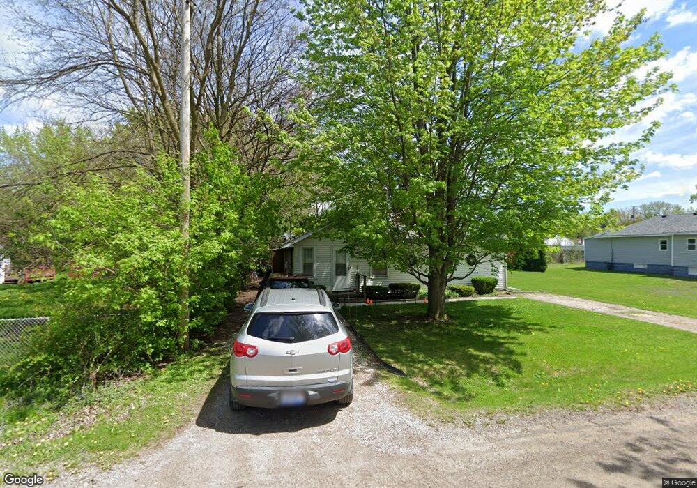
This home is located at 2095 Eberly Rd, Flint, MI 48532 and is currently estimated at $111,506, approximately $102 per square foot. 2095 Eberly Rd is a home located in Genesee County with nearby schools including Carman-Ainsworth High School, Genesee STEM Academy, and St. Paul Lutheran School.
Ownership History
Date
Name
Owned For
Owner Type
Purchase Details
Closed on
Aug 2, 1999
Sold by
Jameson David D and Jameson Stacey R
Bought by
Allen Dana K and Allen Kimberly J
Current Estimated Value
Home Financials for this Owner
Home Financials are based on the most recent Mortgage that was taken out on this home.
Original Mortgage
$46,550
Outstanding Balance
$13,163
Interest Rate
7.68%
Mortgage Type
Purchase Money Mortgage
Estimated Equity
$98,343
Create a Home Valuation Report for This Property
The Home Valuation Report is an in-depth analysis detailing your home's value as well as a comparison with similar homes in the area
Home Values in the Area
Average Home Value in this Area
Purchase History
| Date | Buyer | Sale Price | Title Company |
|---|---|---|---|
| Allen Dana K | $49,000 | Metropolitan Title Company | |
| James David D | $32,000 | Metropolitan Title Company |
Source: Public Records
Mortgage History
| Date | Status | Borrower | Loan Amount |
|---|---|---|---|
| Open | Allen Dana K | $46,550 |
Source: Public Records
Tax History
| Year | Tax Paid | Tax Assessment Tax Assessment Total Assessment is a certain percentage of the fair market value that is determined by local assessors to be the total taxable value of land and additions on the property. | Land | Improvement |
|---|---|---|---|---|
| 2025 | $975 | $42,700 | $0 | $0 |
| 2024 | $439 | $37,300 | $0 | $0 |
| 2023 | $419 | $34,700 | $0 | $0 |
| 2022 | $482 | $25,700 | $0 | $0 |
| 2021 | $860 | $22,100 | $0 | $0 |
| 2020 | $376 | $20,900 | $0 | $0 |
| 2019 | $371 | $18,900 | $0 | $0 |
| 2018 | $795 | $17,600 | $0 | $0 |
| 2017 | $772 | $17,600 | $0 | $0 |
| 2016 | $791 | $17,500 | $0 | $0 |
| 2015 | $623 | $16,100 | $0 | $0 |
| 2014 | $370 | $15,500 | $0 | $0 |
| 2012 | -- | $18,500 | $18,500 | $0 |
Source: Public Records
Map
Nearby Homes
- 2033 Eberly Rd
- 18.41 Taft Rd
- 1512 Crescent Lane Dr Lot#46
- 10 Acres T A Mansour Blvd
- 4199 Sheraton Dr
- 3277 Whitney Ave
- 3365 Ridgecliffe Dr
- 3349 Ridgecliffe Dr
- 4474 Corunna Rd
- VL Clairmont St
- 4480 Corunna Rd
- 1455 S Linden Rd
- 0 Charter Dr Unit 50153638
- 3320 Timberview St
- 3493 Ridgecliffe Dr
- 3.9 Acres W Court St
- 4335 Lennon Rd
- 2521 White Oak Place
- 1137 S Graham Rd
- 3288 Tall Oaks Ct
- 2087 Eberly Rd
- 2100 Algonac Dr
- 2096 Algonac Dr
- 2106 Algonac Dr
- 2084 Algonac Dr
- 2108 Algonac Dr
- 2104 Eberly Rd
- 2079 Eberly Rd
- 2090 Eberly Rd
- 2121 Eberly Rd
- 2118 Algonac Dr
- 4101 Brown St
- 2080 Eberly Rd
- 2095 Algonac Dr
- 2087 Algonac Dr
- 2103 Algonac Dr
- 2120 Eberly Rd
- 2085 Algonac Dr
- 2105 Algonac Dr
- 4105 Brown St
Your Personal Tour Guide
Ask me questions while you tour the home.