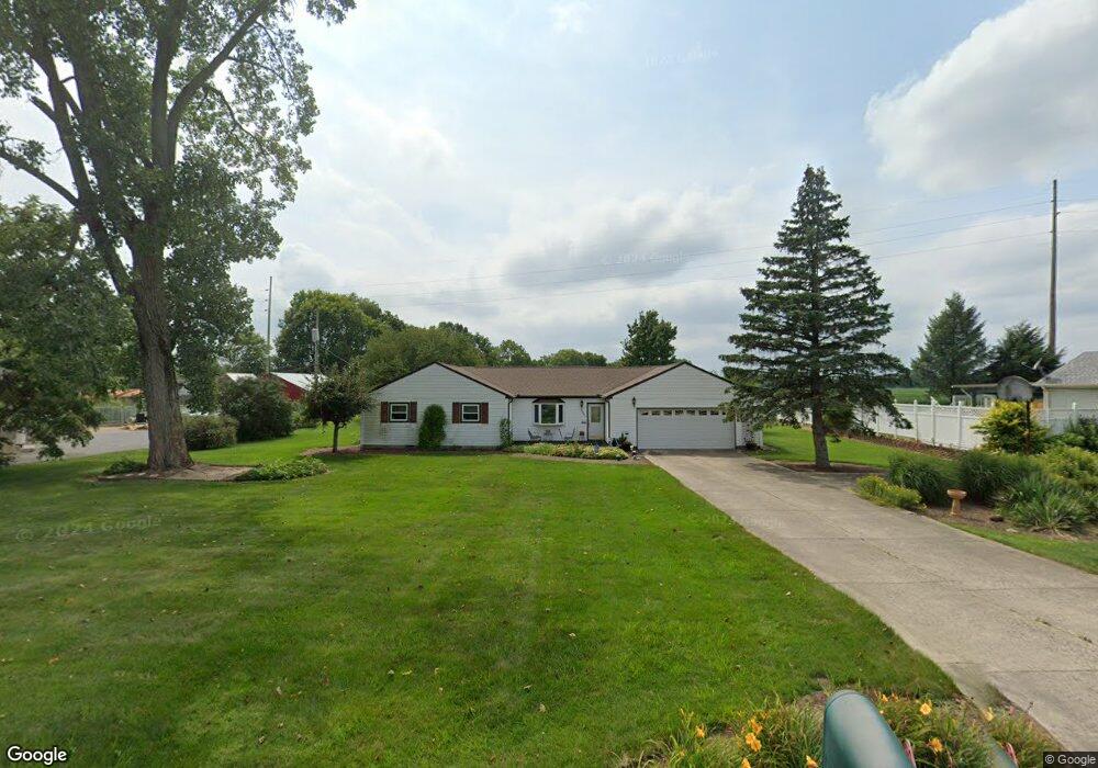
2095 S Union Rd Medway, OH 45341
Estimated Value: $166,000 - $277,000
4
Beds
2
Baths
1,524
Sq Ft
$142/Sq Ft
Est. Value
About This Home
This home is located at 2095 S Union Rd, Medway, OH 45341 and is currently estimated at $215,943, approximately $141 per square foot. 2095 S Union Rd is a home located in Clark County with nearby schools including Donnelsville Elementary School, Park Layne Elementary School, and New Carlisle Elementary School.
Ownership History
Date
Name
Owned For
Owner Type
Purchase Details
Closed on
Sep 27, 2024
Sold by
Measel Shawn E and Measel Nicholette R
Bought by
Measel Taylor and Measel Connor J
Current Estimated Value
Home Financials for this Owner
Home Financials are based on the most recent Mortgage that was taken out on this home.
Original Mortgage
$90,000
Outstanding Balance
$88,654
Interest Rate
5.38%
Mortgage Type
New Conventional
Estimated Equity
$127,289
Purchase Details
Closed on
Aug 9, 2024
Sold by
Rosenlieb Sylvia S
Bought by
Measel Shawn E and Measel Nicholette R
Home Financials for this Owner
Home Financials are based on the most recent Mortgage that was taken out on this home.
Original Mortgage
$90,000
Outstanding Balance
$88,654
Interest Rate
5.38%
Mortgage Type
New Conventional
Estimated Equity
$127,289
Create a Home Valuation Report for This Property
The Home Valuation Report is an in-depth analysis detailing your home's value as well as a comparison with similar homes in the area
Home Values in the Area
Average Home Value in this Area
Purchase History
| Date | Buyer | Sale Price | Title Company |
|---|---|---|---|
| Measel Taylor | $140,000 | Landmark Title | |
| Measel Taylor | $140,000 | Landmark Title | |
| Measel Shawn E | $219,000 | Landmark Title | |
| Measel Shawn E | $219,000 | Landmark Title |
Source: Public Records
Mortgage History
| Date | Status | Borrower | Loan Amount |
|---|---|---|---|
| Open | Measel Taylor | $90,000 | |
| Closed | Measel Taylor | $90,000 |
Source: Public Records
Tax History Compared to Growth
Tax History
| Year | Tax Paid | Tax Assessment Tax Assessment Total Assessment is a certain percentage of the fair market value that is determined by local assessors to be the total taxable value of land and additions on the property. | Land | Improvement |
|---|---|---|---|---|
| 2024 | -- | $56,150 | $9,810 | $46,340 |
| 2023 | $2,479 | $56,150 | $9,810 | $46,340 |
| 2022 | $1,058 | $56,150 | $9,810 | $46,340 |
| 2021 | $1,750 | $42,870 | $7,490 | $35,380 |
| 2020 | $1,755 | $42,870 | $7,490 | $35,380 |
| 2019 | $1,803 | $42,870 | $7,490 | $35,380 |
| 2018 | $1,462 | $34,910 | $7,490 | $27,420 |
| 2017 | $1,453 | $34,906 | $7,487 | $27,419 |
| 2016 | $1,392 | $34,906 | $7,487 | $27,419 |
| 2015 | $744 | $31,777 | $7,487 | $24,290 |
| 2014 | $630 | $31,777 | $7,487 | $24,290 |
| 2013 | $800 | $31,777 | $7,487 | $24,290 |
Source: Public Records
Map
Nearby Homes
- 232 E Main St
- 1292 Medway New Carlisle Rd
- 738 S Medway Carlisle Rd
- 0 Kennedy Rd
- 16 Laurel Rd
- 819 Hedwick St
- 11315 W National Rd
- 1037 Frayne Dr
- 4600 Snider Rd
- 11501 Zeller Dr
- 10850 Musselman Rd
- 419 E Carpenter Dr
- 8966 Haddix Rd
- 842 Edgewick Rd
- 12165 Dille Rd
- 0 N Dayton-Lakeview Rd Unit 944532
- 0 N Dayton-Lakeview Rd Unit 1041631
- 1689 Dale Ridge Rd
- 634 Bowser Dr
- 8721 Haddix Rd
- 2053 S Union Rd
- 2115 S Union Rd
- 2025 S Union Rd
- 2147 S Union Rd
- 2090 S Union Rd
- 2066 S Union Rd
- 2118 S Union Rd
- 2040 S Union Rd
- 2001 S Union Rd
- 2012 S Union Rd
- 9690 Willis Way
- 9680 Willis Way
- 9612 Lower Valley Pike
- 1976 S Union Rd
- 9504 Lower Valley Pike
- 9571 Lower Valley Pike
- 9470 Lower Valley Pike
- 9538 Lower Valley Pike
- 9558 Lower Valley Pike
- 9578 Lower Valley Pike