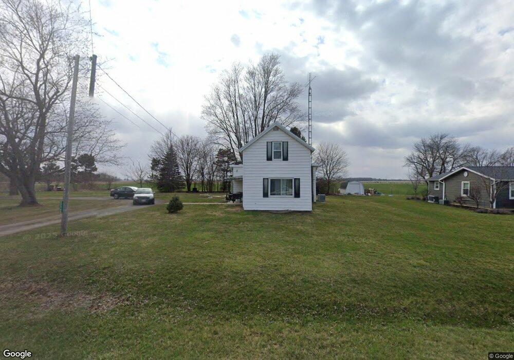
20960 State Route 115 Columbus Grove, OH 45830
Estimated Value: $104,000 - $181,000
--
Bed
1
Bath
960
Sq Ft
$134/Sq Ft
Est. Value
About This Home
This home is located at 20960 State Route 115, Columbus Grove, OH 45830 and is currently estimated at $128,322, approximately $133 per square foot. 20960 State Route 115 is a home located in Putnam County with nearby schools including Columbus Grove Elementary School, Columbus Grove Middle School, and Columbus Grove High School.
Ownership History
Date
Name
Owned For
Owner Type
Purchase Details
Closed on
Jul 18, 2025
Sold by
Mull James M and Mull Genelle A
Bought by
Cartwright Travis M and Cartwright Mary J
Current Estimated Value
Home Financials for this Owner
Home Financials are based on the most recent Mortgage that was taken out on this home.
Original Mortgage
$80,000
Outstanding Balance
$79,865
Interest Rate
6.85%
Mortgage Type
New Conventional
Estimated Equity
$48,457
Purchase Details
Closed on
Apr 2, 2014
Home Financials for this Owner
Home Financials are based on the most recent Mortgage that was taken out on this home.
Interest Rate
4.4%
Purchase Details
Closed on
Feb 14, 2004
Bought by
Mull James M and Surv Genelle A
Create a Home Valuation Report for This Property
The Home Valuation Report is an in-depth analysis detailing your home's value as well as a comparison with similar homes in the area
Home Values in the Area
Average Home Value in this Area
Purchase History
| Date | Buyer | Sale Price | Title Company |
|---|---|---|---|
| Cartwright Travis M | $100,000 | None Listed On Document | |
| -- | $18,000 | -- | |
| Mull James M | $18,000 | -- |
Source: Public Records
Mortgage History
| Date | Status | Borrower | Loan Amount |
|---|---|---|---|
| Open | Cartwright Travis M | $80,000 | |
| Previous Owner | -- | -- |
Source: Public Records
Tax History Compared to Growth
Tax History
| Year | Tax Paid | Tax Assessment Tax Assessment Total Assessment is a certain percentage of the fair market value that is determined by local assessors to be the total taxable value of land and additions on the property. | Land | Improvement |
|---|---|---|---|---|
| 2024 | $946 | $29,660 | $6,150 | $23,510 |
| 2023 | $1,007 | $23,940 | $4,790 | $19,150 |
| 2022 | $903 | $23,941 | $4,792 | $19,149 |
| 2021 | $924 | $23,460 | $4,790 | $18,670 |
| 2020 | $900 | $19,380 | $3,990 | $15,390 |
| 2019 | $792 | $21,120 | $4,790 | $16,330 |
| 2018 | $778 | $21,120 | $4,790 | $16,330 |
| 2017 | $700 | $21,120 | $4,790 | $16,330 |
| 2016 | $700 | $19,380 | $3,990 | $15,390 |
| 2015 | $703 | $19,380 | $3,990 | $15,390 |
| 2014 | $711 | $19,380 | $3,990 | $15,390 |
| 2013 | $703 | $19,380 | $3,990 | $15,390 |
Source: Public Records
Map
Nearby Homes
- 148 S Water St
- 147 Elm St
- 2525 W Lincoln Hwy
- 4150 W Lincoln Hwy
- 6585 Ottawa Rd
- 11059 Ottawa Rd
- 309 Wall St
- 201 Wall St
- 220 Parklane Dr
- 3798 Kissing Hollow Dr
- 308 Delphos Rd
- 0 Fraunfelter Unit 307817
- 0 N Eastown Rd Unit 1034495
- 3456 Shearin Ave
- 209 Willow Bend Dr
- 205 S Broadway St
- 204 S Broadway St
- 3270 Bonnieview Dr
- 4080 Brookshore Dr
- 4050 Brookshore Dr
- 20938 Ohio 115
- 20938 State Route 115
- 21053 State Route 115
- 21021 State Route 115
- 20896 State Route 115
- 20901 St Route Unit 115
- 20901 St Route
- 15053 Old State Route 12
- 15011 Old State Route 12
- 15011 Old St Route
- 15085 Old State Route 12
- 20875 State Route 115
- 15034 Old State Route 12
- 15056 Old State Route 12
- 15014 Old State Route 12
- 15074 Old State Route 12
- 21122 State Route 115
- 21244 State Route 115
- 20651 State Route 115
- 133 Charles St