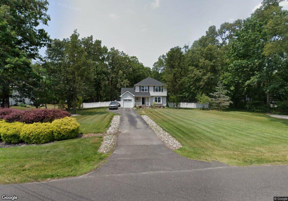
2097 Grant Ave Williamstown, NJ 08094
Franklin Township NeighborhoodEstimated Value: $321,742 - $411,000
--
Bed
--
Bath
1,725
Sq Ft
$220/Sq Ft
Est. Value
About This Home
This home is located at 2097 Grant Ave, Williamstown, NJ 08094 and is currently estimated at $379,436, approximately $219 per square foot. 2097 Grant Ave is a home located in Gloucester County with nearby schools including Delsea Regional Middle School and Delsea Regional High School.
Ownership History
Date
Name
Owned For
Owner Type
Purchase Details
Closed on
Mar 29, 1994
Sold by
Migaris Inc
Bought by
Carione William B and Carione Diane L
Current Estimated Value
Home Financials for this Owner
Home Financials are based on the most recent Mortgage that was taken out on this home.
Original Mortgage
$104,000
Interest Rate
7.07%
Create a Home Valuation Report for This Property
The Home Valuation Report is an in-depth analysis detailing your home's value as well as a comparison with similar homes in the area
Home Values in the Area
Average Home Value in this Area
Purchase History
| Date | Buyer | Sale Price | Title Company |
|---|---|---|---|
| Carione William B | $131,031 | -- |
Source: Public Records
Mortgage History
| Date | Status | Borrower | Loan Amount |
|---|---|---|---|
| Closed | Carione William B | $104,000 |
Source: Public Records
Tax History Compared to Growth
Tax History
| Year | Tax Paid | Tax Assessment Tax Assessment Total Assessment is a certain percentage of the fair market value that is determined by local assessors to be the total taxable value of land and additions on the property. | Land | Improvement |
|---|---|---|---|---|
| 2025 | $6,900 | $180,300 | $30,900 | $149,400 |
| 2024 | $6,736 | $180,300 | $30,900 | $149,400 |
| 2023 | $6,736 | $180,300 | $30,900 | $149,400 |
| 2022 | $6,556 | $180,300 | $30,900 | $149,400 |
| 2021 | $6,460 | $180,300 | $30,900 | $149,400 |
| 2020 | $6,377 | $180,300 | $30,900 | $149,400 |
| 2019 | $6,289 | $180,300 | $30,900 | $149,400 |
| 2018 | $6,199 | $180,300 | $30,900 | $149,400 |
| 2017 | $6,062 | $180,300 | $30,900 | $149,400 |
| 2016 | $6,031 | $180,300 | $30,900 | $149,400 |
| 2015 | $5,791 | $180,300 | $30,900 | $149,400 |
| 2014 | $5,573 | $180,300 | $30,900 | $149,400 |
Source: Public Records
Map
Nearby Homes
- 2323 Sheridan Ave
- 2243 Stanton Ave
- 3060 Williamstown Rd
- 18 Crysta Ct
- 4516 Tuckahoe Rd
- 3653 Tuckahoe Rd
- 0 E Grant Ave
- 236 S Tuckahoe Rd
- 664 Scotland Run Ave
- 0 Tuckahoe & Coles Mill Rd
- 3292 Tuckahoe Rd
- 43 Queensferry Dr
- 893 Fries Mill Rd
- 3050 Tuckahoe Rd
- 61 Howard Ave
- 0 Fries Mill Rd
- 109 Holly Rd
- 271 Kille Rd
- 295 Blackwood Ave
- 201 Luray Dr
- 2111 Grant Ave
- 896 Washington Ave
- 781 Washington Ave
- 2125 Grant Ave
- 846 Lincoln Ave
- 2098 Grant Ave
- 870 Lincoln Ave
- 2076 Grant Ave
- 882 Lincoln Ave
- 2066 Grant Ave
- 2377 Grant Ave
- 894 Lincoln Ave
- 2047 Grant Ave
- 2153 Grant Ave
- 2136 Grant Ave
- 2164 Grant Ave
- 871 Lincoln Ave
- 865 Federal Ave
- 875 Federal Ave
- 777 Lincoln Ave