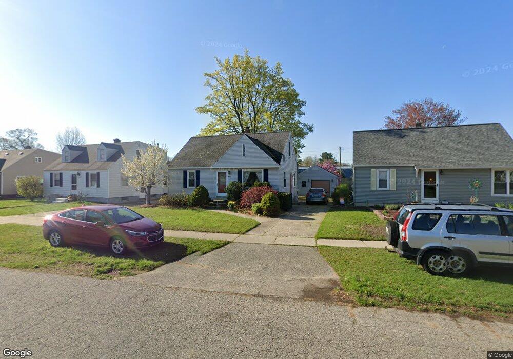
2097 Norman Ave Norton Shores, MI 49441
Estimated Value: $204,293 - $237,000
3
Beds
1
Bath
1,152
Sq Ft
$194/Sq Ft
Est. Value
About This Home
This home is located at 2097 Norman Ave, Norton Shores, MI 49441 and is currently estimated at $223,073, approximately $193 per square foot. 2097 Norman Ave is a home located in Muskegon County with nearby schools including Mona Shores High School, Muskegon Montessori Academy for Environmental Change, and St. Francis De Sales Elementary School.
Ownership History
Date
Name
Owned For
Owner Type
Purchase Details
Closed on
Dec 6, 2013
Sold by
Paulson Michael A and Paulson Kate M
Bought by
Gemazar Branden
Current Estimated Value
Home Financials for this Owner
Home Financials are based on the most recent Mortgage that was taken out on this home.
Original Mortgage
$87,849
Outstanding Balance
$65,557
Interest Rate
4.17%
Mortgage Type
VA
Estimated Equity
$157,516
Purchase Details
Closed on
Feb 28, 2006
Sold by
Carlton Matt and Carlton Jennifer
Bought by
Paulson Michael A
Home Financials for this Owner
Home Financials are based on the most recent Mortgage that was taken out on this home.
Original Mortgage
$84,000
Interest Rate
6.2%
Mortgage Type
Fannie Mae Freddie Mac
Create a Home Valuation Report for This Property
The Home Valuation Report is an in-depth analysis detailing your home's value as well as a comparison with similar homes in the area
Home Values in the Area
Average Home Value in this Area
Purchase History
| Date | Buyer | Sale Price | Title Company |
|---|---|---|---|
| Gemazar Branden | $86,000 | Chicago Title | |
| Paulson Michael A | -- | Harbor Title |
Source: Public Records
Mortgage History
| Date | Status | Borrower | Loan Amount |
|---|---|---|---|
| Open | Gemazar Branden | $87,849 | |
| Previous Owner | Paulson Michael A | $84,000 |
Source: Public Records
Tax History Compared to Growth
Tax History
| Year | Tax Paid | Tax Assessment Tax Assessment Total Assessment is a certain percentage of the fair market value that is determined by local assessors to be the total taxable value of land and additions on the property. | Land | Improvement |
|---|---|---|---|---|
| 2025 | $1,577 | $80,100 | $0 | $0 |
| 2024 | $1,236 | $75,000 | $0 | $0 |
| 2023 | $1,181 | $67,500 | $0 | $0 |
| 2022 | $1,439 | $59,300 | $0 | $0 |
| 2021 | $1,398 | $53,700 | $0 | $0 |
| 2020 | $1,383 | $49,500 | $0 | $0 |
| 2019 | $1,357 | $44,800 | $0 | $0 |
| 2018 | $1,325 | $42,400 | $0 | $0 |
| 2017 | $1,295 | $41,000 | $0 | $0 |
| 2016 | $1,003 | $37,300 | $0 | $0 |
| 2015 | -- | $35,500 | $0 | $0 |
| 2014 | $1,203 | $32,500 | $0 | $0 |
| 2013 | -- | $30,700 | $0 | $0 |
Source: Public Records
Map
Nearby Homes
- 2715 Liberty Rd
- 2686 Forest Hills Rd
- 2648 Bellevue Rd
- 2270 Norman Ave
- 2165 Letart Ave
- 2361 Norman Ave
- 1936 W Sherman Blvd
- 1965 Philo Ave
- 2278 Reneer Ave
- 1752 Bonneville Dr
- 2340 Cutler Ave
- 2484 Lincoln St
- 2163 Harding Ave
- 2432 Blodgett St
- 2280 Arbor Ave
- 1729 Winchester Dr
- 1705 Montague Ave
- 2405 Estes St
- 2245 Morton Ave
- 2263 Lawnel Ave
- 2089 Norman Ave
- 2105 Norman Ave
- 2081 Norman Ave
- 2755 Liberty Rd
- 2073 Norman Ave
- 2754 Pinehurst Rd
- 2121 Norman Ave
- 2747 Liberty Rd
- 2065 Norman Ave
- 2746 Pinehurst Rd
- 2129 Norman Ave
- 2755 Pinehurst Rd
- 2739 Liberty Rd
- 2057 Norman Ave
- 2738 Pinehurst Rd
- 2142 Norman Ave
- 2137 Norman St
- 2049 Norman Ave
- 2137 Norman Ave
- 2756 Liberty Rd