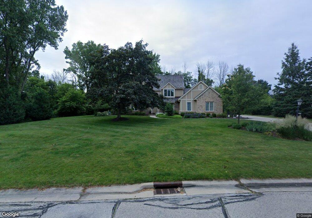
20970 Bartlett Dr Brookfield, WI 53045
Estimated Value: $749,000 - $973,000
4
Beds
4
Baths
3,010
Sq Ft
$283/Sq Ft
Est. Value
About This Home
This home is located at 20970 Bartlett Dr, Brookfield, WI 53045 and is currently estimated at $851,591, approximately $282 per square foot. 20970 Bartlett Dr is a home located in Waukesha County with nearby schools including Brookfield Elementary School, Wisconsin Hills Middle School, and Brookfield Central High School.
Ownership History
Date
Name
Owned For
Owner Type
Purchase Details
Closed on
Nov 16, 1998
Sold by
Ackelsberg Sholom M and Monaghan Susan R
Bought by
Ziegler Thomas J and Ziegler Ellen L
Current Estimated Value
Home Financials for this Owner
Home Financials are based on the most recent Mortgage that was taken out on this home.
Original Mortgage
$50,000
Interest Rate
6.96%
Mortgage Type
Purchase Money Mortgage
Create a Home Valuation Report for This Property
The Home Valuation Report is an in-depth analysis detailing your home's value as well as a comparison with similar homes in the area
Home Values in the Area
Average Home Value in this Area
Purchase History
| Date | Buyer | Sale Price | Title Company |
|---|---|---|---|
| Ziegler Thomas J | $413,500 | -- |
Source: Public Records
Mortgage History
| Date | Status | Borrower | Loan Amount |
|---|---|---|---|
| Closed | Ziegler Thomas J | $50,000 |
Source: Public Records
Tax History
| Year | Tax Paid | Tax Assessment Tax Assessment Total Assessment is a certain percentage of the fair market value that is determined by local assessors to be the total taxable value of land and additions on the property. | Land | Improvement |
|---|---|---|---|---|
| 2024 | $8,438 | $744,200 | $220,000 | $524,200 |
| 2023 | $8,455 | $744,200 | $220,000 | $524,200 |
| 2022 | $8,918 | $613,600 | $220,000 | $393,600 |
| 2021 | $9,456 | $613,600 | $220,000 | $393,600 |
| 2020 | $9,820 | $613,600 | $220,000 | $393,600 |
| 2019 | $9,448 | $613,600 | $220,000 | $393,600 |
| 2018 | $8,964 | $567,300 | $220,000 | $347,300 |
| 2017 | $8,941 | $567,300 | $220,000 | $347,300 |
| 2016 | $9,070 | $567,300 | $220,000 | $347,300 |
| 2015 | $9,010 | $567,300 | $220,000 | $347,300 |
| 2014 | $9,347 | $567,300 | $220,000 | $347,300 |
| 2013 | $9,347 | $567,300 | $220,000 | $347,300 |
Source: Public Records
Map
Nearby Homes
- 2820 Norman Dr
- 2550 Harmony Cir
- 20305 Downing Ct
- 2570 Gaywood Ct
- Lt118 Berwick Ct
- Lt120 Berwick Ct
- Lt116 Berwick Ct
- Lt114 Berwick Ct
- 2465 Lionel Ct
- W221N3075 Greenwood Ct
- 1930 Cotton Tail Ln
- N32W22121 Hill n Dale Cir
- 19260 Brookdale Dr
- 1825 Derrin Ln
- 2000 Kathlynn Ct
- 1775 Derrin Ln
- W224N2507 Ridgewood Ln
- 19775 Trilby Ct
- 18860 N Hills Dr
- 18850 N Hills Dr
- 2685 Norman Dr
- 2660 Bartlett Dr
- 20945 Bartlett Dr
- 2725 Norman Dr
- 2640 Bartlett Dr
- 2690 Norman Dr
- 2720 Norman Dr
- 2625 Norman Ct
- 20875 Bartlett Dr
- 2630 Bartlett Dr
- 20850 Bartlett Ct
- 2615 Norman Ct
- 20855 Lincolnshire Ct
- 2755 Norman Dr
- 2740 Norman Dr
- 20910 Saxon Ct
- 2620 Bartlett Dr
- 20810 Bartlett Ct
- 20845 Bartlett Dr
- 2595 Norman Ct
Your Personal Tour Guide
Ask me questions while you tour the home.