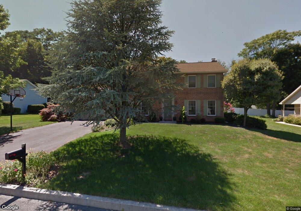
2098 Ashbury Dr Harrisburg, PA 17112
Colonial Park NeighborhoodEstimated Value: $421,852 - $461,000
4
Beds
3
Baths
2,000
Sq Ft
$224/Sq Ft
Est. Value
About This Home
This home is located at 2098 Ashbury Dr, Harrisburg, PA 17112 and is currently estimated at $448,213, approximately $224 per square foot. 2098 Ashbury Dr is a home located in Dauphin County with nearby schools including North Side Elementary School, Linglestown Middle School, and Central Dauphin Senior High School.
Ownership History
Date
Name
Owned For
Owner Type
Purchase Details
Closed on
Oct 10, 2003
Sold by
Morris Stephen
Bought by
Guyer John
Current Estimated Value
Home Financials for this Owner
Home Financials are based on the most recent Mortgage that was taken out on this home.
Original Mortgage
$163,360
Outstanding Balance
$76,965
Interest Rate
6.35%
Mortgage Type
New Conventional
Estimated Equity
$371,248
Purchase Details
Closed on
Jul 31, 2003
Sold by
Morris Stephen
Bought by
Guyer John
Home Financials for this Owner
Home Financials are based on the most recent Mortgage that was taken out on this home.
Original Mortgage
$163,360
Interest Rate
6.35%
Mortgage Type
New Conventional
Create a Home Valuation Report for This Property
The Home Valuation Report is an in-depth analysis detailing your home's value as well as a comparison with similar homes in the area
Home Values in the Area
Average Home Value in this Area
Purchase History
| Date | Buyer | Sale Price | Title Company |
|---|---|---|---|
| Guyer John | $204,200 | -- | |
| Guyer John | $204,200 | -- |
Source: Public Records
Mortgage History
| Date | Status | Borrower | Loan Amount |
|---|---|---|---|
| Open | Guyer John | $163,360 | |
| Previous Owner | Guyer John | $163,360 |
Source: Public Records
Tax History Compared to Growth
Tax History
| Year | Tax Paid | Tax Assessment Tax Assessment Total Assessment is a certain percentage of the fair market value that is determined by local assessors to be the total taxable value of land and additions on the property. | Land | Improvement |
|---|---|---|---|---|
| 2025 | $5,869 | $202,200 | $39,000 | $163,200 |
| 2024 | $5,444 | $202,200 | $39,000 | $163,200 |
| 2023 | $5,444 | $202,200 | $39,000 | $163,200 |
| 2022 | $5,444 | $202,200 | $39,000 | $163,200 |
| 2021 | $5,285 | $202,200 | $39,000 | $163,200 |
| 2020 | $5,227 | $202,200 | $39,000 | $163,200 |
| 2019 | $5,205 | $202,200 | $39,000 | $163,200 |
| 2018 | $5,114 | $202,200 | $39,000 | $163,200 |
| 2017 | $4,933 | $202,200 | $39,000 | $163,200 |
| 2016 | $0 | $202,200 | $39,000 | $163,200 |
| 2015 | -- | $202,200 | $39,000 | $163,200 |
| 2014 | -- | $202,200 | $39,000 | $163,200 |
Source: Public Records
Map
Nearby Homes
- 4419 Carrington Ct
- 2120 Sycamore Dr
- 4444 Dunmore Dr
- 4420 Rathlin Ct
- 31 Fairfax Village S
- 34 Fairfax Village
- 4914 Killington Dr
- 0 Linglestown Rd Unit PADA2042858
- 4102 Crestview Rd
- 00 Edorma Ct
- 0 Marys Way Unit SUMMERGROVE
- 0 Marys Way Unit EDISON PADA2045754
- 0 Marys Way Unit DANBURY PADA2045774
- 0 Marys Way Unit BRANSON PADA2045730
- 0 Marys Way Unit WINSTON PADA2047194
- 0 Marys Way Unit ARDMORE PADA2045760
- 0 Marys Way Unit ESSINGTON
- 1605 Colonial Rd
- 1002 Edorma Ct
- Breckenridge Plan at Nissley Run
- 2100 Ashbury Dr
- 2097 Ashbury Dr
- 4427 Avon Dr
- 2095 Ashbury Dr
- 4429 Avon Dr
- 4419 Winthrop Dr
- 2094 Ashbury Dr
- 2093 Ashbury Dr
- 4425 Avon Dr
- 4418 Winthrop Dr
- 4422 Carrington Ct
- 4421 Winthrop Dr
- 4420 Winthrop Dr
- 4416 Winthrop Dr
- 4420 Carrington Ct
- 2092 Ashbury Dr
- 2091 Ashbury Dr
- 4424 Carrington Ct
- 4422 Winthrop Dr
- 4418 Carrington Ct